- Will Weaver's Weather & Pacific Typhoon Center
- Posts
- WPAC Tropical Weather Outlook - 9/30/25
WPAC Tropical Weather Outlook - 9/30/25
Invest 93W looks likely to be our next tropical cyclone in the Western Pacific, and the Philippines need to monitor its progress.
Will Weaver
September 30, 2025
Active tropical cyclones:
There are no active tropical cyclones.
Disturbances/invest areas:
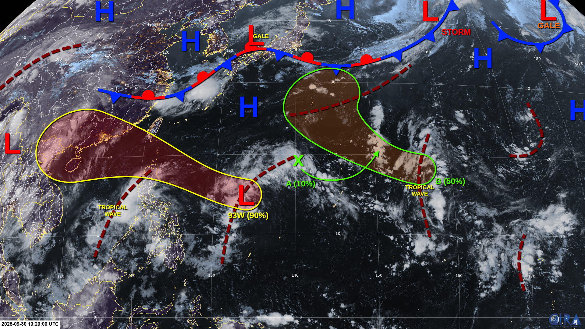
Invest 93W (well east of Luzon): An elongated and poorly defined area of low pressure has formed along a surface trough about halfway between the Philippines and the Marianas. Although the system is showing some signs of organization, it still lacks a well defined circulation center. Environmental conditions are expected to be conducive for additional development, and a tropical depression or tropical storm is likely to form by Thursday or Friday as the system moves west-northwestward across the Philippine Sea. Interests in northern Luzon and the Babuyan Islands should monitor the progress of this system.
Formation chance through 48 hours: HIGH - 80% 🔴
Formation chance through 7 days: HIGH - 90% 🔴
Disturbance A (northwest of the Marianas): A weak area of low pressure is likely to form along a surface trough northwest of the Marianas by the end of the week. Some limited development of this system is possible before it merges with another developing system over the weekend.
Formation chance through 48 hours: VERY LOW - 0% 🟡
Formation chance through 7 days: LOW - 10% 🟡
Disturbance B (well east of the Marianas): A large area of disturbed weather located well to the east of the Marianas is associated with an active tropical wave interacting with a trough of low pressure. A low pressure area will likely form by Saturday as it moves northwestward, and environmental conditions will likely be conducive for additional development. A tropical depression could form by Monday as the system passes north of the CNMI.
Formation chance through 48 hours: VERY LOW - 0% 🟡
Formation chance through 7 days: MEDIUM - 40% 🟠