- Will Weaver's Weather & Pacific Typhoon Center
- Posts
- WPAC Tropical Weather Outlook - 9/29/25
WPAC Tropical Weather Outlook - 9/29/25
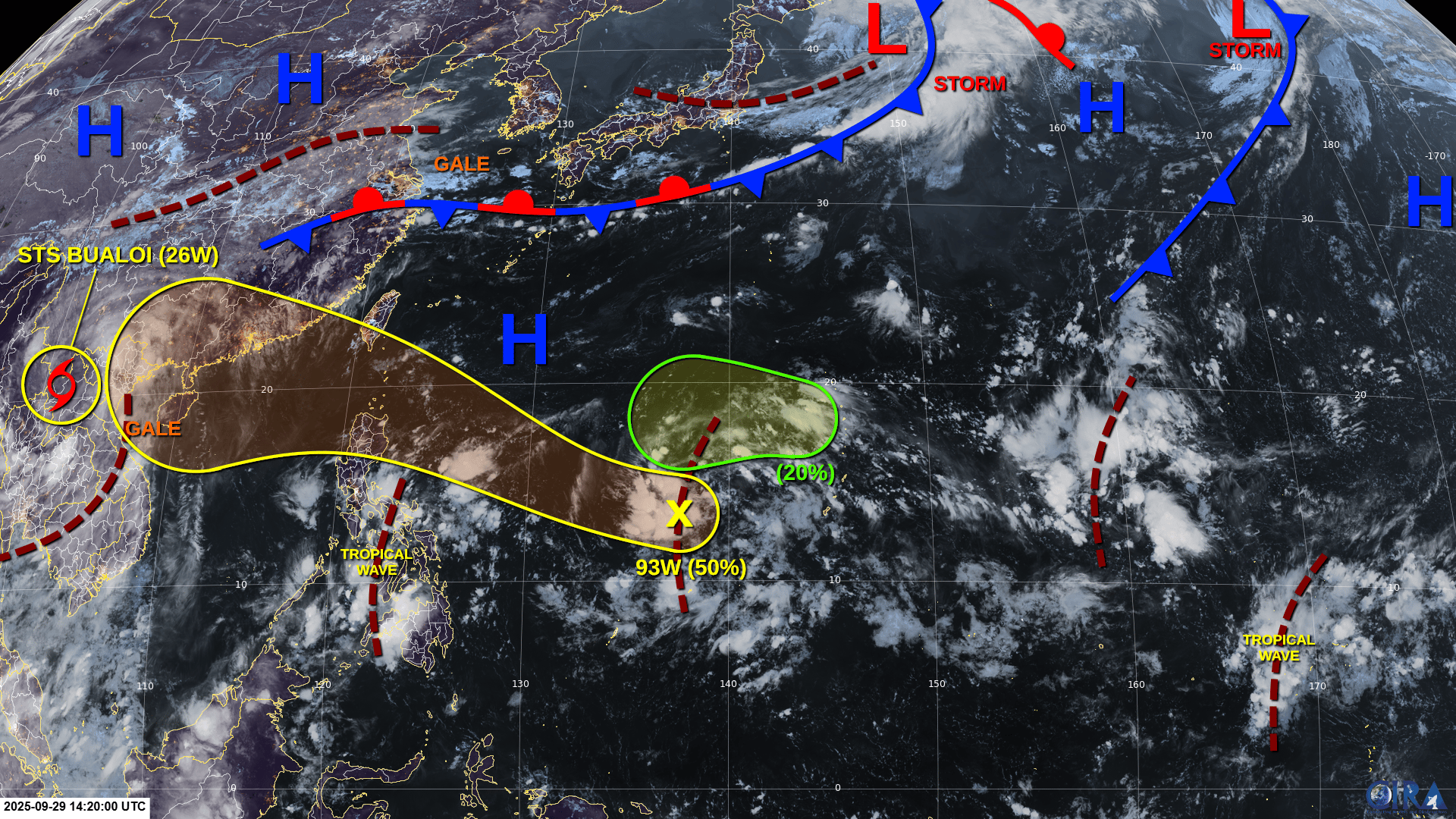
Bualoi is weakening over Laos and Neoguri has exited stage right, but Invest 93W looks like it could pose a threat to the Philippines by the end of the week.

Active tropical cyclones:
Severe Tropical Storm Bualoi (26W), located inland over northwestern Laos. Refer to tropical cyclone advisories.
Disturbances/invest areas:
Invest 93W (north of Yap): A large area of disturbed weather located in the central Philippine Sea to the north of Yap is associated with a trough of low pressure. A low pressure area is forecast to develop along this trough by midweek. Upper-level winds are expected to be conducive for development, and a tropical depression could form by Thursday as the system moves generally west-northwestward.
Formation chance through 48 hours: LOW - 30% 🟡
Formation chance through 7 days: MEDIUM - 50% 🟠
Disturbance A (near the northern CNMI): Another area of low pressure is forecast to form west of the northernmost Mariana Islands late in the week. Some slow development of this system is possible as it moves west-southwestward through the weekend.
Formation chance through 48 hours: VERY LOW - 0% 🟡
Formation chance through 7 days: LOW - 20% 🟡