- Will Weaver's Weather & Pacific Typhoon Center
- Posts
- WPAC Tropical Weather Outlook: 7/19/25
WPAC Tropical Weather Outlook: 7/19/25
A large monsoon gyre east of the Philippines could cause some issues for Okinawa by midweek
Will Weaver
July 19, 2025
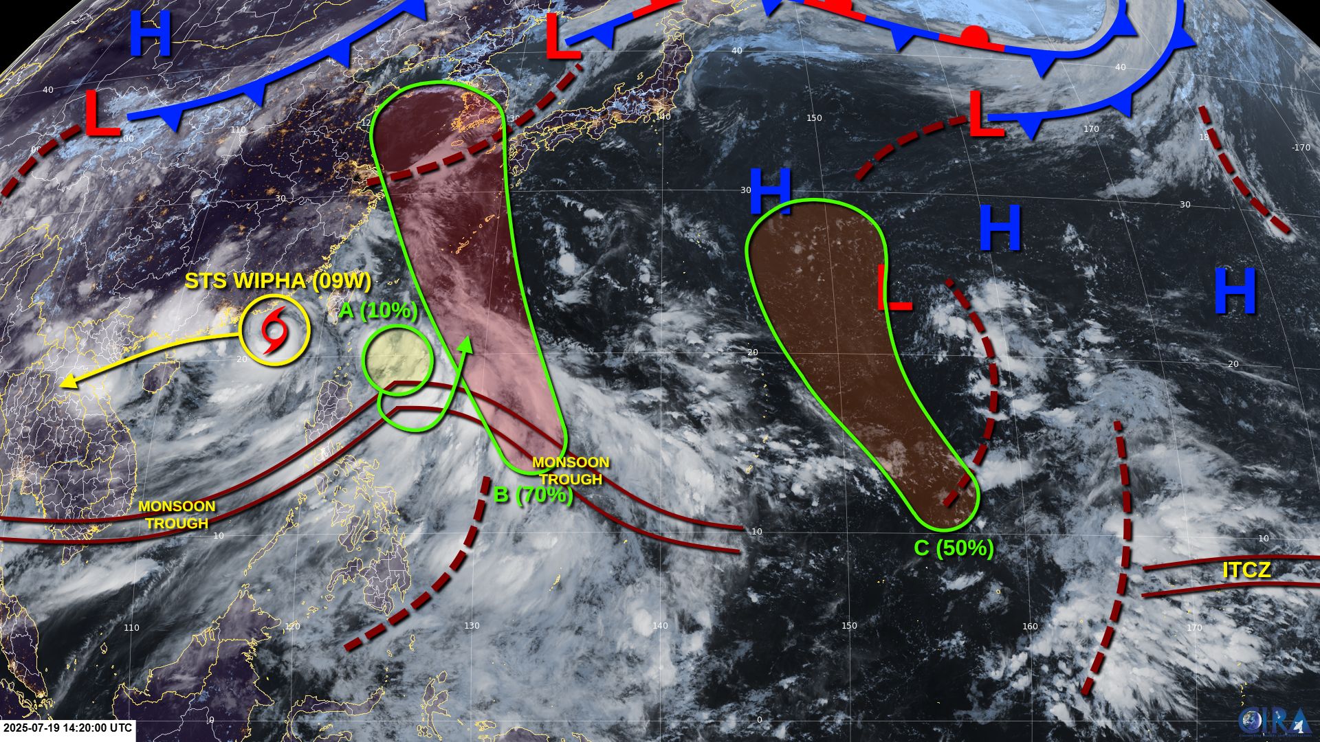
Active tropical cyclones:
Severe Tropical Storm Wipha (09W), southeast of Hong Kong. Refer to tropical cyclone advisories.
Disturbances/invest areas:
Disturbance A (northeast of Luzon): An area of low pressure is likely to form northeast of Luzon within an extremely large area of disturbed weather associated with a monsoon trough. This system could have a brief opportunity for some development before merging with a larger disturbance to the southeast by Monday or Tuesday.
Formation chance through 48 hours: LOW - 10% 🟡
Formation chance through 7 days: LOW - 10% 🟡
Disturbance B (well east-northeast of Samar): Another area of low pressure is expected to form in the central Philippine Sea within the same large area of disturbed weather on Sunday or Monday. Upper-level winds are not expected to be particularly conducive for development, but they could become more favorable by midweek, and a tropical depression is likely to form by Wednesday or Thursday as the system moves into the East China Sea. Interests in the Yaeyama and Ryukyu Islands (including Okinawa) should monitor the progress of this system.
Formation chance through 48 hours: LOW - 20% 🟡
Formation chance through 7 days: HIGH - 70% 🔴
Disturbance C (east-southeast of Guam): Another low pressure area is forecast to form along a tropical wave well to the east-southeast of Guam by midweek. Environmental conditions are expected to be conducive for development, and a tropical depression or tropical storm could form by Friday as the system moves generally north-northwestward over open waters.
Formation chance through 48 hours: VERY LOW - 0% 🟡
Formation chance through 7 days: MEDIUM - 50% 🟠