- Will Weaver's Weather & Pacific Typhoon Center
- Posts
- Typhoon Sinlaku (04W) – Tropical Cyclone Advisory #8: 0000 UTC 12 April 2026
Typhoon Sinlaku (04W) – Tropical Cyclone Advisory #8: 0000 UTC 12 April 2026
Sinlaku explosively intensifying and now a Category 3 typhoon. Additional rapid intensification likely today.
Will Weaver
April 11, 2026
…Sinlaku explosively intensifying and now a Category 3 typhoon…
…Additional rapid intensification likely today…
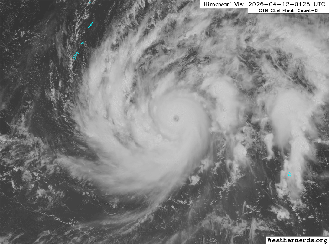
Himawari-9 visible satellite image (Weathernerds)
Current storm information:
Position: 9.8°N 151.2°E
Movement: NNW at 6 knots (10 km/h)
Intensity: 110 knots (205 km/h)
Intensity category: 3
Central pressure: 943 hPa
Trend:
Continued rapid intensification is forecast today and Sinlaku will likely become a Category 4 typhoon tonight.
Watches and warnings:
Areas that should monitor this system:
| Hazards affecting land:
|
Discussion:
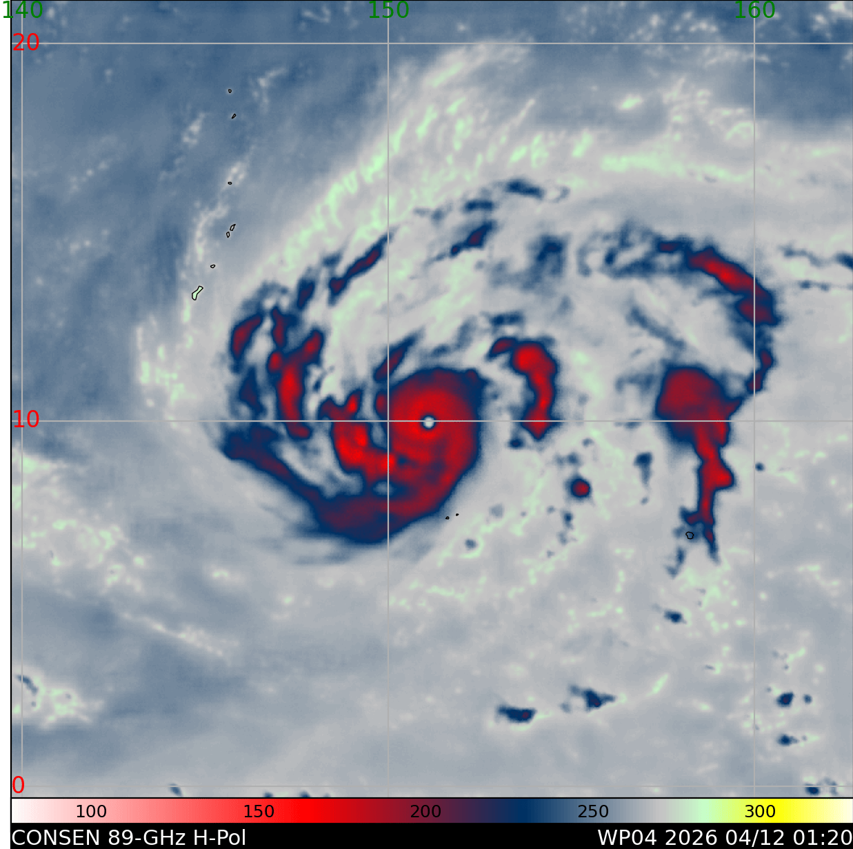
Sinlaku has undergone explosive intensification during the past several hours. The typhoon has finally moved into a much more favorable environment and it has responded promptly by quickly building a central dense overcast with very cold cloud tops and a rapidly clearing eye. Microwave satellite imagery indicates that Sinlaku has a complete eyewall, though convection on its eastern side is slightly weaker, likely due to some residual easterly shear. Outflow is excellent in all quadrants, and actually extends into the southern hemisphere - Sinlaku’s equatorward outflow channel was partially responsible for shearing Tropical Cyclone Maila in the Solomon Sea to pieces yesterday. The intensity is increased to a potentially conservative 110 kts; although Dvorak estimates suggest a higher intensity (T6.0 to T6.5), a recent RCM-3 SAR pass suggests the winds are 105-110 kts and that the wind field is quite symmetrical.
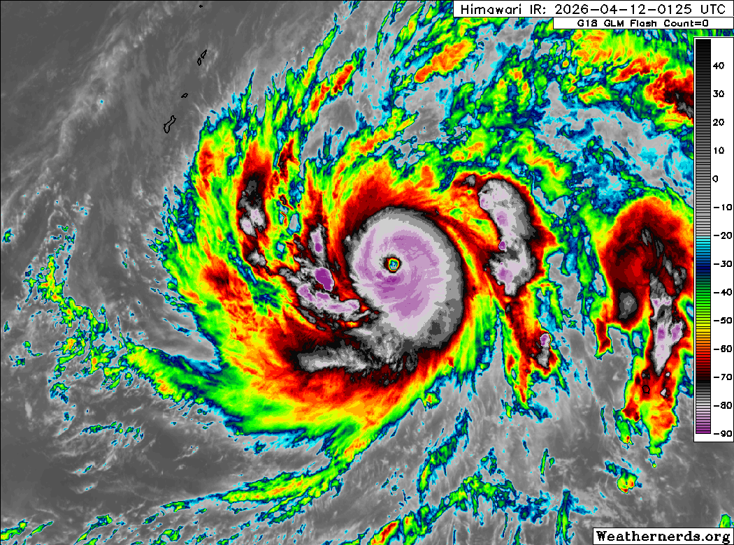
Himawari-9 infrared satellite image (Weathernerds)
Because it briefly stalled out near Chuuk, Sinlaku’s track and intensity forecasts have changed significantly from previous advisories. In what has turned out to be a big win for the ECMWF and Google DeepMind ensembles, Sinlaku has begun moving north-northwestward in response to a trough amplifying off the coast of Japan. If Sinlaku had not stalled out, it would likely have continued in a more westward trajectory. The new track is much further north than the previous one and indicates a passage between Rota and Tinian on Tuesday, later than previously anticipated. Unfortunately for the islands, Sinlaku’s rapid intensification is likely to continue during the next 24 hours or so. RIPA rapid intensification parameters are quite high with a nearly 70% chance of an increase of 35 kts in the next 24 hours. Sinlaku is now forecast to peak at super typhoon (JTWC) strength on Monday before inner-core dynamics and a potential increase in shear causes some gradual weakening. Sinlaku is still expected to be an extremely dangerous Category 4 typhoon as it approaches Guam and the CNMI.
After entering the Philippine Sea, Sinlaku should turn northward and enter the weakness in the subtropical ridge. A faster rate of weakening should ensue as shear increases and SSTs decrease, and extratropical transition will likely begin around the end of the forecast period.
Forecast positions and maximum winds (1-min)
000 hrs: 09.8°N 151.2°E – 110 kts 205 km/h
012 hrs: 10.9°N 150.3°E – 125 kts 230 km/h
024 hrs: 12.1°N 149.3°E – 135 kts 250 km/h
048 hrs: 14.1°N 146.0°E – 125 kts 230 km/h
072 hrs: 15.6°N 144.2°E – 120 kts 220 km/h
096 hrs: 18.4°N 143.5°E – 100 kts 185 km/h
120 hrs: 20.9°N 143.9°E – 85 kts 155 km/h
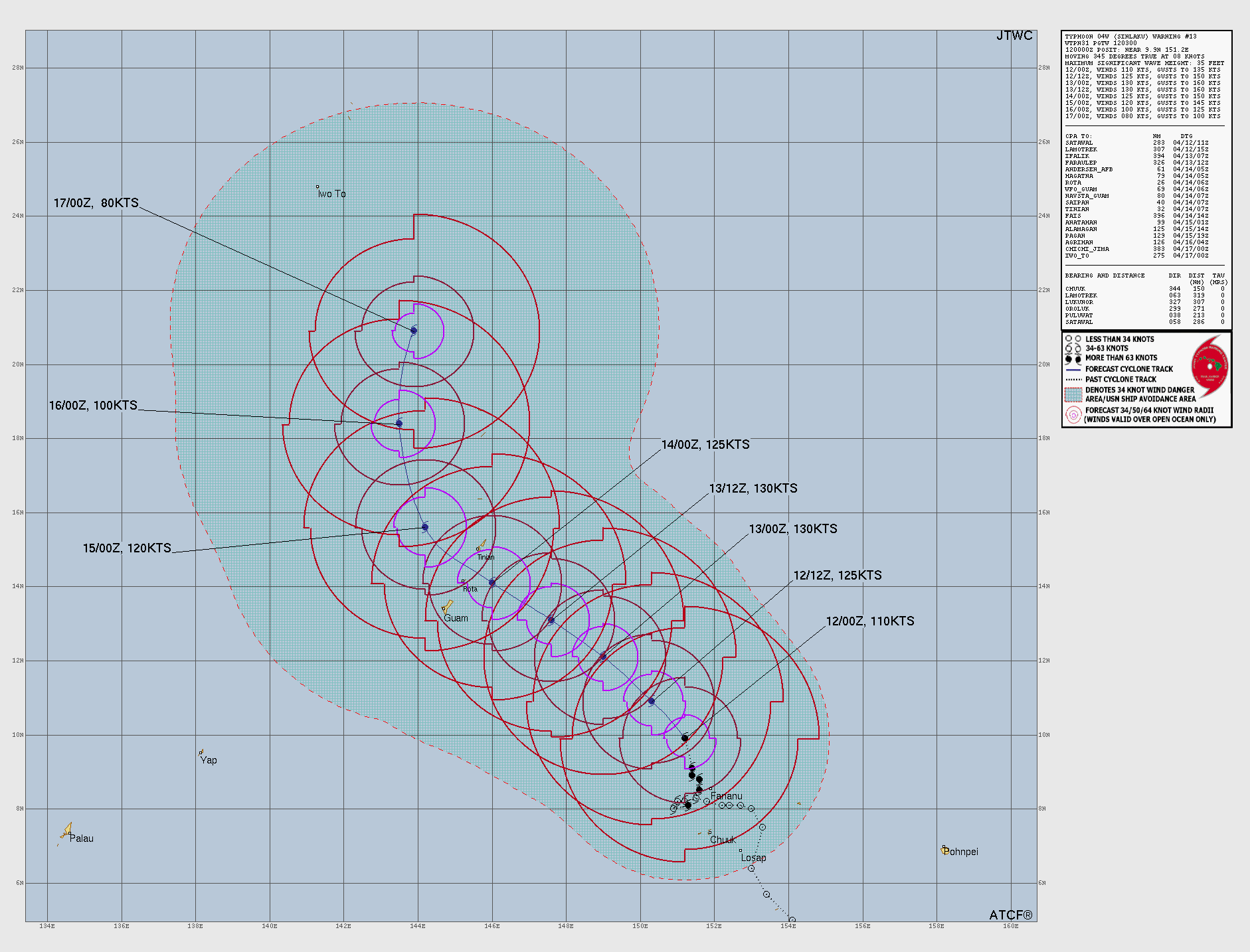
JTWC forecast map