- Will Weaver's Weather & Pacific Typhoon Center
- Posts
- Typhoon #Ragasa (24W) – Tropical Cyclone Advisory #15: 1200 UTC 24 September 2025
Typhoon #Ragasa (24W) – Tropical Cyclone Advisory #15: 1200 UTC 24 September 2025
Ragasa makes landfall in southern China.
Will Weaver
September 24, 2025
…Ragasa makes landfall in southern China…
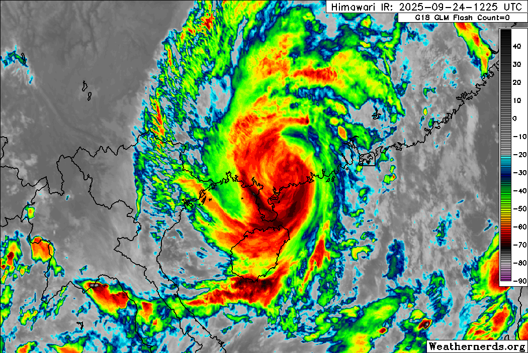
Himawari-9 infrared satellite image (Weathernerds)
Current storm information:
Position: 21.7°N 111.1°E
Movement: W at 12 knots (25 km/h)
Intensity: 80 knots (150 km/h) [Category 1]
Central pressure: 967 hPa
Trend:
Rapid weakening is expected during the next 24 hours. Ragasa is forecast to weaken to a tropical storm later tonight and a tropical depression on Thursday.
Watches and warnings:
| Hazards affecting land:
|
Discussion:
Ragasa made landfall in China’s Guangdong province to the east of Maoming at about 0840 UTC with winds of 105 kts. Satellite imagery indicates that the typhoon had begun rapidly weakening shortly before landfall as both the inner and outer eyewalls collapsed and became indiscernible on both radar and satellite imagery. Since landfall, the central dense overcast has lost its symmetry and appears to be racing ahead of the surface circulation, although cloud tops remain quite cold for a system now over land. CIMSS shear analysis indicates some increasing easterly shear over the system which may be contributing to its loss of organization. Assuming some decay since landfall, the intensity is lowered to 80 kts.
Ragasa is about to be captured by a new subtropical ridge centered over far southwestern China, and as a result it is likely to continue moving almost due west during the next couple of days. Although there is a chance Ragasa could move back over water midday Thursday, Ragasa is expected to continue rapidly weakening. Ragasa should weaken to a tropical storm later tonight, and it should become a tropical depression over far northeastern Vietnam on Thursday evening. Most of the model guidance shows the circulation opening up into a trough by Friday.
Forecast positions and maximum winds
00 hrs: 21.7°N 111.1°E – 80 kts inland
12 hrs: 21.7°N 108.9°E – 45 kts inland
24 hrs: 21.9°N 106.4°E – 25 kts inland
48 hrs: Dissipated

JMA forecast map