- Will Weaver's Weather & Pacific Typhoon Center
- Posts
- Typhoon Ragasa (24W/Nando) – Tropical Cyclone Advisory #12: 0000 UTC 23 September 2025
Typhoon Ragasa (24W/Nando) – Tropical Cyclone Advisory #12: 0000 UTC 23 September 2025
Ragasa moving away from the Philippines and taking aim at Hong Kong and Macau.
Will Weaver
September 22, 2025
…Ragasa moving away from the Philippines and taking aim at Hong Kong and Macau… …Preparations there should be rushed to completion…
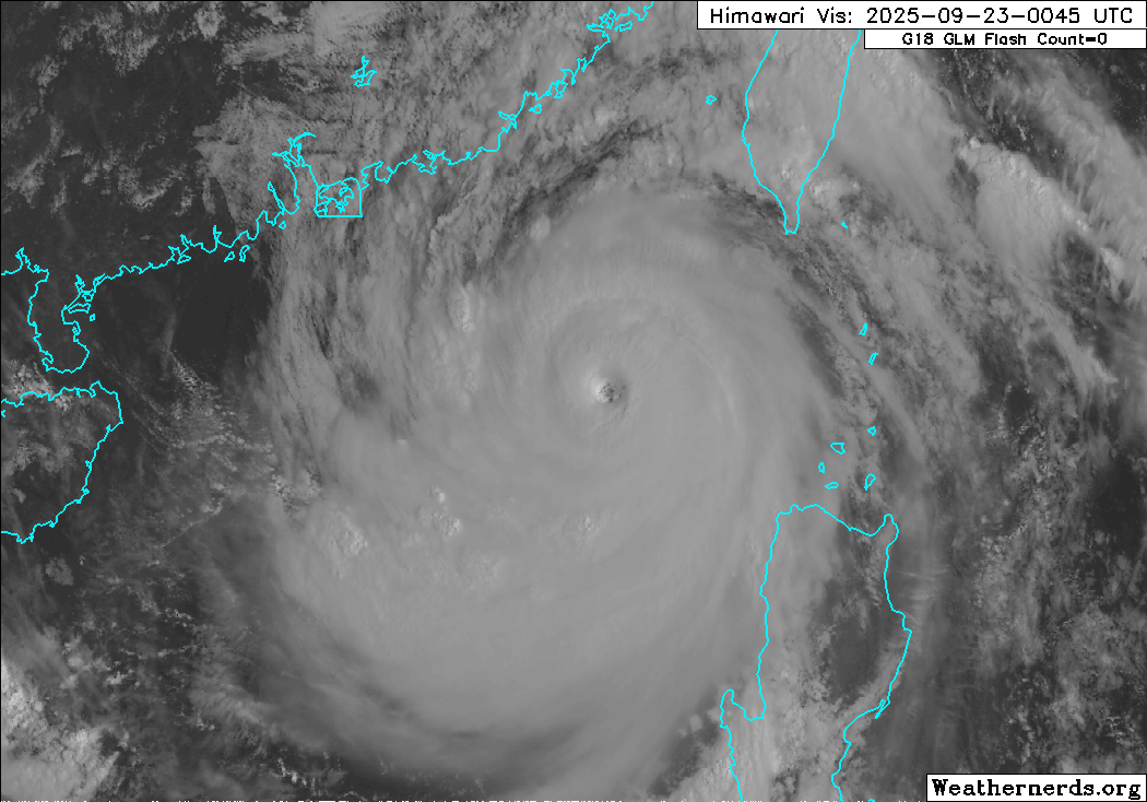
Himawari-9 visible satellite image (Weathernerds)
Current storm information:
Position: 19.9°N 118.3°E
Movement: WNW at 10 knots (20 km/h)
Intensity: 125 knots (230 km/h) [Category 4]
Central pressure: 915 hPa
Trend:
Gradual weakening is expected during the next 24 hours, but Ragasa is expected to remain an extremely dangerous Category 4 typhoon through Wednesday.
Watches and warnings:  PAGASA wind signal map (click to enlarge)
| Hazards affecting land:
|
The next advisory will be posted after 1200 UTC 23 September 2025.
Forecast positions and maximum winds
00 hrs: 19.9°N 118.3°E – 125 kts
12 hrs: 20.8°N 116.1°E – 120 kts
24 hrs: 21.4°N 113.9°E – 110 kts
48 hrs: 21.8°N 108.5°E – 50 kts inland
72 hrs: 21.6°N 104.0°E – 25 kts inland
96 hrs: Dissipated
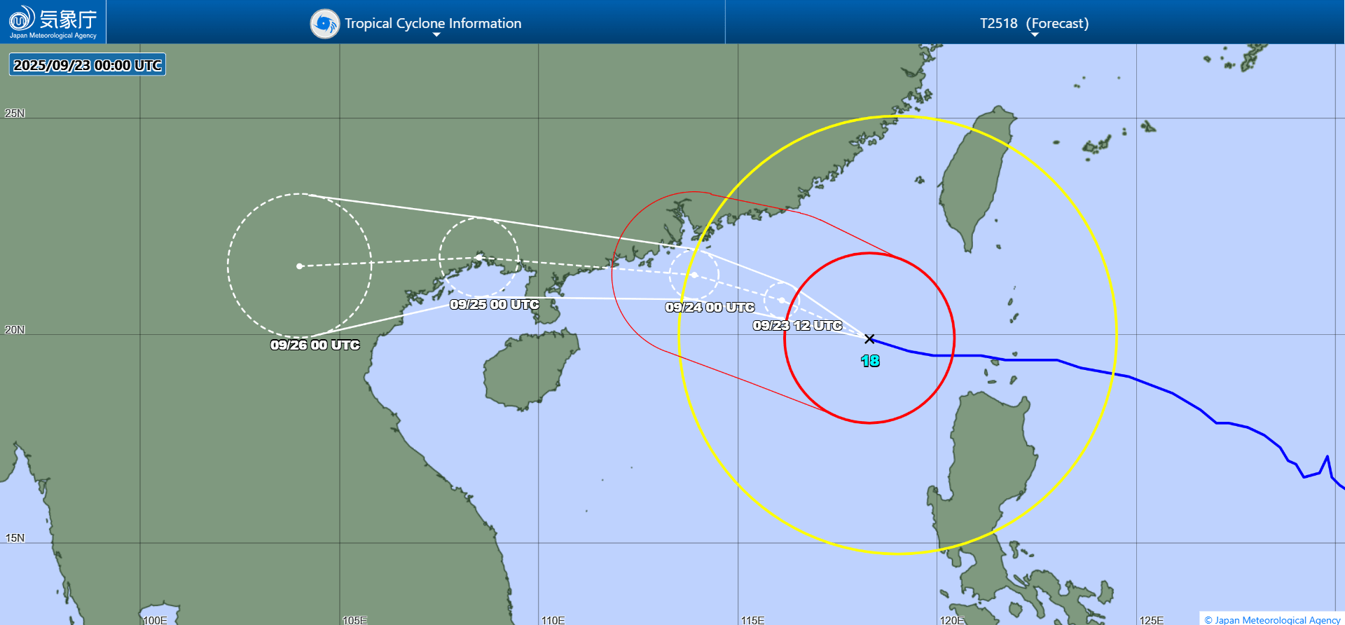
JMA forecast map