- Will Weaver's Weather & Pacific Typhoon Center
- Posts
- Typhoon Neoguri (25W) – Tropical Cyclone Advisory #6: 1500 UTC 20 September 2025
Typhoon Neoguri (25W) – Tropical Cyclone Advisory #6: 1500 UTC 20 September 2025
Neoguri continues to rapidly intensify far away from any land areas.
Will Weaver
September 20, 2025
…Neoguri continues to rapidly intensify far away from any land areas…
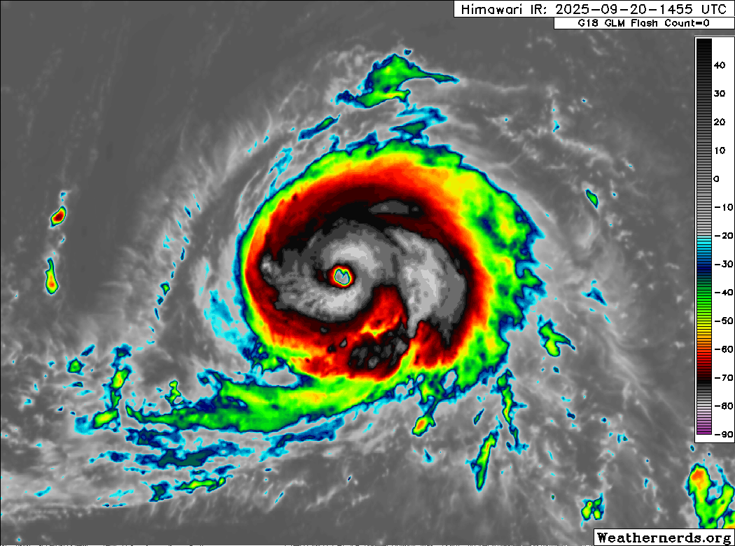
Himawari-9 infrared satellite image (Weathernerds)
Current storm information:
Position: 26.5°N 154.5°E
Movement: WNW at 10 knots (20 km/h)
Intensity: 95 knots (175 km/h) [Category 2]
Central pressure: 955 hPa
Trend:
Additional intensification is expected during the next 24 hours, and Neoguri will likely become a Category 4 typhoon on Sunday.
Watches and warnings:
| Hazards affecting land:
|
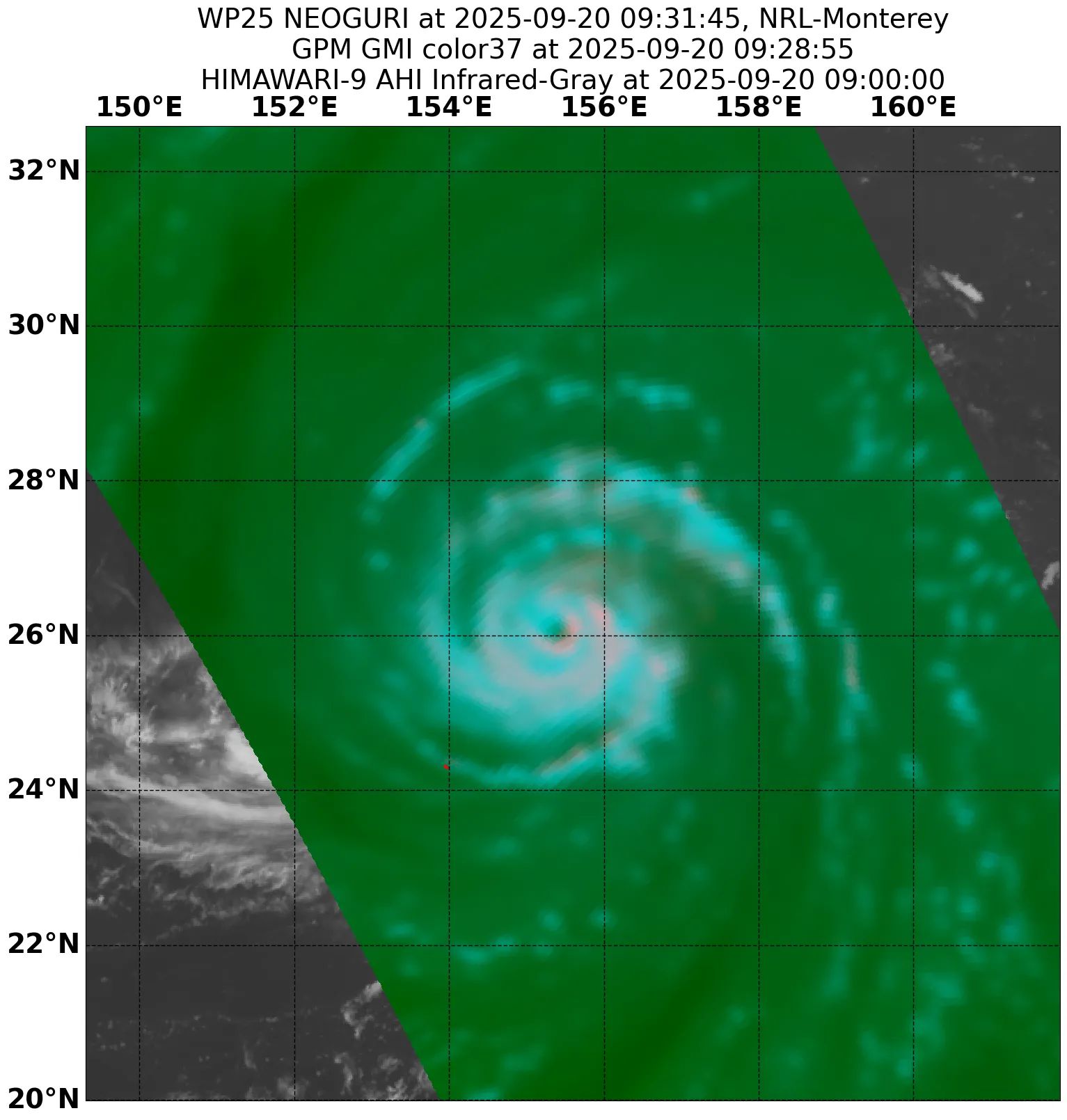
GPM GMI 37GHz microwave satellite image
The next advisory will be posted after 0000 UTC 21 September 2025.
Forecast positions and maximum winds
00 hrs: 26.5°N 154.5°E – 95 kts
12 hrs: 27.2°N 152.9°E – 105 kts
24 hrs: 28.3°N 151.5°E – 115 kts
48 hrs: 30.6°N 152.0°E – 120 kts
72 hrs: 32.0°N 153.8°E – 105 kts
96 hrs: 33.0°N 155.4°E – 90 kts
120 hrs: 35.7°N 158.1°E – 75 kts Post-tropical/extratropical
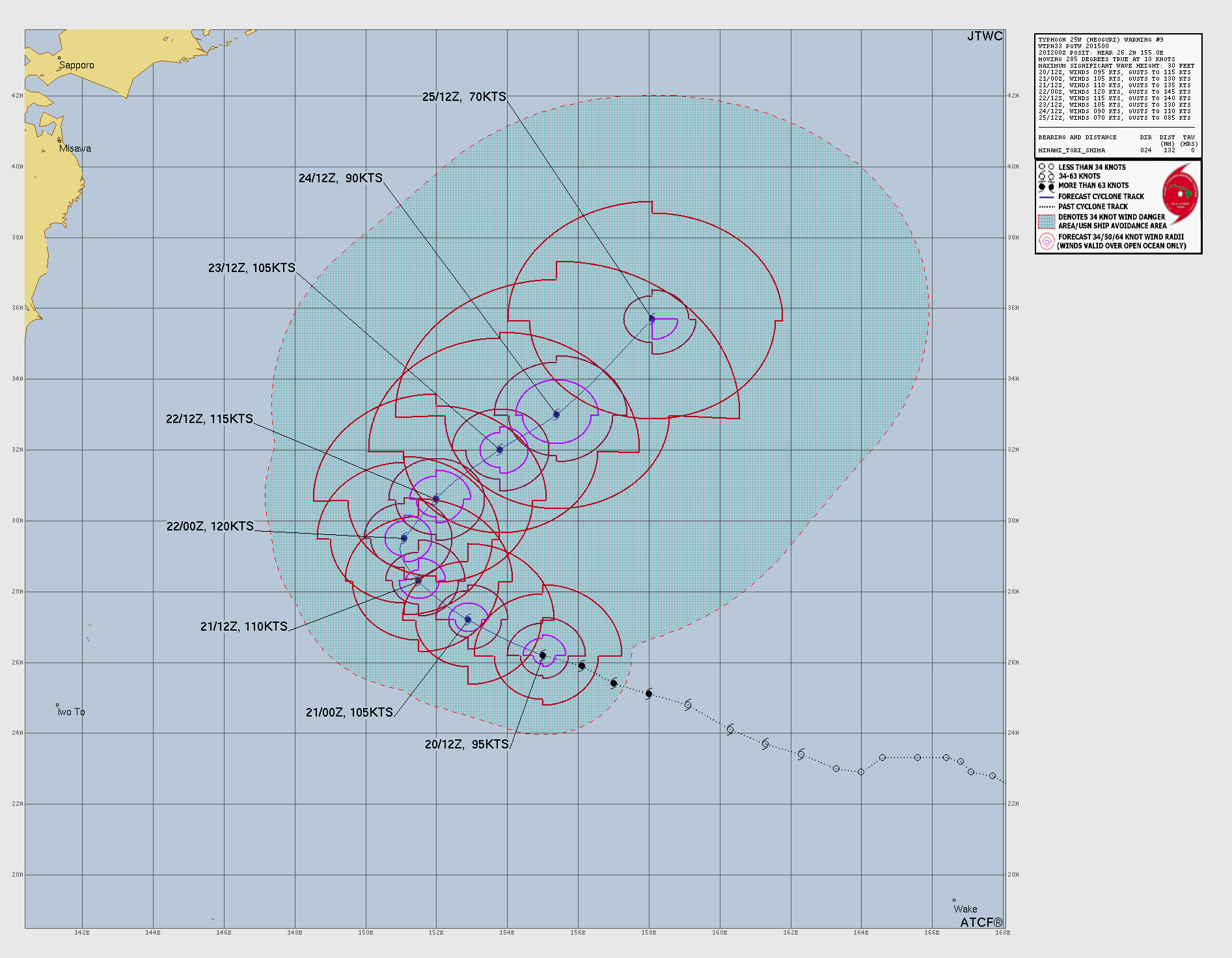
JTWC forecast map