- Will Weaver's Weather & Pacific Typhoon Center
- Posts
- Typhoon Neoguri (25W) – Tropical Cyclone Advisory #22: 1500 UTC 28 September 2025
Typhoon Neoguri (25W) – Tropical Cyclone Advisory #22: 1500 UTC 28 September 2025
Neoguri persists as a powerful Category 3 typhoon as it accelerates northeastward.
Will Weaver
September 28, 2025
…Neoguri persists as a powerful Category 3 typhoon as it accelerates northeastward… …Expected to become an exceptionally powerful post-tropical cyclone soon…
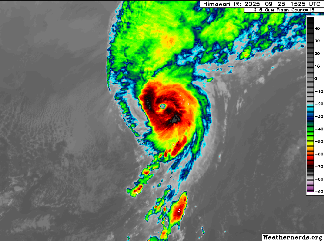
Himawari-9 infrared satellite image (Weathernerds)
Current storm information:
Position: 38.0°N 167.3°E
Movement: NE at 30 knots (55 km/h)
Intensity: 105 knots (195 km/h) [Category 3]
Central pressure: 956 hPa
Trend:
Rapid weakening is forecast once extratropical transition is complete.
Watches and warnings:
| Hazards affecting land:
|
Discussion:
Neoguri pulled off an extremely difficult feat and reached a peak intensity of 110 kts at 0600 UTC. Since then, however, the environment has begun to catch up with it. Although Neoguri continues to sport a slightly elongated CDO with very cold convective cloud tops, the eye has shrunk in recent hours, and microwave satellite imagery suggests it is no longer vertically aligned over the surface center. Meanwhile, convection is beginning to advect along a warm front located to the north. Despite the slight deterioration in Neoguri’s satellite presentation, a Sentinel-1 SAR pass indicated maximum 10-minute winds of 88 kts. Dvorak fixes range from T5.0 to T6.0 and CIMSS ADT and D-PRINT estimates range from 99 to 107 kts. Combining all these data yields an intensity of 105 kts.
Neoguri is now over waters colder than 26°C and water vapor satellite imagery indicates that a cold front is very close to overtaking Neoguri’s surface circulation. Although Neoguri is moving at a very quick pace, the shear will likely soon overwhelm it and trigger a very rapid extratropical transition, which will likely be completed by midday Monday. Neoguri should weaken rapidly after becoming post-tropical as it loses its baroclinic support, but it is expected to remain a distinct entity and retain near-gale to gale-force winds through the end of the forecast period. Some of the models suggest some slight restrengthening as post-tropical Neoguri approaches southeastern Alaska.
Forecast positions and maximum winds
000 hrs: 38.0°N 167.3°E – 105 kts
012 hrs: 41.7°N 172.5°E – 75 kts Post-tropical/extratropical
024 hrs: 44.2°N 178.3°E – 50 kts Post-tropical/extratropical
048 hrs: 46.2°N 170.1°W – 30 kts Post-tropical/extratropical
072 hrs: 50.0°N 163.6°W – 30 kts Post-tropical/extratropical
096 hrs: 54.8°N 153.4°W – 35 kts Post-tropical/extratropical
120 hrs: 58.2°N 141.5°W – 40 kts Post-tropical/extratropical
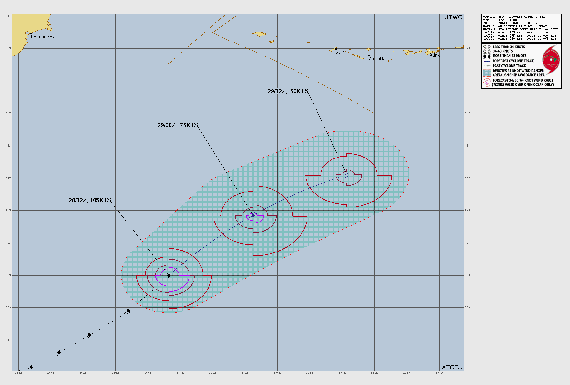
JTWC forecast map. The extratropical phase is omitted.