- Will Weaver's Weather & Pacific Typhoon Center
- Posts
- Typhoon Neoguri (25W) – Tropical Cyclone Advisory #21: 0000 UTC 28 September 2025
Typhoon Neoguri (25W) – Tropical Cyclone Advisory #21: 0000 UTC 28 September 2025
Neoguri rapidly intensifying and expected to become an extremely powerful hurricane-force post-tropical cyclone over the northern Pacific later today.
Will Weaver
September 27, 2025
…Neoguri rapidly intensifying and expected to become an extremely powerful hurricane-force post-tropical cyclone over the northern Pacific later today…
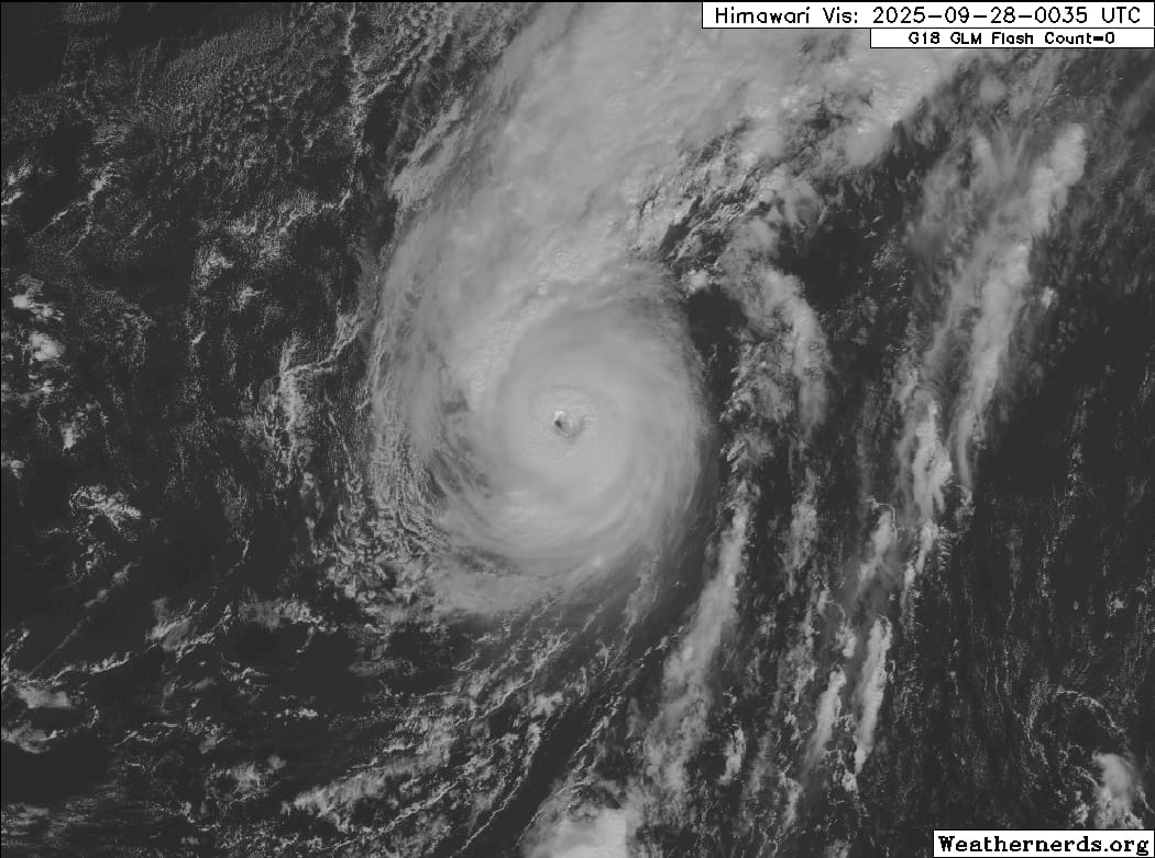
Himawari-9 visible satellite image (Weathernerds)
Current storm information:
Position: 34.3°N 162.4°E
Movement: ENE at 14 knots (25 km/h)
Intensity: 95 knots (175 km/h) [Category 2]
Central pressure: 956 hPa
Trend:
Some additional strengthening is forecast during the next 12 to 24 hours, and Neoguri will likely become a hurricane-force post-tropical cyclone tonight. Rapid weakening is forecast once extratropical transition is complete.
Watches and warnings:
| Hazards affecting land:
|
Discussion:

GPM GMI 89GHz microwave satellite image
Despite being in an unusual location and embedded within a deep-layer trough associated with an approaching frontal system, Neoguri is undergoing rapid intensification. The cyclone has very quickly cleared out a small and very warm eye with a stadium effect present on visible satellite imagery, and the CDO’s cloud tops remain quite cold, although the effects of west-southwesterly shear are evident with some very high clouds being sheared off the top of the CDO. It appears that Neoguri’s fast forward motion may be blunting the effects of the shear. Dvorak estimates range from T5.0 to T5.5 from the various agencies, with CIMSS ADT and D-PRINT estimates of 99 and 96 kts respectively. Taking a blend of these estimates yields an intensity of 95 kts.
Neoguri is expected to continue to move in phase with the shear for the next day or so, and it is possible that it could reattain Category 3 intensity while it remains over warm waters. By tonight, however, Neoguri should cross the 26°C isotherm, which will likely mark the end of any strengthening through barotropic (your typical, tropical) means. Neoguri should quickly transition into an exceptionally powerful hurricane-force post-tropical cyclone shortly after. By Monday, Neoguri will likely begin weakening rapidly as it loses its baroclinic support, although it will likely remain a distinct entity and retain near-gale to gale-force winds through the end of the 5-day forecast period.
Forecast positions and maximum winds
000 hrs: 34.3°N 162.4°E – 95 kts
012 hrs: 38.1°N 167.0°E – 100 kts
024 hrs: 42.1°N 172.2°E – 90 kts Post-tropical/extratropical
048 hrs: 44.6°N 177.5°W – 65 kts Post-tropical/extratropical
072 hrs: 48.3°N 166.3°W – 30 kts Post-tropical/extratropical
096 hrs: 53.6°N 157.9°W – 30 kts Post-tropical/extratropical
120 hrs: 59.8°N 145.9°W – 40 kts Post-tropical/extratropical
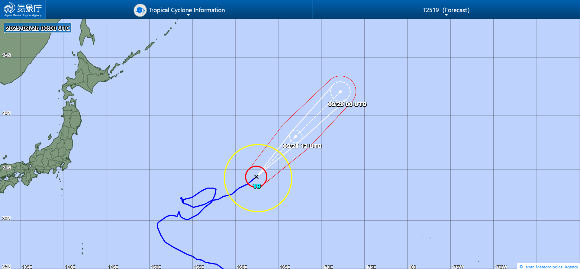
JMA forecast map. The extratropical phase is omitted.