- Will Weaver's Weather & Pacific Typhoon Center
- Posts
- Typhoon Neoguri (#25W) – Tropical Cyclone Advisory #12: 1200 UTC 23 September 2025
Typhoon Neoguri (#25W) – Tropical Cyclone Advisory #12: 1200 UTC 23 September 2025
Neoguri remains parked over the northern Pacific.
Will Weaver
September 23, 2025
…Neoguri remains parked over the northern Pacific…
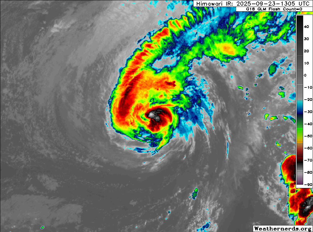
Himawari-9 infrared satellite image (Weathernerds)
Current storm information:
Position: 30.4°N 153.6°E
Movement: Nearly stationary
Intensity: 75 knots (140 km/h) [Category 1]
Central pressure: 970 hPa
Trend:
Gradual weakening is forecast during the next 24 hours.
Watches and warnings:
| Hazards affecting land:
|
Discussion:
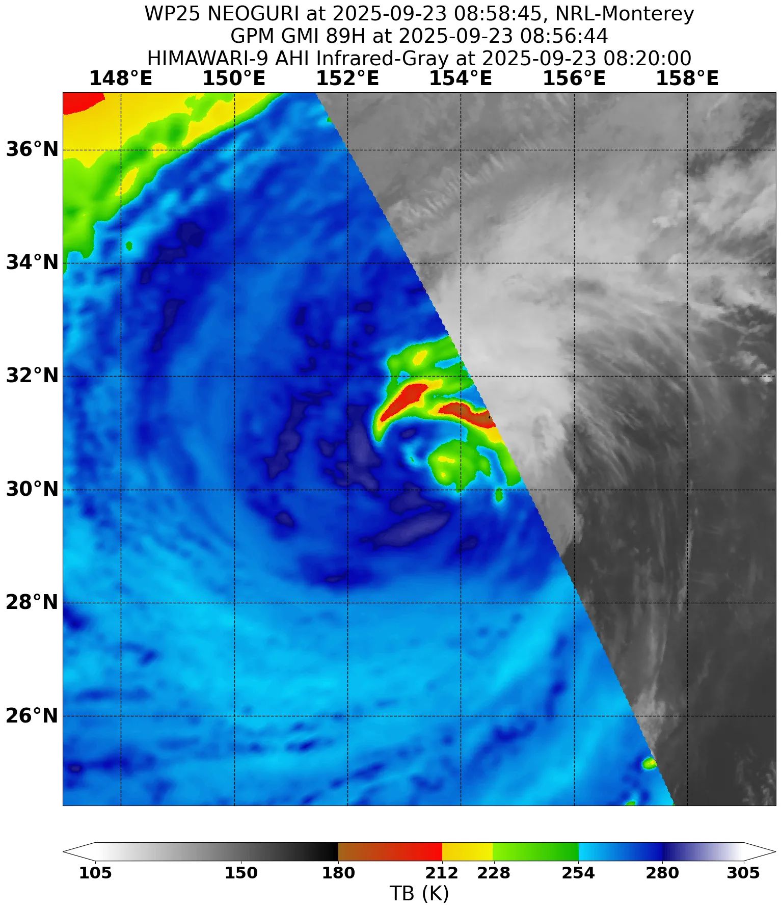
GPM GMI 89GHz microwave satellite image
Neoguri continues to go nowhere fast as it remains embedded in an area of almost nonexistent steering currents. The tropical cyclone continues to have a not-very-tropical satellite presentation with convection sheared to the north and east of the circulation center and cool, dry air wrapping into the center from the south and west. Microwave satellite imagery also depicts a less than tropical appearance with a highly asymmetric convective structure and no signs of an eye feature. Although automated estimates are not particularly kind to Neoguri and are well below typhoon strength, the intensity is currently 75 kts, based on Dvorak fixes of T4.5 and a RCM-3 SAR pass that found winds of 70 to 75 kts in the northeastern quadrant.
Neoguri is currently meandering over the northern Pacific and will continue to do so for another couple of days as the frontal system to its north leaves it behind. Ridging should build in behind the front and force Neoguri back westward before a second frontal system approaches on Friday. This second front should finally pick up Neoguri and send it off to the northeast. Neoguri should rapidly become a post-tropical cyclone this weekend.
Forecast positions and maximum winds
00 hrs: 30.4°N 153.6°E – 75 kts
12 hrs: 30.5°N 155.0°E – 65 kts
24 hrs: 31.8°N 156.8°E – 55 kts
48 hrs: 32.2°N 154.6°E – 50 kts
72 hrs: 31.6°N 152.6°E – 50 kts
96 hrs: 32.7°N 156.1°E – 50 kts Post-tropical/extratropical
120 hrs: 37.5°N 163.3°E – 45 kts Post-tropical/extratropical

JMA forecast map