- Will Weaver's Weather & Pacific Typhoon Center
- Posts
- Typhoon Fung-wong (32W) – Tropical Cyclone Advisory #16: 0000 UTC 11 November 2025
Typhoon Fung-wong (32W) – Tropical Cyclone Advisory #16: 0000 UTC 11 November 2025
Typhoon warnings issued for portions of Taiwan...
Will Weaver
November 10, 2025
…Typhoon warnings issued for portions of Taiwan…
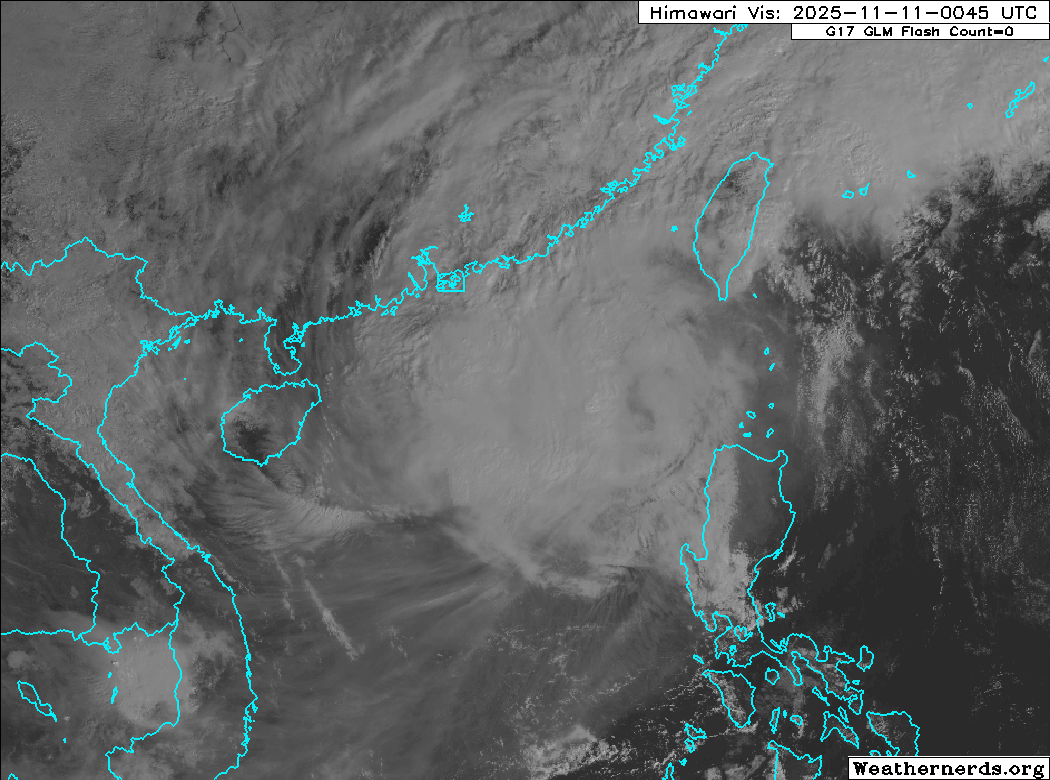
Himawari-9 visible satellite image (Weathernerds)
Current storm information:
Position: 19.8°N 117.9°E
Movement: NNW at 7 knots (10 km/h)
Intensity: 65 knots (120 km/h) [Category 1]
Central pressure: 981 hPa
Trend:
Continued weakening is forecast during the next 24 hours, and Fung-wong will likely weaken to a tropical storm later today.
Watches and warnings:  PAGASA wind signal map (click to enlarge)
| Hazards affecting land:
|
Discussion:
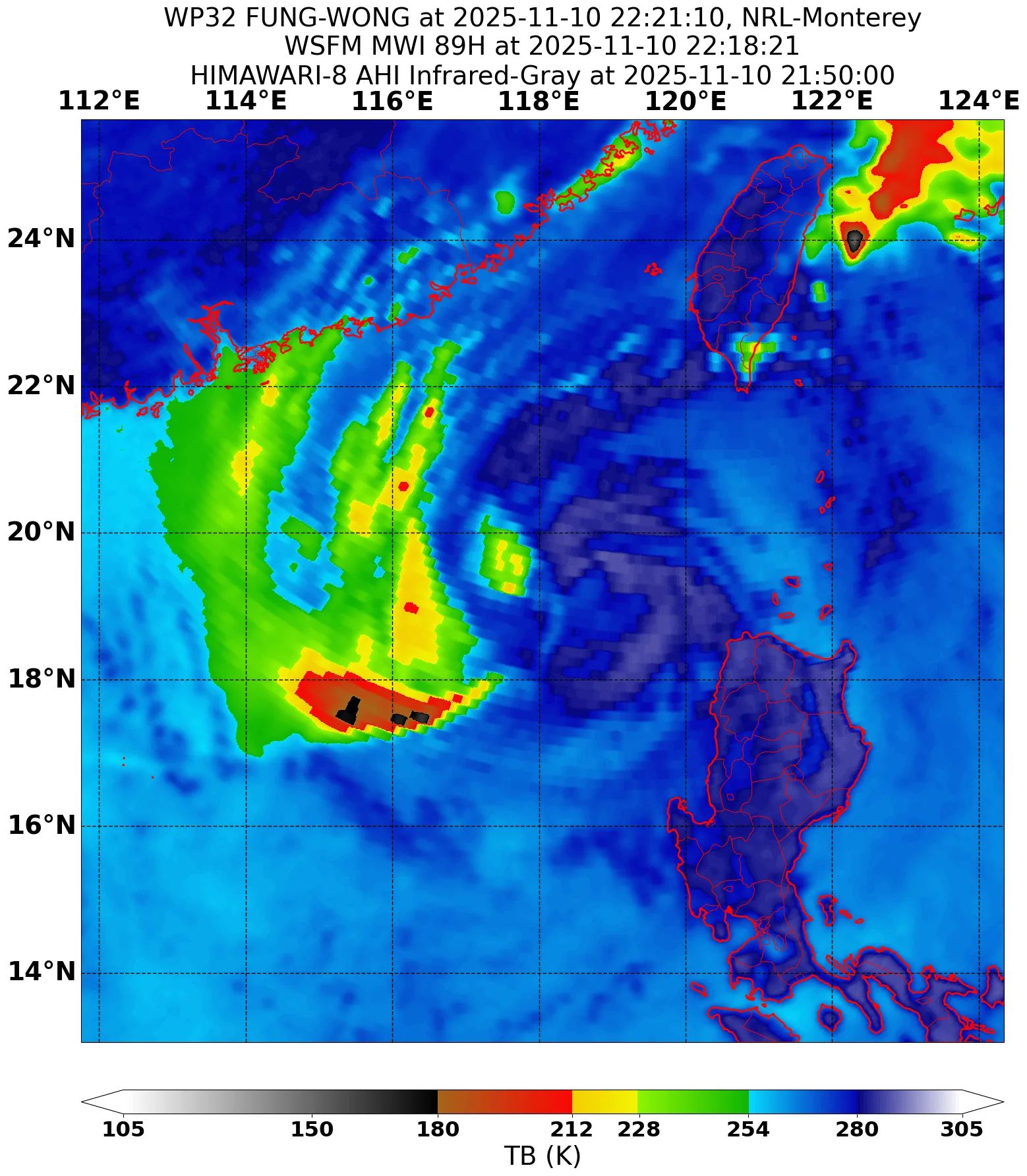
The northeast monsoon flow is starting to interact with Fung-wong, and the typhoon’s already disrupted structure is now even more disrupted as a result. The central dense overcast now has a shredded appearance, and most of the convection is now displaced to the west of the circulation center, which has begun to become exposed. Convection north of the center has eroded significantly, likely as a result of the strong northeasterly surface flow. Despite this disruption, Fung-wong continues to have an extremely large wind field, and despite PAGASA lifting signal #3 along the northwestern coast of Luzon and signal #2 for the eastern coast, scatterometer data indicates that tropical storm force winds are still occurring well off the eastern coast of Luzon, while winds of 50 to 60 kts are still occurring just south and east of the center. There are tropical storm force winds extending up the Taiwan Strait, but these do not appear to be directly associated with Fung-wong. The intensity is lowered to 65 kts, based on consensus T4.0 Dvorak fixes and a SATCON estimate of 65 kts. Other automated estimates also average out to 65 kts.
With Fung-wong now being battered by the northeast monsoon and increasing shear ahead of it on its track, steady weakening appears likely as Fung-wong gradually turns northeastward along the western periphery of a strong ridge anchored over the Philippine Sea. Fung-wong should weaken to a tropical storm later today. The forecast track has been nudged slightly eastward from the previous one and shows landfall over southwestern Taiwan in about 36 hours. Simulated satellite imagery from the HWRF, HAFS-A, and GFS models suggest that Fung-wong will likely lose all of its convection around the time of landfall, so it will likely become a remnant low by 48 hours, assuming the circulation survives Taiwan’s central mountain range. The remnant low should curve southeastward back into the Philippine Sea on Friday before dissipating.
Forecast positions and maximum winds (1-min)
000 hrs: 19.8°N 117.9°E – 65 kts 120 km/h
012 hrs: 20.6°N 118.2°E – 55 kts 100 km/h
024 hrs: 21.3°N 118.9°E – 45 kts 85 km/h
048 hrs: 24.8°N 122.5°E – 30 kts 55 km/h Post-tropical/remnant low
072 hrs: 24.5°N 126.9°E – 25 kts 45 km/h Post-tropical/remnant low
096 hrs: Dissipated
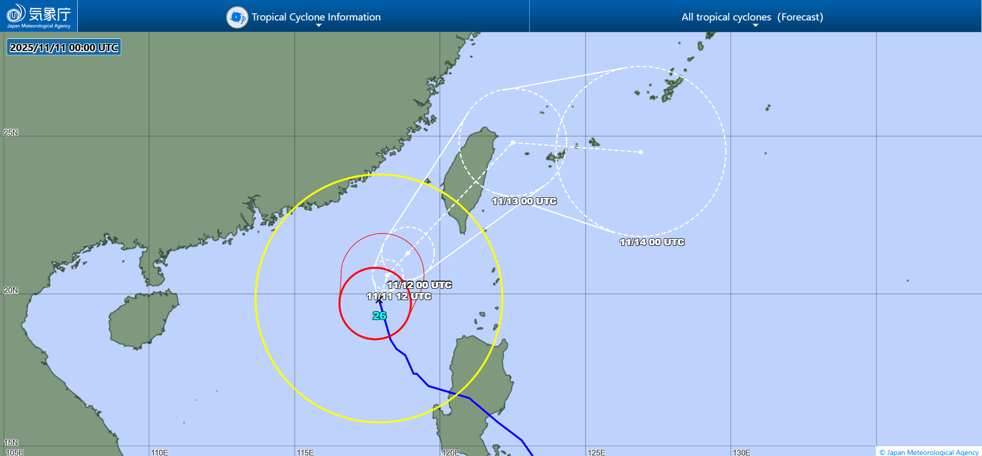
JMA forecast map