- Will Weaver's Weather & Pacific Typhoon Center
- Posts
- Typhoon Bualoi (26W) – Tropical Cyclone Advisory #12: 0000 UTC 29 September 2025
Typhoon Bualoi (26W) – Tropical Cyclone Advisory #12: 0000 UTC 29 September 2025
Bualoi still a typhoon and about to cross into Laos.
Will Weaver
September 28, 2025
…Bualoi still a typhoon and about to cross into Laos…
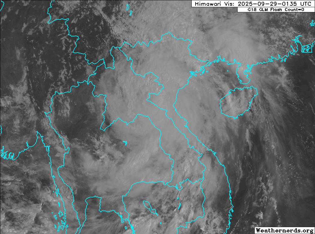
Himawari-9 visible satellite image (Weathernerds)
Current storm information:
Position: 18.7°N 105.1°E
Movement: WNW at 11 knots (20 km/h)
Intensity: 65 knots (120 km/h) [Category 1]
Central pressure: 982 hPa
Trend:
Rapid weakening is forecast during the next 24 hours.
Watches and warnings:
| Hazards affecting land:
|
Discussion:
Bualoi has quickly pushed inland and despite being close to the border of Vietnam and Laos, it is still a typhoon. Bualoi continues to sport a fairly impressive structure for a system so far inland, with convective hot towers flaring around the center and an eye feature still present on microwave satellite imagery. ASCAT data suggests that there are still 60-65 kt winds occurring along the coast and the latest CIMSS D-PRINT estimate was 77 kts. Accounting for decay over land, the intensity is lowered to 65 kts.
Bualoi will soon be moving over much more rugged terrain as it crosses into Laos, and this should do a number on its surface circulation. Most available model guidance loses Bualoi’s vortex within the next 24 hours, but given how resilient it has been so far, there is a 24-hour forecast point in the forecast below with an incredible intensity of 15 kts.
Forecast positions and maximum winds
000 hrs: 18.7°N 105.1°E – 65 kts inland
012 hrs: 20.4°N 102.2°E – 35 kts inland
024 hrs: 21.4°N 100.0°E – 15 kts inland
048 hrs: Dissipated
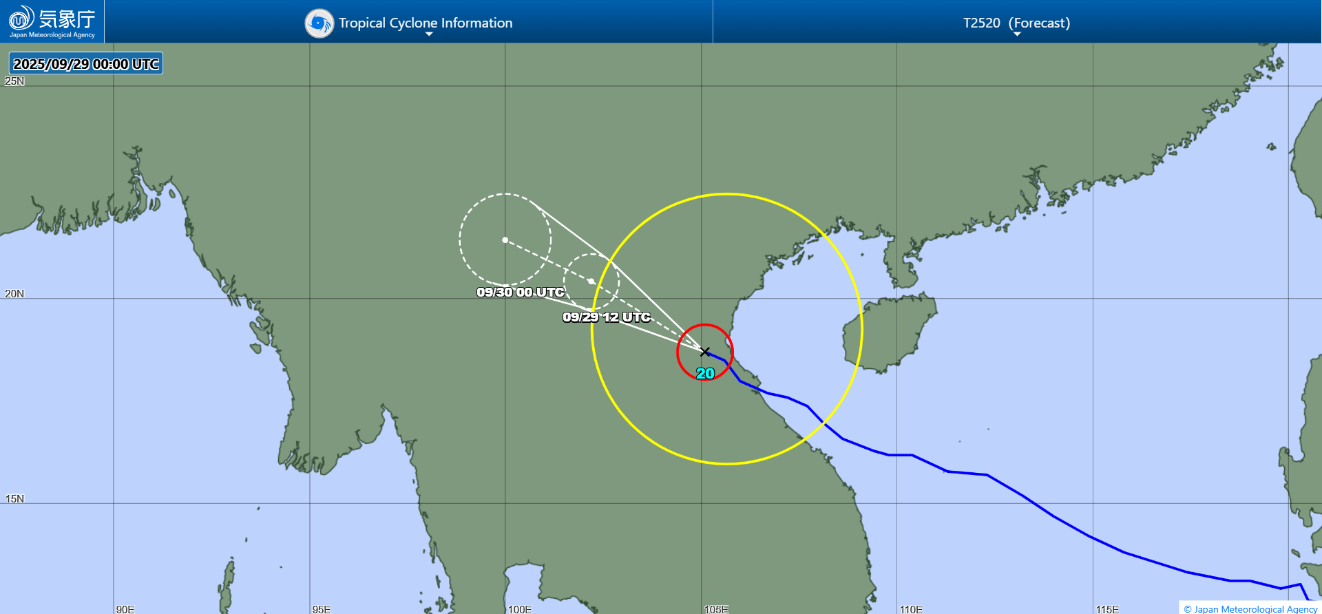
JMA forecast map