- Will Weaver's Weather & Pacific Typhoon Center
- Posts
- Typhoon Bualoi (26W) – Tropical Cyclone Advisory #11: 1500 UTC 28 September 2025
Typhoon Bualoi (26W) – Tropical Cyclone Advisory #11: 1500 UTC 28 September 2025
Bualoi making landfall in north central Vietnam.
Will Weaver
September 28, 2025
…Bualoi making landfall in north central Vietnam…
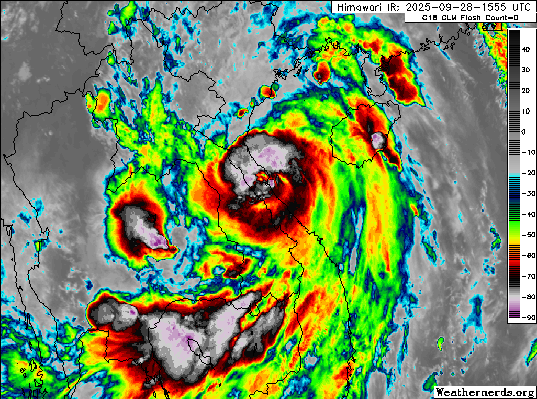
Himawari-9 infrared satellite image (Weathernerds)
Current storm information:
Position: 18.0°N 106.5°E
Movement: NW at 15 knots (25 km/h)
Intensity: 70 knots (130 km/h) [Category 1]
Central pressure: 977 hPa
Trend:
Rapid weakening is forecast during the next 24 hours.
Watches and warnings:
| Hazards affecting land:
|
Discussion:
Satellite imagery indicates that Bualoi has just made landfall in Vietnam northwest of Da Nang within the past 30 minutes. All indications are that Bualoi failed to strengthen as it crossed over the Gulf of Tonkin. Although microwave satellite imagery indicates that a very large eye feature had developed around the circulation center, convection within the eyewall and the CDO remains fragmented due to persistent northerly subsidence over the system associated with a strong upper-level ridge centered over eastern India and Bangladesh. The intensity remains 70 kts, hedged between pre-landfall Dvorak fixes of T4.0 to T4.5 but slightly lower than a D-PRINT estimate of 81 kts.
Now that Bualoi has made landfall, it should weaken rapidly as it races further inland. Bualoi should weaken to a tropical storm within the next few hours, and the circulation will likely decay into a trough over northern Laos on Tuesday. Even though the circulation of Bualoi should dissipate quickly, it remains a significant rainfall hazard for portions of Vietnam, Laos, Thailand, and Myanmar during the next several days.
Forecast positions and maximum winds
000 hrs: 18.0°N 106.5°E – 70 kts inland
012 hrs: 18.9°N 104.7°E – 45 kts inland
024 hrs: 19.9°N 102.0°E – 25 kts inland
048 hrs: Dissipated
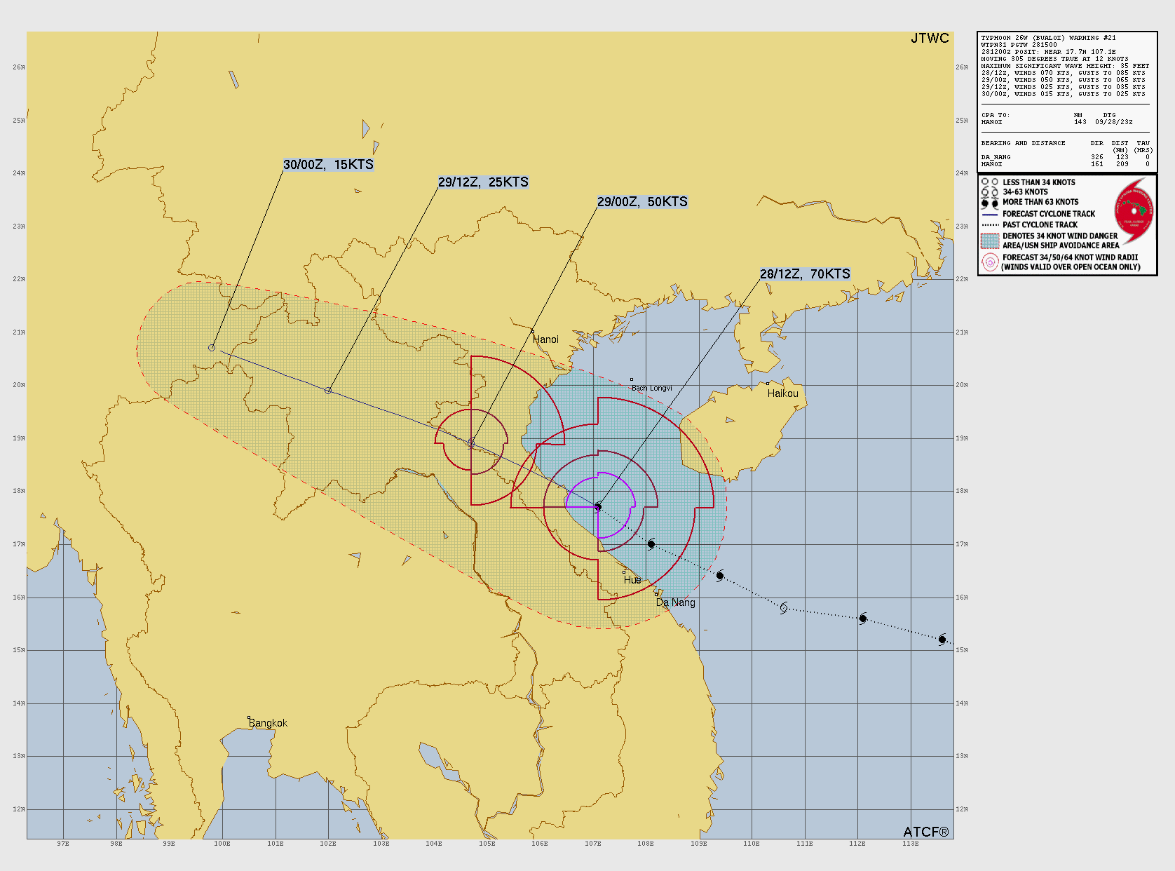
JTWC forecast map