- Will Weaver's Weather & Pacific Typhoon Center
- Posts
- Typhoon Bualoi (26W) – Tropical Cyclone Advisory #10: 0000 UTC 28 September 2025
Typhoon Bualoi (26W) – Tropical Cyclone Advisory #10: 0000 UTC 28 September 2025
Bualoi to make landfall in Vietnam overnight tonight into Monday.
Will Weaver
September 27, 2025
…Bualoi to make landfall in Vietnam overnight tonight into Monday…
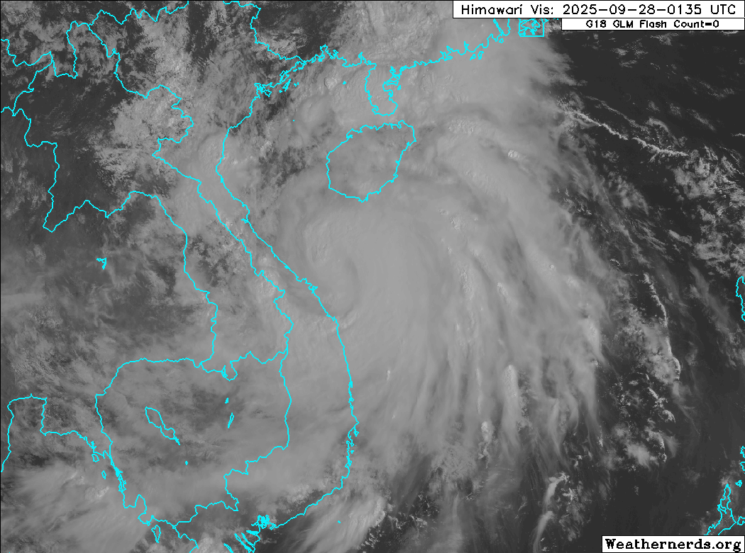
Himawari-9 visible satellite image (Weathernerds)
Current storm information:
Position: 16.3°N 109.4°E
Movement: W at 15 knots (25 km/h)
Intensity: 70 knots (130 km/h) [Category 1]
Central pressure: 980 hPa
Trend:
Some slight strengthening is forecast before Bualoi makes landfall. Rapid weakening is expected thereafter.
Watches and warnings:
| Hazards affecting land:
|
Discussion:
Bualoi has not gotten significantly better organized since the previous advisory. In fact, its structure and satellite presentation have actually deteriorated, and CIMSS shear analysis suggests the culprit is some northerly subsidence that is impacting the system. Microwave satellite imagery indicates that the eye feature that had developed before the previous advisory has lost definition, with just a curved band of convection present along the southeastern periphery of the circulation center. In addition, the CDO has become fragmented, although some bands of intense convection are attempting to wrap back into the center from the north and west. The northerly subsidence also seems to be impinging upon Bualoi’s poleward outflow channel, which is restricted. The intensity is nudged down slightly to 70 kts, hedged between Dvorak estimates of T4.0 to T4.5 and automated ADT, AiDT, and D-PRINT estimates ranging from 59 to 77 kts.
Bualoi is about 18 hours away from landfall. The environment seems to be favorable for a little bit of additional strengthening before then, although given Bualoi’s current structure, it doesn’t appear that strengthening will be rapid. After landfall late tonight or early Monday, Bualoi should weaken very rapidly as it crosses rough terrain and encounters strong shear, and Bualoi should weaken to a tropical depression over Laos by Monday evening and dissipate outright on Tuesday.
Forecast positions and maximum winds
000 hrs: 16.3°N 109.4°E – 70 kts
012 hrs: 17.6°N 107.1°E – 80 kts
024 hrs: 18.7°N 104.7°E – 45 kts inland
048 hrs: 20.8°N 100.1°E – 25 kts inland
072 hrs: Dissipated
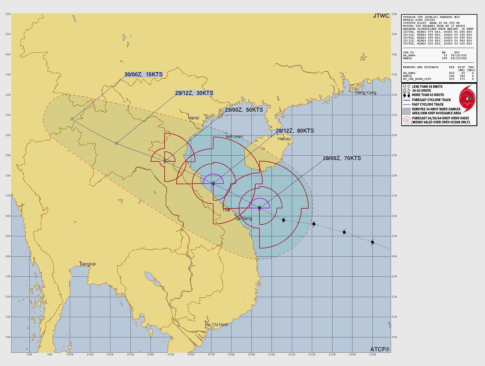
JTWC forecast map