- Will Weaver's Weather & Pacific Typhoon Center
- Posts
- Tropical Storm Nongfa (20W) – Tropical Cyclone Advisory #4: 0000 UTC 30 August 2025
Tropical Storm Nongfa (20W) – Tropical Cyclone Advisory #4: 0000 UTC 30 August 2025
Depression strengthens into Tropical Storm Nongfa in the Gulf of Tonkin.
…Depression strengthens into Tropical Storm Nongfa in the Gulf of Tonkin…

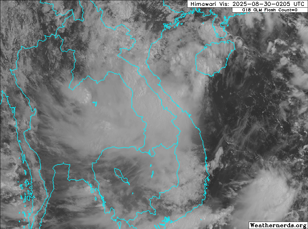
Himawari-9 visible satellite image (Weathernerds)
Current storm information:
Position: 17.9°N 107.9°E
Movement: WNW at 15 knots (25 km/h)
Intensity: 35 knots (65 km/h)
Central pressure: 994 hPa
Trend:
Little change in strength is forecast before landfall. Rapid weakening is expected afterward, and Nongfa will likely dissipate on Sunday.
Watches and warnings:
| Hazards affecting land:
|
Discussion:

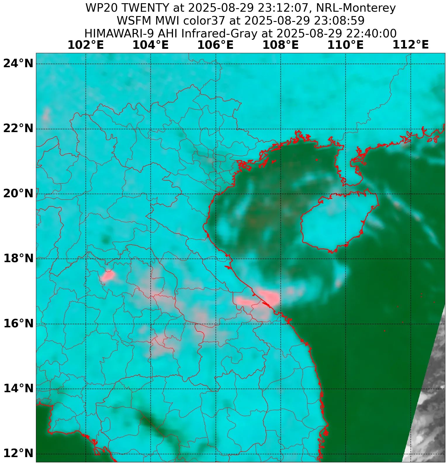
WSFM MWI 37GHz microwave satellite image
Although Tropical Depression 20W remains a sheared system, it has gotten better organized as it accelerates into the Gulf of Tonkin, which is reducing the effective shear over the system. Most of the convection is displaced to the west of the circulation center and is located over Vietnam and Laos, but the circulation center itself is no longer exposed and is tucked under the eastern edge of the convection. Radar and microwave satellite data also indicates the circulation has become a bit better defined. ASCAT data and surface observations indicate that there are now tropical storm force winds occurring north and northeast of the center, and Dvorak estimates range from T2.0 to T2.5 with CIMSS ADT and D-PRINT estimates of 45 and 33 kts. All of these data suggest that 20W is now a tropical storm, and so it is upgraded to Tropical Storm Nongfa with 35 kt winds.
Nongfa will be making landfall in central Vietnam south of Ba Don within the next few hours. Given Nongfa’s sheared appearance, it does not seem likely it will strengthen any further before then. Most of the model guidance weakens Nongfa below 15 kts within 18 hours of landfall, which is effectively dissipation. Although Nongfa will dissipate quickly after landfall, its associated moisture should linger for a few days and contribute to flooding rainfall in areas that previously experienced flooding from Typhoon Kajiki.
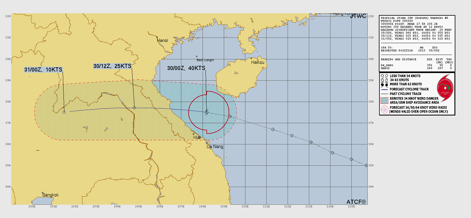
Forecast positions and maximum winds
00 hrs: 17.9°N 107.9°E – 35 kts
12 hrs: 17.7°N 104.8°E – 20 kts inland
24 hrs: Dissipated

JTWC forecast map