- Will Weaver's Weather & Pacific Typhoon Center
- Posts
- Tropical Storm Nokaen (01W/Ada) – Tropical Cyclone Advisory #6: 1500 UTC 16 January 2026
Tropical Storm Nokaen (01W/Ada) – Tropical Cyclone Advisory #6: 1500 UTC 16 January 2026
Nokaen strengthens a little as it passes to the east of Samar...
Will Weaver
January 16, 2026
…Nokaen strengthens a little as it passes to the east of Samar…
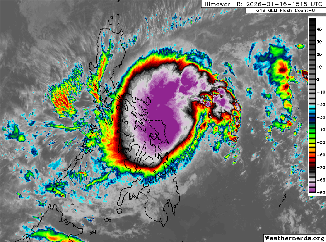
Himawari-9 infrared satellite image (Weathernerds)
Current storm information:
Position: 12.2°N 127.0°E
Movement: N at 8 knots (15 km/h)
Intensity: 40 knots (75 km/h)
Central pressure: 996 hPa
Trend:
Little change in strength is forecast during the next 24 hours.
Watches and warnings:  PAGASA wind signal map (click to enlarge)
Areas that should monitor this system: This section is new for 2026 – not every agency issues local tropical cyclone watches or warnings. This is a general list of land areas that should monitor the progress of this system and plan accordingly, whether or not official tropical cyclone watches or warnings are in effect.
| Hazards affecting land:
|
The next advisory will be posted after 0000 UTC 17 January 2026.
Forecast positions and maximum winds (1-min)
000 hrs: 12.2°N 127.0°E – 40 kts 75 km/h
012 hrs: 13.0°N 125.8°E – 40 kts 75 km/h
024 hrs: 13.9°N 125.2°E – 45 kts 85 km/h
048 hrs: 15.4°N 125.3°E – 40 kts 75 km/h
072 hrs: 16.3°N 127.0°E – 35 kts 65 km/h
096 hrs: 16.3°N 128.7°E – 35 kts 65 km/h
120 hrs: 15.2°N 130.0°E – 30 kts 55 km/h Post-tropical/remnant low
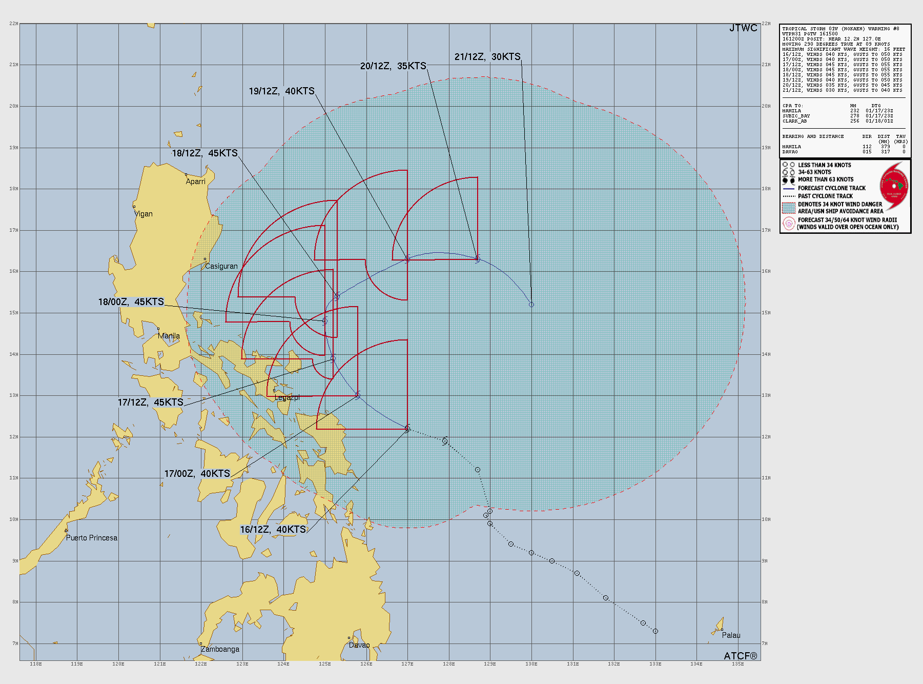
JTWC forecast map