- Will Weaver's Weather & Pacific Typhoon Center
- Posts
- Tropical Storm Nakri (29W) – Tropical Cyclone Advisory #7: 0000 UTC 11 October 2025
Tropical Storm Nakri (29W) – Tropical Cyclone Advisory #7: 0000 UTC 11 October 2025
Nakri remains nearly stationary southeast of Amami Oshima.
Will Weaver
October 10, 2025
…Nakri remains nearly stationary southeast of Amami Oshima…
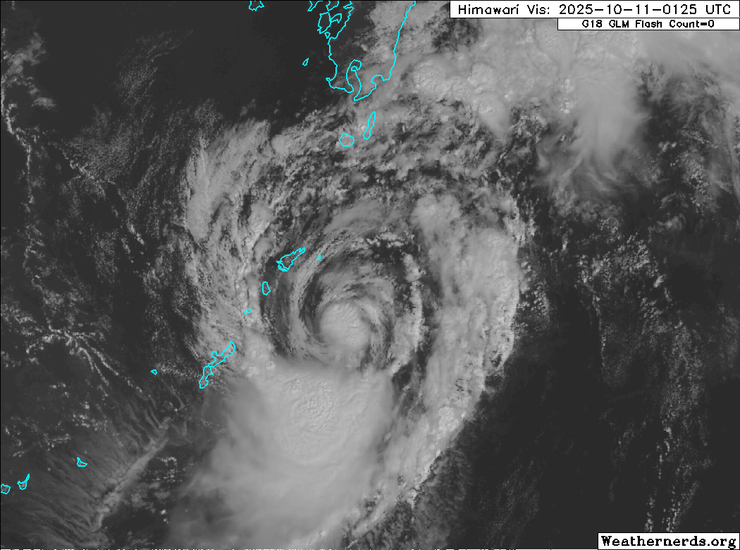
Himawari-9 visible satellite image (Weathernerds)
Current storm information:
Position: 27.2°N 130.3°E
Movement: Nearly stationary
Intensity: 45 knots (85 km/h)
Central pressure: 996 hPa
Trend:
Some slow strengthening is forecast during the next 24 hours.
Watches and warnings:
| Hazards affecting land:
|
The next advisory will be posted after 1200 UTC 11 October 2025.
Forecast positions and maximum winds
000 hrs: 27.2°N 130.3°E – 45 kts
012 hrs: 29.1°N 131.6°E – 50 kts
024 hrs: 30.7°N 133.7°E – 55 kts
048 hrs: 33.4°N 141.3°E – 65 kts
072 hrs: 34.8°N 151.7°E – 70 kts
096 hrs: 34.3°N 162.6°E – 60 kts Post-tropical/extratropical
120 hrs: 33.9°N 171.6°E – 40 kts Post-tropical/extratropical

JMA forecast map