- Will Weaver's Weather & Pacific Typhoon Center
- Posts
- Tropical Storm Krosa (12W) – Tropical Cyclone Advisory #22: 0000 UTC 3 August 2025
Tropical Storm Krosa (12W) – Tropical Cyclone Advisory #22: 0000 UTC 3 August 2025
Krosa expected to become a post-tropical cyclone by Monday.
Will Weaver
August 02, 2025
…Krosa expected to become a post-tropical cyclone by Monday…
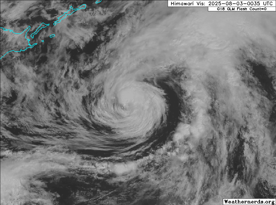
Himawari-9 visible satellite image (Weathernerds)
Current storm information:
Position: 39.9°N 150.9°E
Movement: ENE at 21 knots (35 km/h)
Intensity: 50 knots (95 km/h)
Central pressure: 977 hPa
Trend:
Gradual weakening is expected during the next 24 hours, and Krosa will likely become a post-tropical cyclone late tonight or early on Monday.
Watches and warnings:
| Hazards affecting land:
|
Discussion:
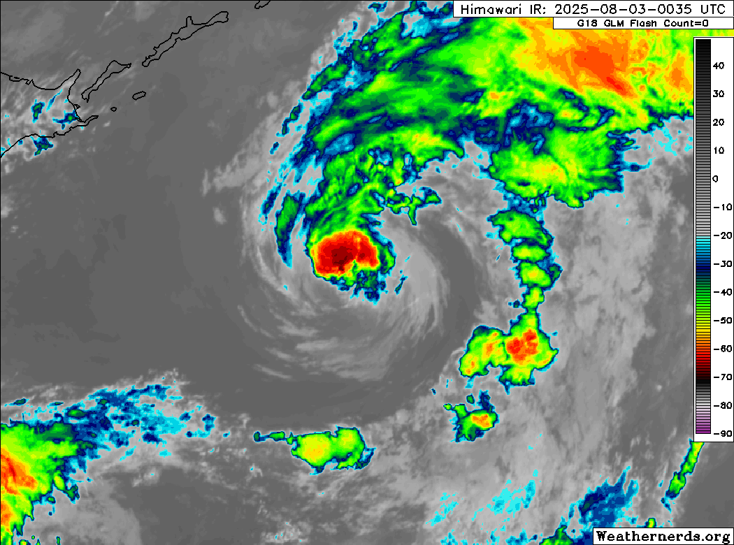
Himawari-9 visible satellite image (Weathernerds)
Krosa has crossed the northern wall of 26°C SSTs in the subtropical Pacific, and the storm is starting to take on extratropical characteristics. Convection has become limited to north and east of the center, and the center itself is becoming elongated from southwest to northeast. Meanwhile, a slot of very dry air is present and wrapping into the center from the south, and JMA and OPC surface analyses indicate the presence of cold and warm fronts very close to Krosa’s center. Available scatterometer data indicates the wind field has continued to expand to the south and east, as well. The intensity is lowered to 50 kts, hedged between Dvorak fixes ranging from T2.5 to T3.5, and CIMSS ADT and SATCON estimates of 51 and 49 kts respectively.
Now that Krosa is over colder waters and becoming embedded within a baroclinic zone, it should quickly lose the rest of its tropical characteristics during the day today. Krosa is expected to become a post-tropical cyclone as early as late tonight or early Monday morning. The post-tropical cyclone should continue racing eastward, exiting the basin on Monday evening before becoming absorbed by a large extratropical low pressure system over the southern Bering Sea on Tuesday.
Forecast positions and maximum winds
00 hrs: 39.9°N 150.9°E – 50 kts
12 hrs: 41.0°N 156.9°E – 50 kts
24 hrs: 42.2°N 162.5°E – 45 kts Post-tropical/extratropical
48 hrs: 43.4°N 174.5°E – 40 kts Post-tropical/extratropical
72 hrs: Absorbed by larger extratropical low
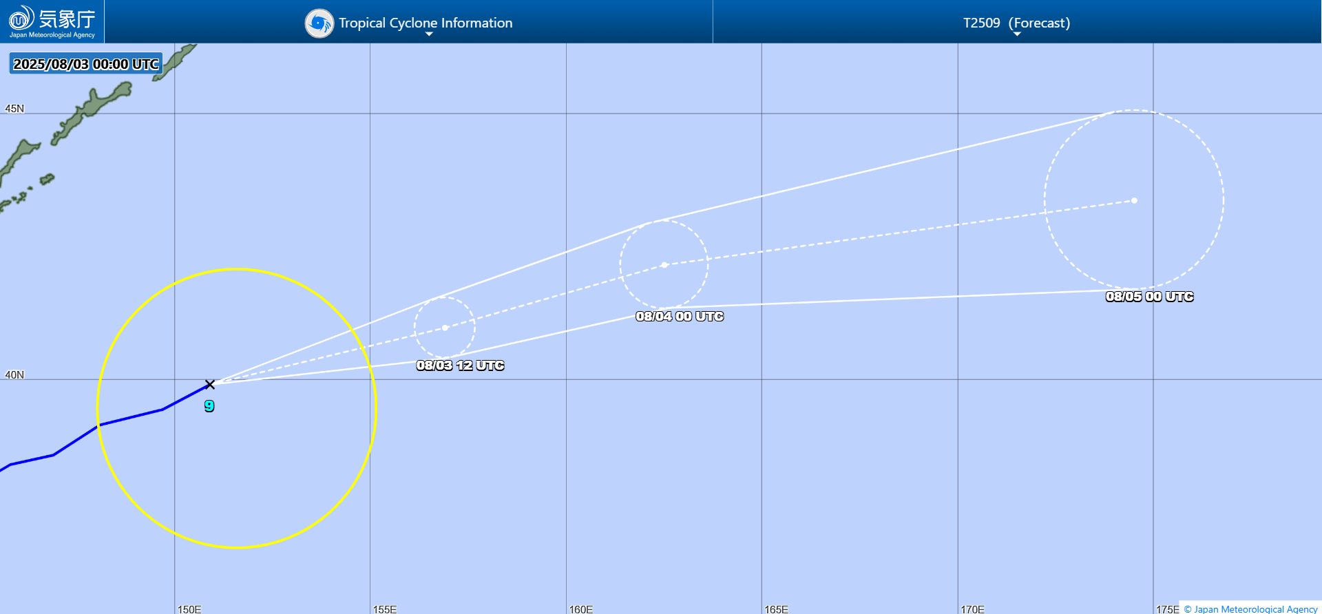
JMA forecast map