- Will Weaver's Weather & Pacific Typhoon Center
- Posts
- Tropical Storm Hagupit (05W) – Tropical Cyclone Advisory #6: 0000 UTC 8 May 2026
Tropical Storm Hagupit (05W) – Tropical Cyclone Advisory #6: 0000 UTC 8 May 2026
Hagupit a little stronger as it continues producing tropical storm conditions in Yap State.
Will Weaver
May 07, 2026
…Hagupit a little stronger as it continues producing tropical storm conditions in Yap State…

Himawari-9 visible satellite image (Weathernerds)
Current storm information:
Position: 8.0°N 140.1°E
Movement: WNW at 10 knots (20 km/h)
Intensity: 40 knots (75 km/h)
Central pressure: 998 hPa
Trend:
Little change in strength is forecast during the next 24 hours.
Watches and warnings:
Areas that should monitor this system:
| Hazards affecting land:
|
Discussion:

Himawari-9 infrared satellite image (Weathernerds)
Hagupit has gotten somewhat better organized during the last few hours. Convection has increased substantially over the center and to the east, and it is quite intense with cloud tops as cold as -95°C with impressive poleward outflow. The circulation remains fairly broad and poorly defined, however, and the convection over the center lacks structure. CIMSS shear analysis indicates that westerly shear has begun to increase, and despite the increase in convection, the circulation remains partially exposed. Dvorak estimates range from T2.5 to T3.0 with CIMSS ADT, AiDT, and D-PRINT estimates covering a wide range from 33 to 49 kts. The intensity is increased to a potentially conservative 40 kts; it should be noted that a recent RCM-2 SAR pass found winds of 40 to 45 kts north of the center.
This is a recording: Hagupit is forecast to move generally west-northwestward during the next couple of days as the ridge to the north weakens. Most of the model guidance has Hagupit’s convection blown apart by much stronger shear over the weekend, and simulated satellite imagery from the GFS, HWRF, and HAFS-A models suggest that Hagupit will degenerate into a non-convective post-tropical cyclone or remnant low as soon as Sunday. The remnant low will likely continue on a west-northwest to northwest trajectory in the Philippine Sea before dissipating well to the east of Luzon early next week.
Forecast positions and maximum winds (1-min)
000 hrs: 08.0°N 140.1°E – 40 kts 75 km/h
012 hrs: 08.6°N 138.7°E – 40 kts 75 km/h
024 hrs: 09.5°N 137.0°E – 40 kts 75 km/h
048 hrs: 10.9°N 134.3°E – 35 kts 65 km/h POST-TROPICAL
072 hrs: 12.2°N 131.7°E – 30 kts 55 km/h POST-TROPICAL/REMNANT LOW
096 hrs: 14.6°N 130.7°E – 25 kts 45 km/h POST-TROPICAL/REMNANT LOW
120 hrs: DISSIPATED
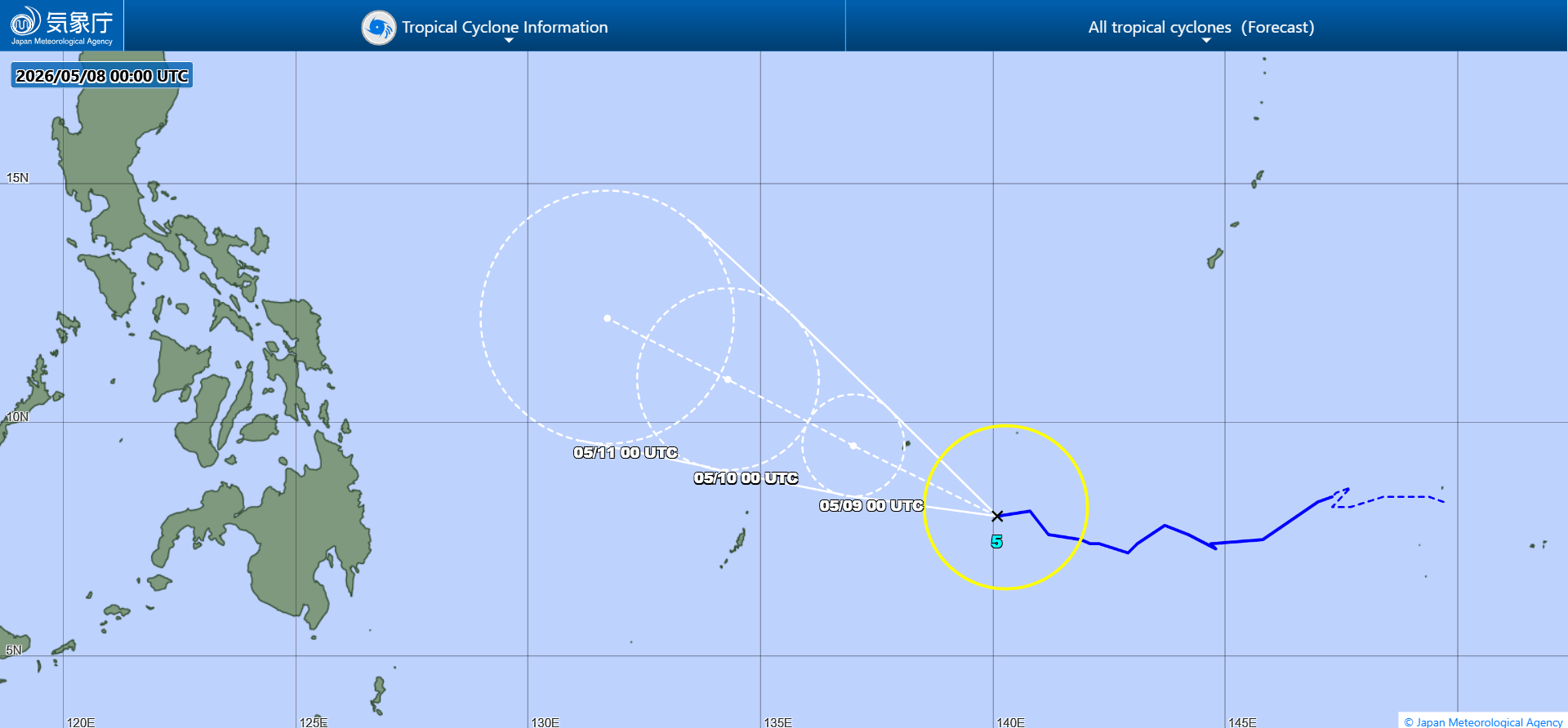
JMA forecast map