- Will Weaver's Weather & Pacific Typhoon Center
- Posts
- Tropical Storm Fung-wong (32W/Uwan) – Tropical Cyclone Advisory #19: 1200 UTC 12 November 2025
Tropical Storm Fung-wong (32W/Uwan) – Tropical Cyclone Advisory #19: 1200 UTC 12 November 2025
Fung-wong clinging to life as a tropical cyclone as it crosses southern Taiwan...
Will Weaver
November 12, 2025
…Fung-wong clinging to life as a tropical cyclone as it crosses southern Taiwan…
Current storm information:
Position: 22.2°N 120.6°E
Movement: ENE at 10 knots (20 km/h)
Intensity: 40 knots (75 km/h)
Central pressure: 998 hPa
Trend:
Continued gradual weakening is forecast during the next 24 hours, and Fung-wong will likely become a post-tropical cyclone later tonight or on Thursday.
Watches and warnings:
| Hazards affecting land:
|
Discussion:
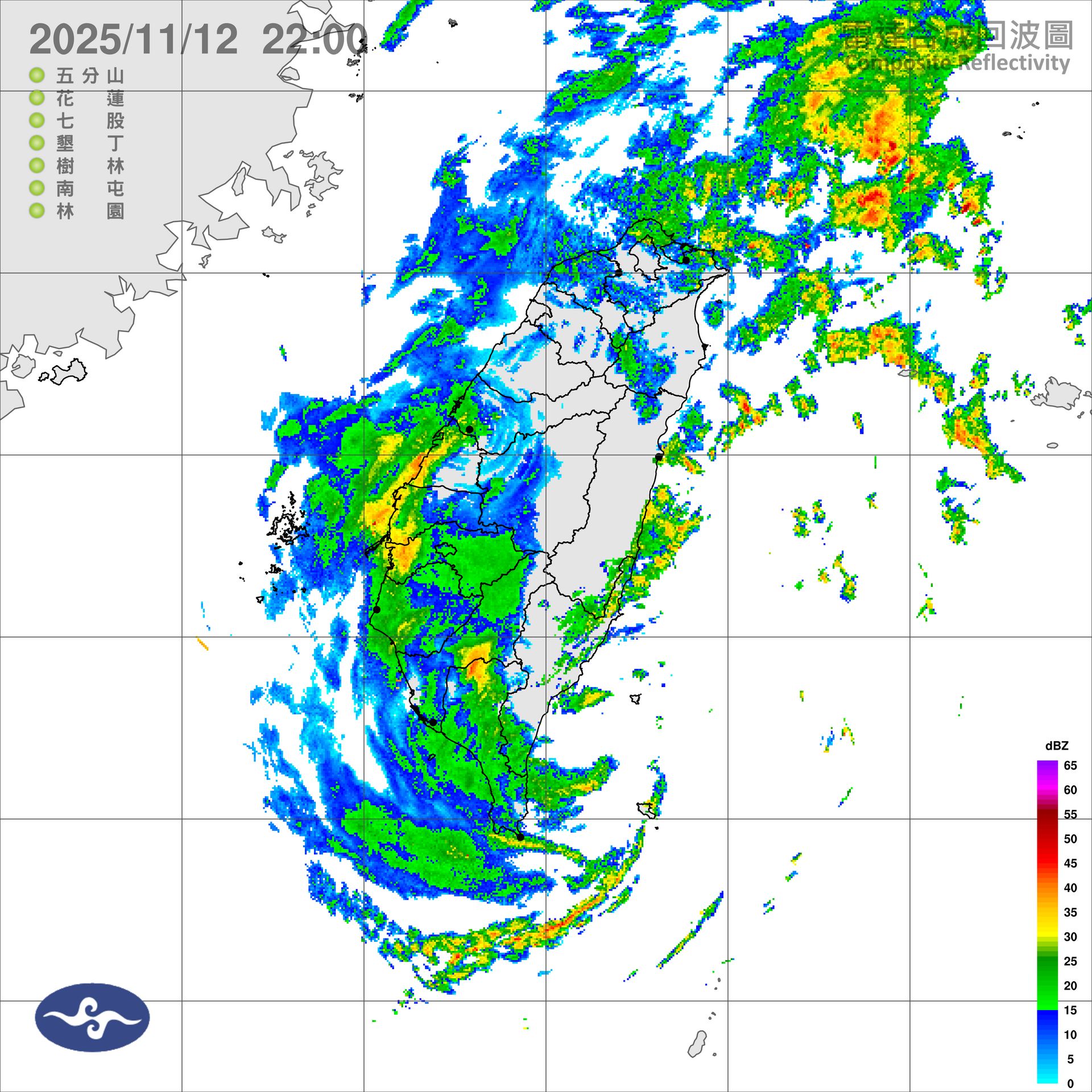
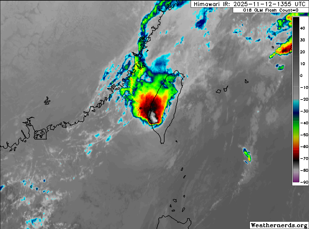
Despite the extremely hostile environment, Fung-wong recently began generating some deep convection near its center, and it stubbornly continues to do so even as it crosses over southern Taiwan. This convection has given it a bit of a reprieve from becoming a post-tropical cyclone, and it was still a tropical storm when it made landfall not too long ago. Still, this convection is being sheared off to the northwest and is very limited in coverage. Although Dvorak estimates range from T1.5 to T2.5 and pre-landfall automated estimates suggest that Fung-wong is only barely a tropical storm, scatterometer data suggests that Fung-wong is continuing to produce a small area of 35 to 40 kt winds near its center that are not associated with the northeast monsoon, so the intensity is lowered to 40 kts.
No changes to the forecast are necessary. Fung-wong is forecast to continue moving generally east-northeastward toward the Yaeyama and Ryukyu Islands during the next day or two. Although Fung-wong will move back over fairly warm waters, strong westerly shear and continued dry air entrainment will preclude any restrengthening, and Fung-wong will likely become a post-tropical cyclone later tonight or early on Thursday. Although the model guidance suggests that Fung-wong will begin producing more convection on Thursday, this appears to be due to a baroclinic interaction with a frontal boundary, and so Fung-wong is classified as a post-tropical/extratropical low at the 24 hour forecast point. Fung-wong’s circulation should become absorbed by the frontal system by Saturday as it passes just south of Okinawa.
Forecast positions and maximum winds (1-min)
000 hrs: 22.2°N 120.6°E – 40 kts 75 km/h
012 hrs: 23.2°N 121.8°E – 40 kts 75 km/h Post-tropical
024 hrs: 25.0°N 124.9°E – 35 kts 65 km/h Post-tropical/extratropical
048 hrs: 25.9°N 131.7°E – 30 kts 55 km/h Post-tropical/extratropical
072 hrs: Absorbed by extratropical low
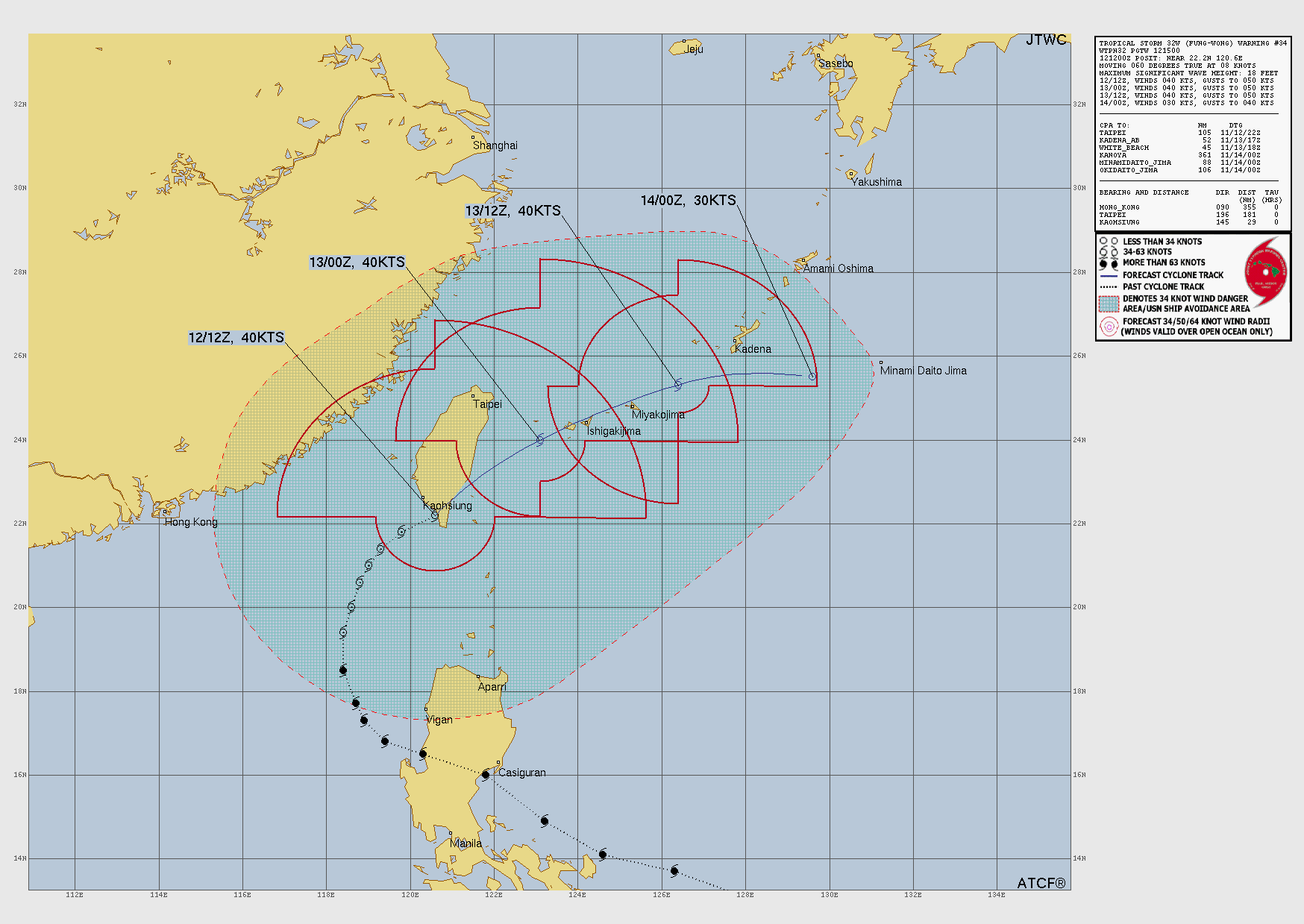
JTWC forecast map