- Will Weaver's Weather & Pacific Typhoon Center
- Posts
- Tropical Storm Fung-wong (32W) – Tropical Cyclone Advisory #18: 0000 UTC 12 November 2025
Tropical Storm Fung-wong (32W) – Tropical Cyclone Advisory #18: 0000 UTC 12 November 2025
Fung-wong likely to become a post-tropical cyclone before reaching Taiwan...
Will Weaver
November 11, 2025
…Fung-wong likely to become a post-tropical cyclone before reaching Taiwan…
Replace this image with a current satellite image of the storm (Source)
ent storm information:
Position: 21.7°N 119.3°E
Movement: NE at 6 knots (10 km/h)
Intensity: 45 knots (85 km/h)
Central pressure: 994 hPa
Trend:
Continued weakening is forecast during the next 24 hours, and Fung-wong could become a post-tropical cyclone before reaching Taiwan.
Watches and warnings:
| Hazards affecting land:
|
Discussion:
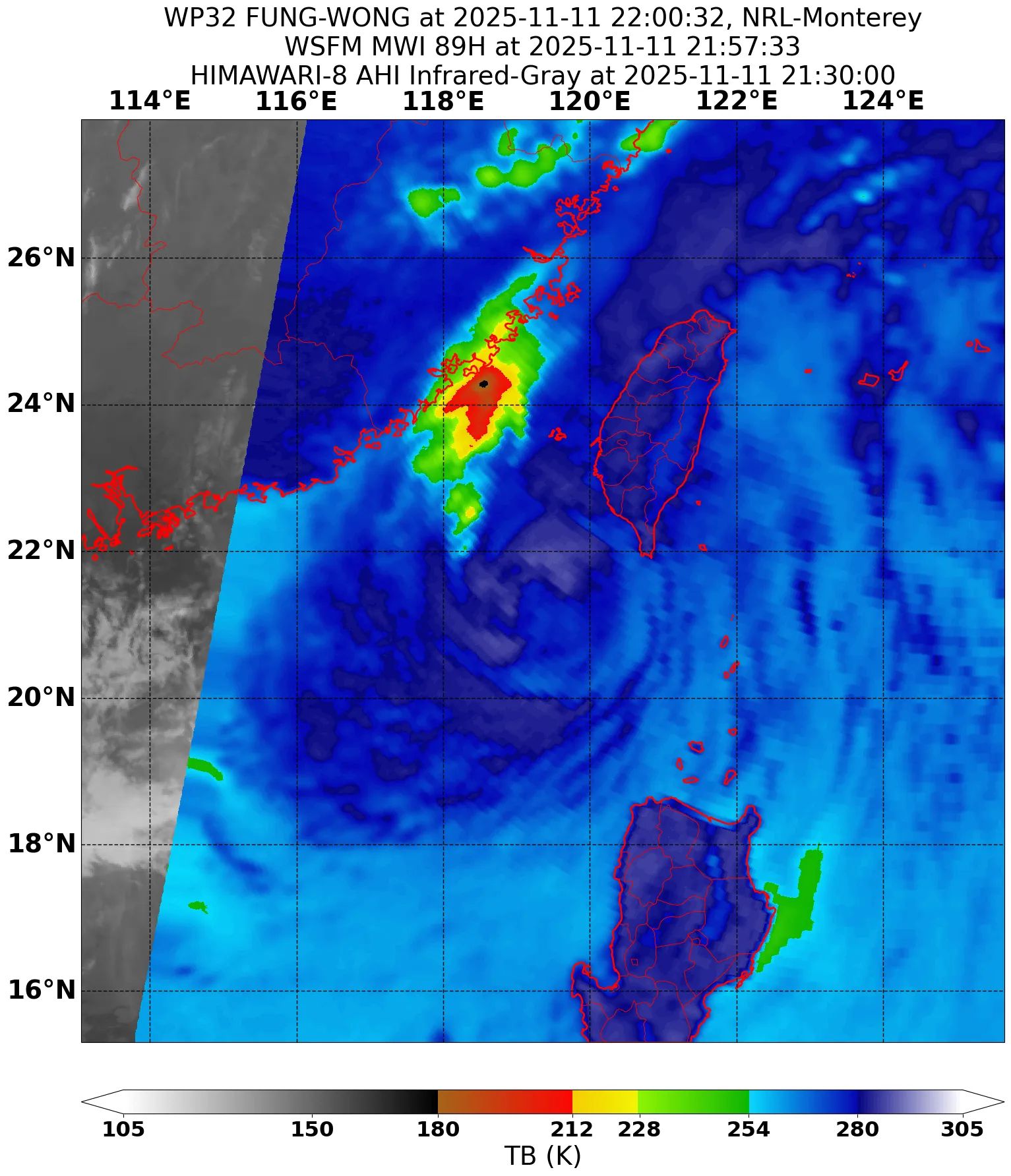
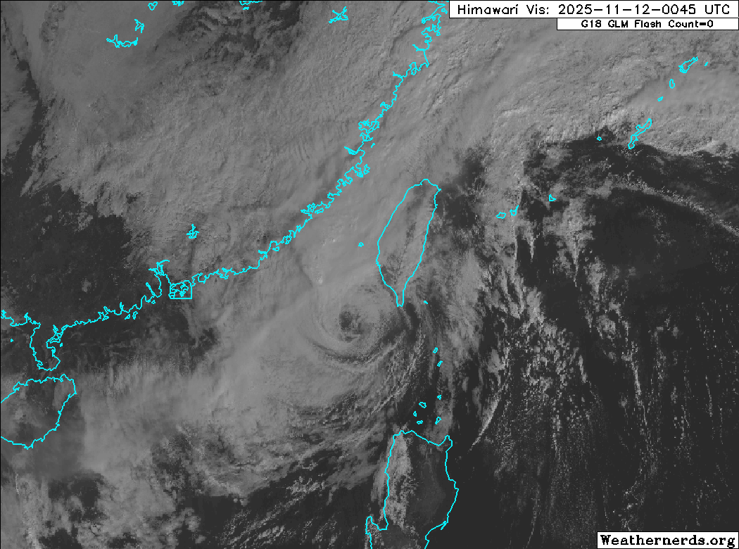
Fung-wong has lost nearly all of its convection, and aside from a small area in the Taiwan Strait, it is mostly devoid of convection and consists of a fully exposed swirl of low clouds drifting northeastward toward Taiwan. The remaining convection has taken on an almost linear appearance due to interaction with strong southeasterly shear and the strong northeasterly cold surge in the Taiwan Strait and East China Sea, and it is becoming less likely that this convection is directly associated with Fung-wong. Dvorak estimates are dropping very rapidly and range from T1.5 (from KNES) to T3.0 (from PGTW and RJTD). The intensity is lowered to 45 kts, which is likely generous, but there has been no recent scatterometer data to “truth” this estimate.
Given the extremely hostile environment Fung-wong is located in, it does not appear likely that it will be able to generate new deep convection near its center, and it is now expected to become a post-tropical cyclone just before reaching southern Taiwan. The forecast track has been nudged a bit south of the previous one, and the new track no longer has Fung-wong passing over Taiwan’s central mountain range. However, the environment is expected to remain extremely hostile, so even though the circulation will likely persist for a few days, moving erratically toward the east-northeast before turning southeast near Okinawa, the system should continue to spin down before dissipating to the south of Okinawa on Saturday. There are some models that indicate Fung-wong’s remnants generating new convection around that time, but this would likely happen as they are absorbed into a developing frontal system south of Japan.
Forecast positions and maximum winds (1-min)
000 hrs: 21.7°N 119.3°E – 45 kts 85 km/h
012 hrs: 21.9°N 120.7°E – 35 kts 65 km/h Post-tropical
024 hrs: 24.8°N 123.1°E – 25 kts 45 km/h Post-tropical/remnant low
048 hrs: 26.5°N 131.1°E – 20 kts 35 km/h Post-tropical/remnant low
072 hrs: Dissipated
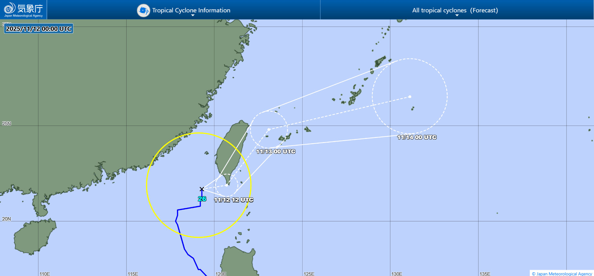
JMA forecast map