- Will Weaver's Weather & Pacific Typhoon Center
- Posts
- Tropical Storm Francisco (10W/Dante) – Tropical Cyclone Advisory #2: 0000 UTC 23 July 2025
Tropical Storm Francisco (10W/Dante) – Tropical Cyclone Advisory #2: 0000 UTC 23 July 2025
Depression southeast of Okinawa strengthens into Tropical Storm Francisco
Will Weaver
July 22, 2025
…Depression southeast of Okinawa strengthens into Tropical Storm Francisco…
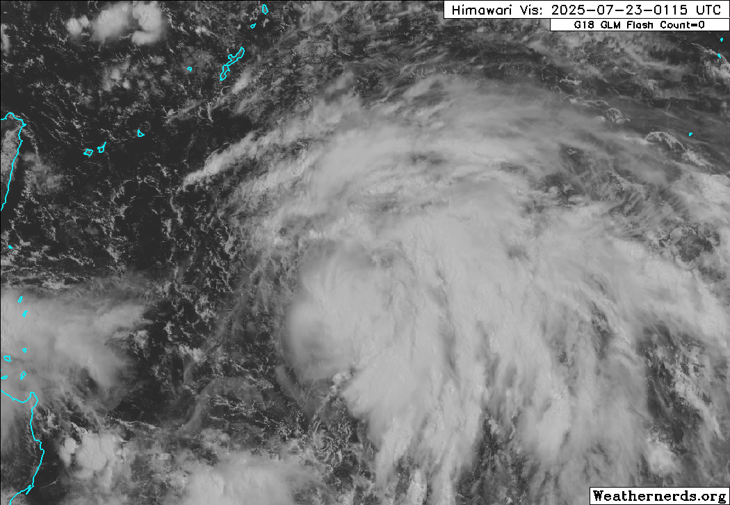 Himawari-9 visible satellite image (Weathernerds) | Current storm information:
Trend:
|
Watches and warnings:
| Hazards affecting land:
|
Discussion:

Himawari-9 visible satellite image (Weathernerds)
Tropical Depression 10W has continued to show some signs of organization, although it retains its monsoonal characteristics. The convection is forming up into discrete bands, although as a whole it is slightly displaced to the south and east of the circulation center, which is partially exposed on the northwestern edge of the main convective mass. Dvorak estimates of T2.0 to T2.5 and CIMSS ADT and D-PRINT estimates of 41 and 30 kts average out to 10W being a 35 kt tropical storm, and JMA has upgraded it to Tropical Storm Francisco.
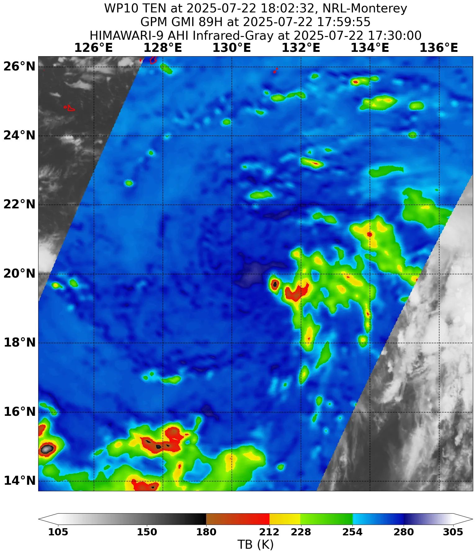
GPM GMI 89GHz microwave satellite image, showing most of the convective banding displaced to the southeast of the center
Francisco is embedded within a large monsoon gyre that extends from the central South China Sea across Luzon and into the central Philippine Sea, and this gyre includes both Tropical Depression 11W and a smaller low pressure area (invest 90W). This is not going to change any time soon, and Francisco is forecast to move generally northwestward in the monsoonal flow. Although SSTs are quite warm, strong northwesterly shear is forecast to persist, and this will limit any strengthening. Only slight strengthening is expected during the next couple of days. By the time Francisco enters the East China Sea on Friday, its circulation is forecast to stretch out and decay into a trough of low pressure as the monsoon gyre breaks down, and Francisco will likely cease to be a trackable entity by Saturday. A 72-hour forecast point is provided, but it is very likely Francisco will have dissipated by then.
Forecast positions and maximum winds
00 hrs: 20.4°N 130.4°E – 35 kts
12 hrs: 22.0°N 128.5°E – 40 kts
24 hrs: 23.6°N 126.8°E – 40 kts
48 hrs: 25.9°N 123.7°E – 40 kts
72 hrs: 27.6°N 121.2°E – 35 kts
96 hrs: Dissipated
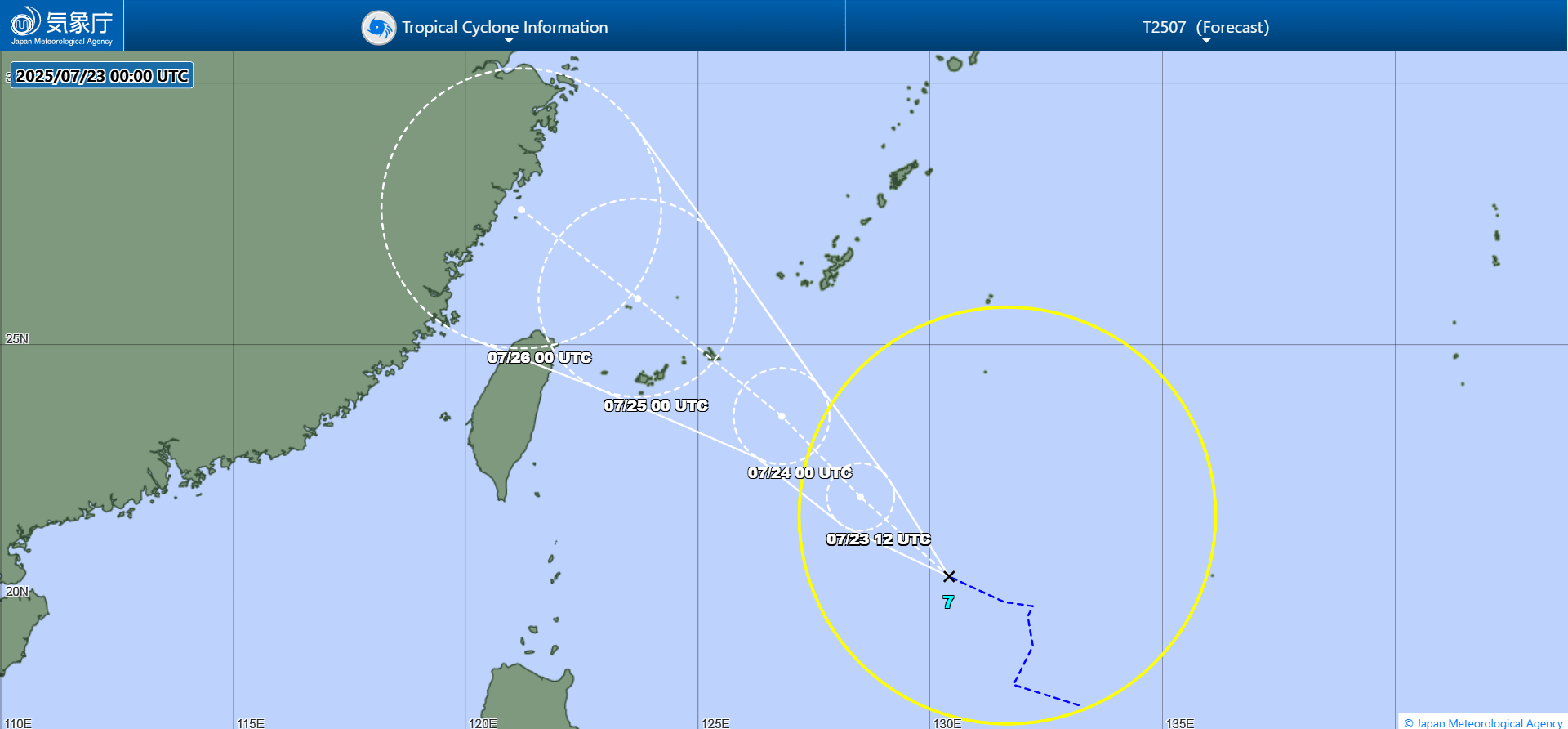
JMA forecast map