- Will Weaver's Weather & Pacific Typhoon Center
- Posts
- Tropical Storm Fengshen (30W) – Tropical Cyclone Advisory #13: 1200 UTC 22 October 2025
Tropical Storm Fengshen (30W) – Tropical Cyclone Advisory #13: 1200 UTC 22 October 2025
Fengshen weakening at a spectacular rate as it approaches the Vietnam coast...
Will Weaver
October 22, 2025
…Fengshen weakening at a spectacular rate as it approaches the Vietnam coast…
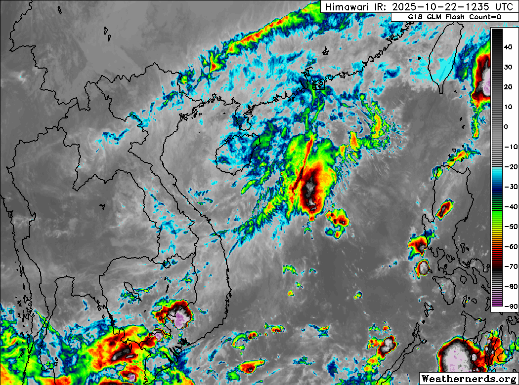
Himawari-8 infrared satellite image (Weathernerds)
Current storm information:
Position: 17.0°N 109.7°E
Movement: WSW at 5 knots (10 km/h)
Intensity: 45 knots (85 km/h)
Central pressure: 994 hPa
Trend:
Rapid weakening is forecast during the next 24 hours, and Fengshen could dissipate before reaching the Vietnam coast.
Watches and warnings:
| Hazards affecting land:
|
Discussion:
What a difference a few hours makes. Almost right on cue, not long after the previous advisory was posted, Fengshen’s convection began evaporating at a truly spectacular rate. The central dense overcast that had been present at that time is now gone, and the only convection associated with Fengshen consists of a few skeletal bands located well to the east of the circulation center. The center itself has become even less defined than it already was, and is barely discernible on proxy-visible and shortwave infrared satellite imagery. This is likely the result of the cooler, drier air associated with the northeasterly cold surge finally working its way into Fengshen’s circulation. Estimates of Fengshen’s intensity are dropping as quickly as the Dvorak technique’s rules allow, and the current intensity is lowered to a potentially generous 45 kts.
Given Fengshen’s extremely rapid rate of decay, it does not appear that it will last much longer. Most of the model guidance continues to show Fengshen’s circulation opening up into a trough just before reaching the Vietnam coast, with only the HWRF model and a few GFS ensemble members showing an actual landfall. The environment should remain extremely hostile despite very warm SSTs, and Fengshen will likely weaken to a tropical depression or a remnant low within the next 12 hours, and dissipate before landfall.
Forecast positions and maximum winds
000 hrs: 17.0°N 109.7°E – 45 kts
012 hrs: 16.2°N 108.7°E – 30 kts Post-tropical/remnant low
024 hrs: Dissipated
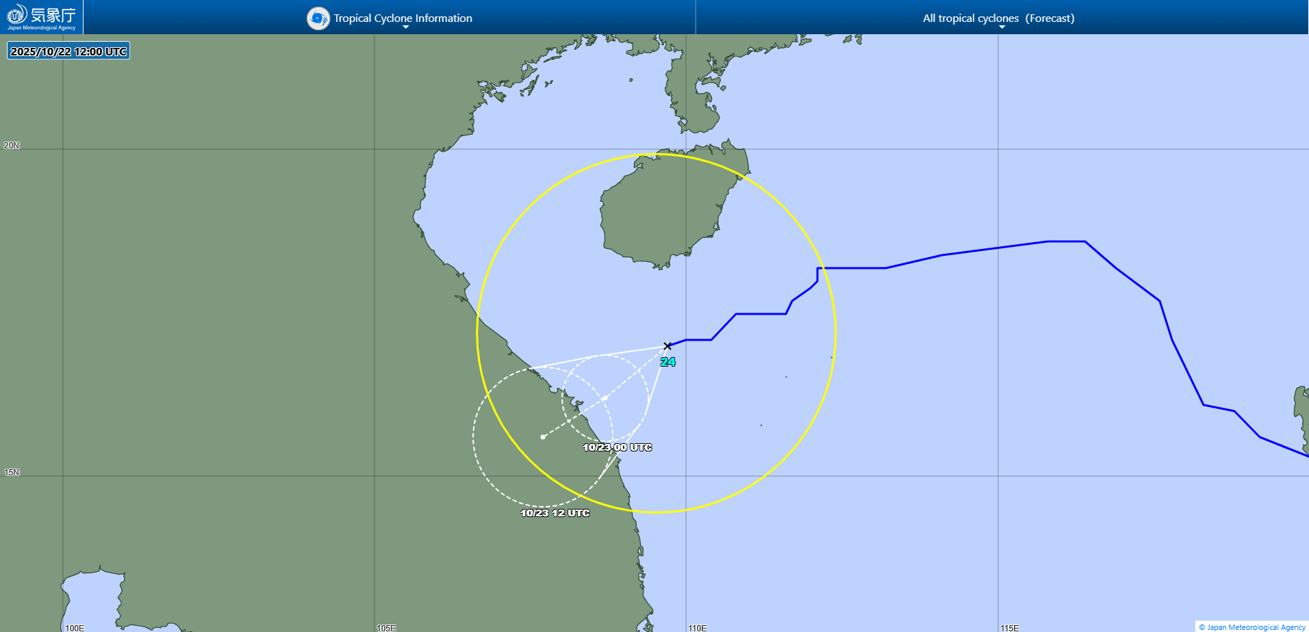
JMA forecast map