- Will Weaver's Weather & Pacific Typhoon Center
- Posts
- Tropical Storm Danas (05W) - Tropical Cyclone Advisory #8: 0000 UTC 8 July 2025
Tropical Storm Danas (05W) - Tropical Cyclone Advisory #8: 0000 UTC 8 July 2025
Poorly organized Danas turning westward toward Eastern China
Will Weaver
July 07, 2025
…Poorly organized Danas turning westward toward Eastern China…
Current storm information:
Position: 28.0°N 122.2°E
Movement: NW at 5 knots (10 km/h)
Intensity: 40 knots (75 km/h)
Central pressure: 994 hPa
Trend:
Little change in strength is forecast during the next 12 hours, with rapid weakening expected after landfall.
Watches and warnings:
There are no land-based watches or warnings in effect.
Hazards affecting land:
Danas (and its remnants) is expected to produce widespread heavy rainfall over portions of southeastern China and Taiwan during the next several days. This rainfall will likely cause widespread severe flooding. For additional information and possible warnings, refer to products from your local weather office.
Discussion:

Himawari-9 visible satellite image (Weathernerds)
Danas has become even less organized during the past several hours. The tropical storm continues to consist of clusters of convection forming a fragmented ring around a rather broad and partially exposed circulation center. Radar imagery from CMA does suggest that a mid-level eye feature is trying to become established, but dry air remains firmly entrenched within the circulation north of the center. There remains a large band of convection well removed to the south and east of the center, enhanced by an area of convergence associated with a developing TUTT cell over the northern Philippine Sea. The intensity of 40 kts is based on Dvorak estimates of T2.5 to T3.0 from KNES and PGTW, and CIMSS ADT and D-PRINT estimates of 45 and 35 kts respectively.
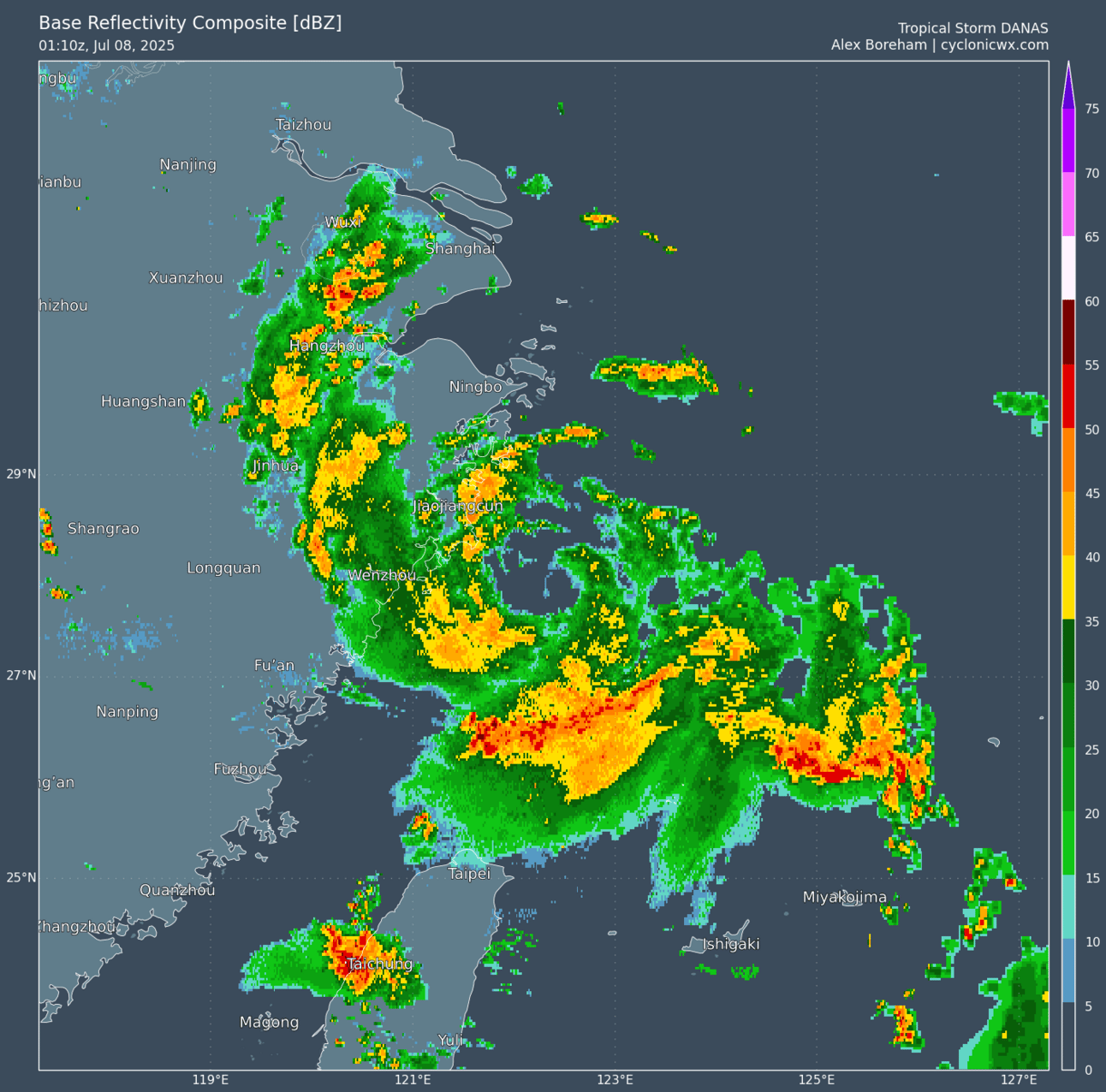
Composite radar image (CyclonicWx)
Danas is in the process of turning westward, and it is about 12 hours away from making landfall in Eastern China (in the Wenzhou area). No significant change in strength appears likely before then. After landfall, Danas should turn sharply southwestward over southeastern China as the TUTT cell moves westward and contributes to the formation of a monsoon gyre over the East China Sea. Danas will begin a wide loop to the south, but the circulation will likely dissipate over land by Wednesday or Thursday before it can complete the loop. A 72-hour forecast point is included, but it is likely Danas will not be an identifiable entity by then.
Forecast positions and maximum winds
00 hrs: 28.0°N 122.2°E – 40 kts
12 hrs: 28.0°N 121.3°E – 35 kts inland
24 hrs: 27.6°N 119.2°E – 25 kts inland
48 hrs: 25.4°N 115.7°E – 25 kts inland
72 hrs: 22.8°N 113.3°E – 20 kts inland
96 hrs: Dissipated

Forecast map