- Will Weaver's Weather & Pacific Typhoon Center
- Posts
- Tropical Storm Co-May (11W/Emong) – Special Tropical Cyclone Advisory #3: 1800 UTC 23 July 2025
Tropical Storm Co-May (11W/Emong) – Special Tropical Cyclone Advisory #3: 1800 UTC 23 July 2025
Co-May continues to rapidly intensify and is now near typhoon intensity. Signal #2 issued for parts of northwestern Luzon.
Will Weaver
July 23, 2025
…Co-May continues to rapidly intensify and is now near typhoon intensity… …Signal #2 issued for parts of northwestern Luzon…
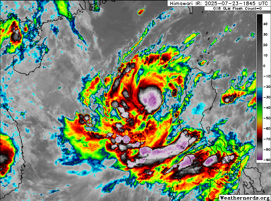 Himawari-9 infrared satellite image (Weathernerds) | Current storm information:
Trend:
|
Watches and warnings:  PAGASA wind signal map (click to enlarge)
| Hazards affecting land:
|
Discussion:

Himawari-9 infrared satellite image (Weathernerds)
This special advisory is being posted to note a significant increase in Co-May’s intensity. JTWC’s best track data has been revised to indicate an intensity of 40 kts at 0600 UTC and 50 kts at 1200 UTC. Since then, the compact tropical cyclone has continued to become better organized. Although the eye is currently not distinct on conventional satellite imagery, 37 GHz microwave imagery from the ISS’s COVWR instrument indicates that the eyewall structure has improved quite a bit from earlier, and Co-May now sports a complete eyewall with a very small eye. However, the equatorward outflow channel has become somewhat restricted, likely due to a slight increase in easterly shear. Given the improved structure and Dvorak estimates of T3.5 from PGTW and KNES, the intensity is increased to 60 kts.

ISS COWVR 34 GHz microwave image of Co-May, showing a complete eyewall feature near its center
There are no changes to the forecast with the exception of higher intensities prior to landfall. The environment remains conducive for continued rapid intensification, and Co-May could be a strong typhoon by the time it makes landfall near Vigan overnight Thursday into Friday. The forecast continues to call for Co-May to decay into a trough south of the Yaeyama Islands on Saturday.
Forecast positions and maximum winds
00 hrs: 16.9°N 118.0°E – 60 kts
12 hrs: 16.7°N 119.0°E – 75 kts
24 hrs: 17.4°N 120.4°E – 85 kts on the Luzon coast
48 hrs: 23.1°N 125.7°E – 35 kts
72 hrs: Dissipated

JMA forecast map