- Will Weaver's Weather & Pacific Typhoon Center
- Posts
- Tropical Storm Bailu (13W) – Tropical Cyclone Advisory #5: 1500 UTC 3 August 2025
Tropical Storm Bailu (13W) – Tropical Cyclone Advisory #5: 1500 UTC 3 August 2025
Bailu headed out to sea and losing tropical characteristics.
Will Weaver
August 03, 2025
…Bailu headed out to sea and losing tropical characteristics…
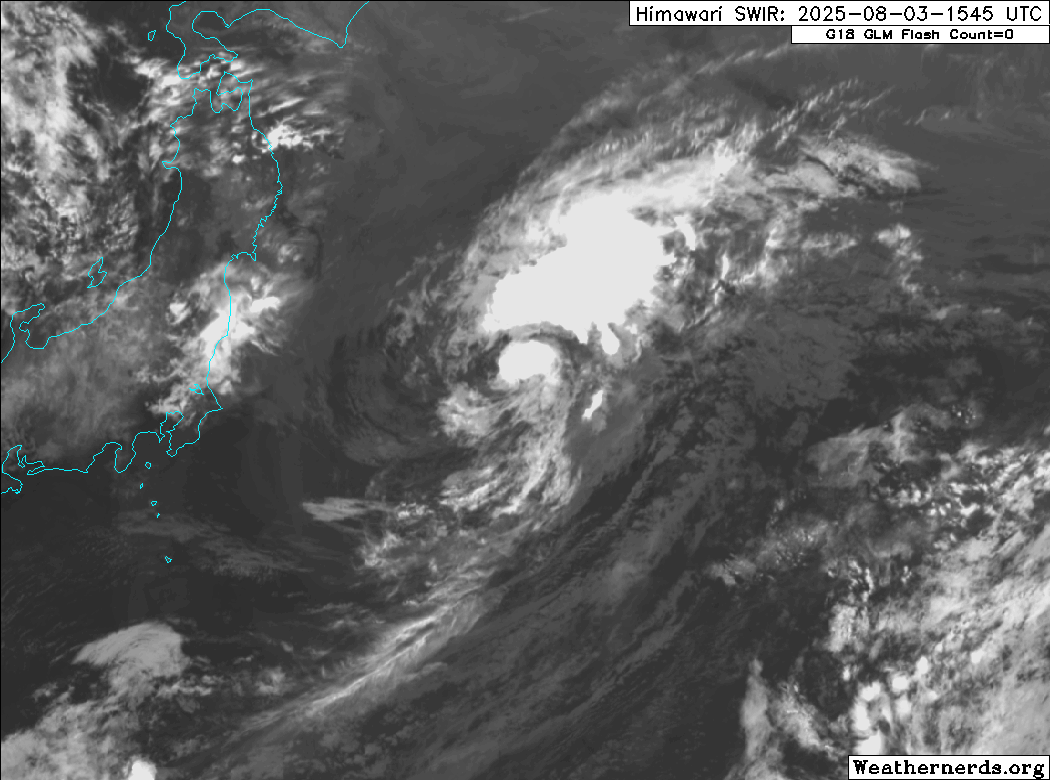
Himawari-9 shortwave infrared satellite image (Weathernerds)
Current storm information:
Position: 36.2°N 146.4°E
Movement: NE at 20 knots (35 km/h)
Intensity: 35 knots (65 km/h)
Central pressure: 995 hPa
Trend:
Little change in strength is forecast during the next 24 hours.
Watches and warnings:
| Hazards affecting land:
|
The next advisory will be posted after 0000 UTC 4 August 2025.
Forecast positions and maximum winds
00 hrs: 36.2°N 146.4°E – 35 kts
12 hrs: 37.5°N 149.8°E – 35 kts
24 hrs: 37.8°N 153.5°E – 35 kts
48 hrs: 39.1°N 159.2°E – 35 kts Post-tropical/extratropical
72 hrs: 42.3°N 165.0°E – 35 kts Post-tropical/extratropical
96 hrs: 44.6°N 174.4°E – 30 kts Post-tropical/extratropical
120 hrs: Dissipated

JTWC forecast map