- Will Weaver's Weather & Pacific Typhoon Center
- Posts
- Tropical Depression (Invest 97W / Salome) – Tropical Cyclone Advisory #2: 0000 UTC 23 October 2025
Tropical Depression (Invest 97W / Salome) – Tropical Cyclone Advisory #2: 0000 UTC 23 October 2025
Poorly organized depression passing west of the Batanes Islands.
Will Weaver
October 22, 2025
…Poorly organized depression passing west of the Batanes Islands…
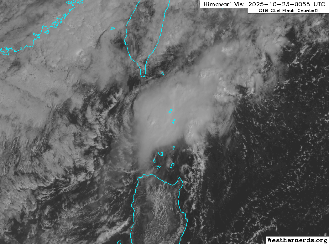
Himawari-8 visible satellite image (Weathernerds)
Current storm information:
Position: 19.7°N 121.3°E
Movement: SW at 10 knots (20 km/h)
Intensity: 25 knots (45 km/h)
Central pressure: 1006 hPa
Trend:
The depression is forecast to dissipate later today.
Watches and warnings:  PAGASA wind signal map (click to enlarge)
| Hazards affecting land:
|
Discussion:
Not much change with 97W/TD Salome this morning. The depression remains a highly sheared system embedded within the cold surge flow rushing down the Taiwan and Luzon Straits. The low-level circulation center is not well defined, but is at least discernible in Oceansat and ASCAT scatterometer data. Most of the convection remains displaced well to the east of the center, and the convection lacks any significant structure. Although the scatterometer data shows some 30 to 35 kt winds close by, it does not appear these winds are directly associated with the depression, and the intensity is lowered to 25 kts.
Even though Fengshen, the source of most of the shear affecting 97W/TD Salome, has dissipated, the continuing cold surge should result in a continued highly unfavorable environment. Most of the model guidance dissipates the system within the next 12 to 24 hours as it moves southwestward off the coast of northwestern Luzon. It is possible that the depression could fall below warning criteria before then.
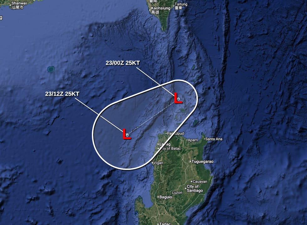
Forecast positions and maximum winds
000 hrs: 19.7°N 121.3°E – 25 kts
012 hrs: 18.5°N 119.5°E – 25 kts
024 hrs: Dissipated
Forecast map