- Will Weaver's Weather & Pacific Typhoon Center
- Posts
- Tropical Depression (Invest 97W / Salome) – Tropical Cyclone Advisory #1: 1200 UTC 22 October 2025
Tropical Depression (Invest 97W / Salome) – Tropical Cyclone Advisory #1: 1200 UTC 22 October 2025
Tropical depression east of Taiwan moving very slowly south-southwestward toward the Luzon Strait, expected to be short-lived...
Will Weaver
October 22, 2025
…Tropical depression east of Taiwan moving very slowly south-southwestward toward the Luzon Strait… …Expected to be short-lived…
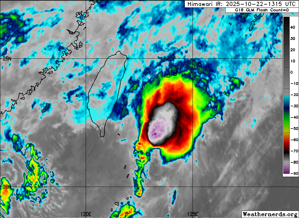
Himawari-8 infrared satellite image (Weathernerds)
Current storm information:
Position: 22.0°N 122.9°E
Movement: SSW at 4 knots (5 km/h)
Intensity: 30 knots (55 km/h)
Central pressure: 1006 hPa
Trend:
Little change in strength is forecast during the next 24 hours.
Watches and warnings: 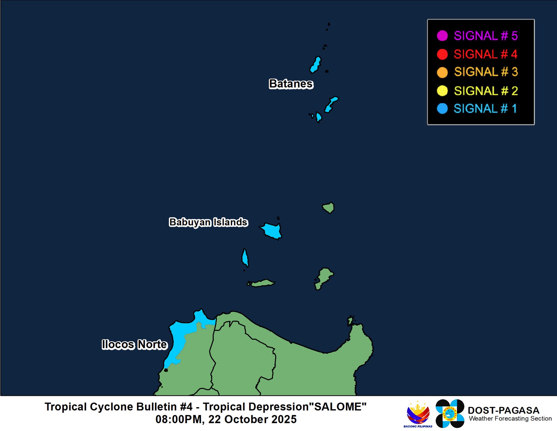 PAGASA wind signal map (click to enlarge)
| Hazards affecting land:
|
Discussion:
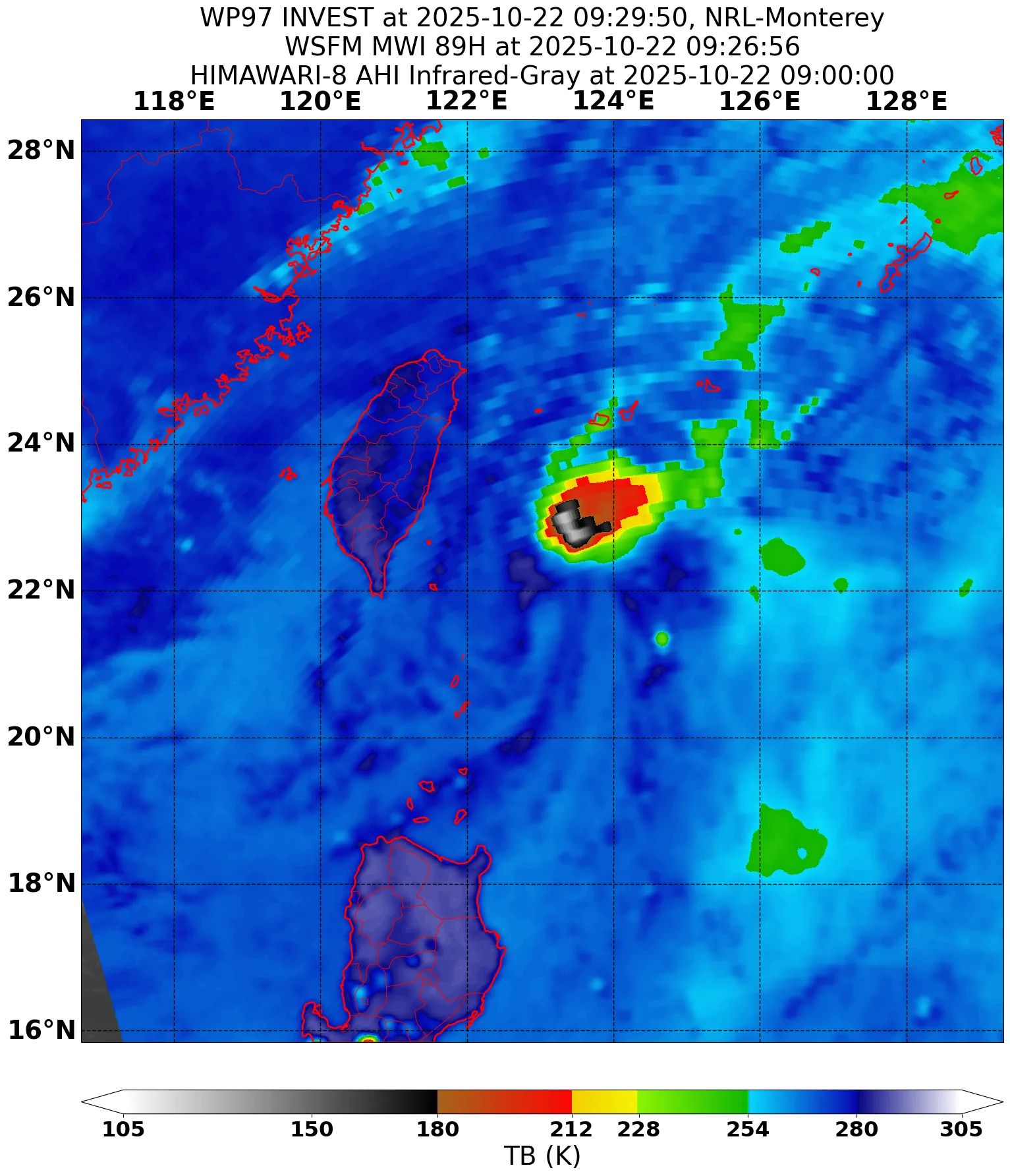
WSFM MWI 89GHz microwave satellite image
PAGASA has issued wind signals for portions of the Philippines in association with the minor tropical depression located off the eastern coast of Taiwan, so tropical cyclone advisories are being initiated. This system is expected to be fairly short-lived as it is located in about as hostile an environment as possible. The depression is currently embedded within a strong northeasterly cold surge, which is generating strong to extreme amounts of mid- to upper-level shear over the system. Adding to the unfavorable environment is the close proximity of Tropical Storm Fengshen’s large mid-level circulation and an upper-level anticyclone in the South China Sea associated with it. All of this has resulted in a system that consists of a poorly defined and sharply elongated circulation with deep convection well removed to the east of the center. Scatterometer data shows a large area of 35 to 40 kt winds in the area that are associated with the cold surge, but there are some 30 to 35 kt wind barbs close to the depression’s center which seem unrelated to the surge flow. Between that and consensus Dvorak fixes of T2.0, the intensity is set to 30 kts.
TD 97W is expected to be very short-lived owing to the extremely hostile environment it is located in. The shear is expected to persist as 97W moves generally southwestward during the next day or two within the cold surge flow. The PAGASA forecast shows 97W remaining a tropical depression through Thursday evening. Although PAGASA has a forecast point for Friday morning as a low-pressure area, the overwhelming majority of the model guidance decays 97W into a trough before then.
Forecast positions and maximum winds
000 hrs: 22.0°N 122.9°E – 30 kts
012 hrs: 20.3°N 121.4°E – 30 kts
024 hrs: 18.2°N 118.9°E – 25 kts
048 hrs: Dissipated
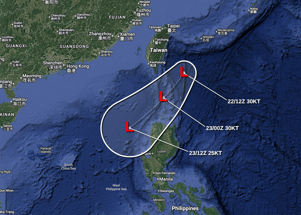
Forecast map