- Will Weaver's Weather & Pacific Typhoon Center
- Posts
- Tropical Depression Co-May (#11W) – Tropical Cyclone Advisory #17: 1200 UTC 31 July 2025
Tropical Depression Co-May (#11W) – Tropical Cyclone Advisory #17: 1200 UTC 31 July 2025
Co-May still hanging on as a tropical depression well inland.
Will Weaver
July 31, 2025
…Co-May still hanging on as a tropical depression well inland…
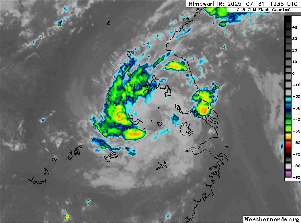
Himawari-9 infrared satellite image (Weathernerds)
Current storm information:
Position: 32.1°N 117.8°E
Movement: W at 5 knots (10 km/h)
Intensity: 25 knots (45 km/h)
Central pressure: 994 hPa
Trend:
Co-May is expected to become a remnant low later tonight or on Friday.
Watches and warnings:
| Hazards affecting land:
|
Discussion:

F-16 SSMIS 91GHz microwave satellite image, showing bands of convection that stubbornly refuse to quit (RAMMB/CIRA)
Despite being quite well inland and embedded in a stable air mass, Co-May stubbornly continues to produce deep convection. Convection has actually increased somewhat in coverage, consisting of a well defined band wrapping into the center from the west. The center itself is actually fairly well defined despite a great deal of land interaction, and radar data from CMA suggests that the remnants of the inner core are still present. Although surface observations suggest that pressures are still fairly low, observed winds are not particularly impressive, and the intensity is lowered to 25 kts.
Co-May has turned westward under the influence of a weak upper-level low to its south. That upper-level low is producing favorable convergence that is probably aiding Co-May in continuing to produce convection. Continued land interaction and increasingly unfavorable environmental conditions should put an end to Co-May’s convection later tonight or tomorrow.
Forecast positions and maximum winds
00 hrs: 32.1°N 117.8°E – 25 kts inland
12 hrs: 32.2°N 116.5°E – 20 kts Post-tropical/remnant low inland
24 hrs: Dissipated