- Will Weaver's Weather & Pacific Typhoon Center
- Posts
- Tropical Depression Co-May (11W) – Tropical Cyclone Advisory #11: 1200 UTC 28 July 2025
Tropical Depression Co-May (11W) – Tropical Cyclone Advisory #11: 1200 UTC 28 July 2025
Co-May weakens to a depression as it moves away from Okinawa.
Will Weaver
July 28, 2025
…Co-May weakens to a depression as it moves away from Okinawa…
 Himawari-9 infrared satellite image (Weathernerds) | Current storm information:
Trend:
|
Watches and warnings:
| Hazards affecting land:
|
Discussion:

Himawari-9 infrared satellite image of a very scrambled looking Co-May (Weathernerds)
Co-May has continued to lose organization since the previous advisory. Satellite imagery indicates that Co-May’s circulation has stretched out and become elongated from west to east, and it is possible the circulation may no longer be closed. An Oceansat-3 scatterometer pass from 0415 UTC did depict a closed circulation, however, but the winds are not particularly impressive. The convection is also not well organized and exists as clusters far to the west and far to the east of the circulation center. Although JMA shows Co-May as a 40-knot tropical storm, its own Dvorak estimates and those of PGTW and KNES suggest that Co-May is a much weaker system, and the Oceansat-3 pass did not find any winds stronger than 30 kts, so Co-May is downgraded to a 30 kt tropical depression.
Although Co-May’s circulation is becoming poorly defined, most of the model guidance continues to insist that Co-May will strengthen as it moves further into the East China Sea. Theoretically, there is no reason why it shouldn’t strengthen as SSTs are quite warm and shear is low, with the only negative factor being a somewhat stable air mass to the north. Therefore, the forecast once again calls for Co-May to strengthen gradually before making landfall near Shanghai on Wednesday. After landfall, Co-May should slow down dramatically as steering currents collapse due to Co-May being caught between two competing subtropical ridges. Rapid weakening is expected after landfall, but once again it should be noted that an increasing amount of model guidance shows Co-May emerging over the Yellow Sea near the end of the forecast period, where it could once again regenerate into a tropical storm.
Forecast positions and maximum winds
00 hrs: 26.6°N 126.6°E – 30 kts
12 hrs: 27.6°N 124.3°E – 35 kts
24 hrs: 28.3°N 123.4°E – 40 kts
48 hrs: 30.9°N 121.4°E – 35 kts inland
72 hrs: 32.8°N 119.5°E – 30 kts inland
96 hrs: 33.3°N 119.7°E – 25 kts inland
120 hrs: 33.7°N 120.3°E – 25 kts inland
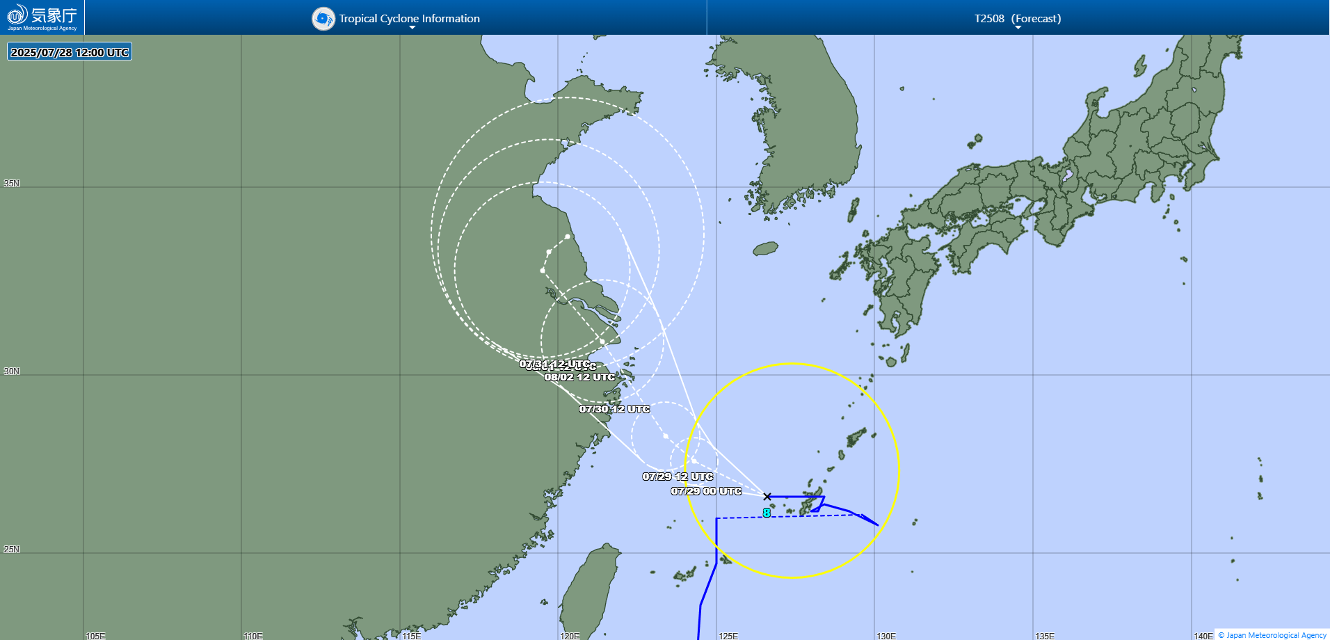
JMA forecast map