- Will Weaver's Weather & Pacific Typhoon Center
- Posts
- Tropical Depression (92W/Huaning) – Tropical Cyclone Advisory #2: 1500 UTC 18 August 2025
Tropical Depression (92W/Huaning) – Tropical Cyclone Advisory #2: 1500 UTC 18 August 2025
Poorly organized depression weakens but still expected to produce heavy rain in Okinawa beginning on Tuesday afternoon.
Will Weaver
August 18, 2025
…Poorly organized depression weakens but still expected to produce heavy rain in Okinawa beginning on Tuesday afternoon…
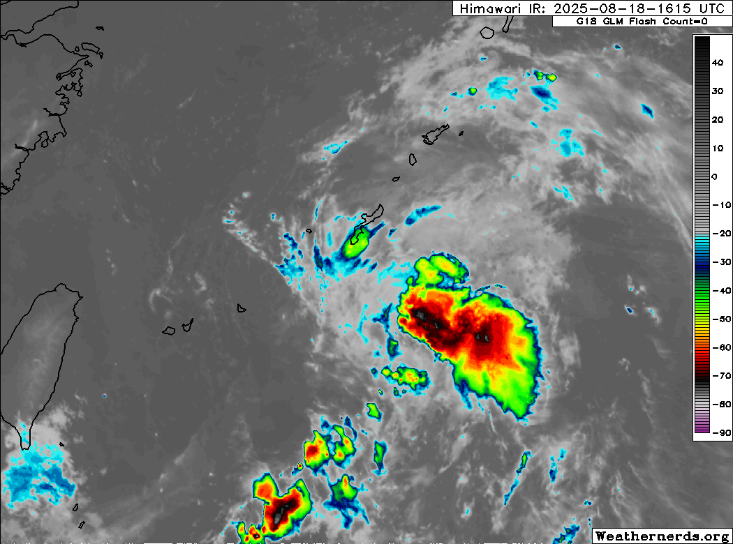
Himawari-9 infrared satellite image
Current storm information:
Position: 23.3°N 126.8°E
Movement: NNE at 7 knots (10 km/h)
Intensity: 25 knots (45 km/h)
Central pressure: 1010 hPa
Trend:
Little change in strength is expected during the next 24 hours.
Watches and warnings:
| Hazards affecting land:
|
Discussion:
TD 92W is not a well organized system. Convection associated with the system has decreased in coverage, consisting mainly of fragmented bands located to the north and east of the circulation center. The center itself has lost some definition since the previous advisory, and is difficult to discern on conventional satellite imagery. The center is much easier to identify on scatterometer data, but recent HYSAT and ASCAT data suggests that the depression’s winds are not very strong - in fact, the HYSAT pass did not find any winds stronger than 20 kts. The ASCAT pass did find a very small area of 25 kt winds well to the northeast of the center. Given that Dvorak estimates from KNES, PGTW, and RJTD are all T1.0 to T1.5, the intensity is lowered to 25 kts, and TD 17W barely still meets warning criteria.
Global model guidance no longer strengthens TD 92W at all - in fact, the GFS and ECMWF models rapidly lose the circulation within the next 24 hours. The ECMWF ensemble and the HWRF model, meanwhile, show significant strengthening as 92W moves northward. Given that the environment is not favorable - there is significant dry air in the region, with strong southwesterly shear associated with a TUTT cell impacting 92W - it does not appear likely that 92W will strengthen much, if at all. Instead, 92W should limp northward with little change in strength during the next day or two before dissipating off the coast of Kyushu by Thursday.
Forecast positions and maximum winds
00 hrs: 23.3°N 126.8°E – 25 kts
12 hrs: 25.5°N 127.0°E – 25 kts
24 hrs: 27.5°N 126.9°E – 25 kts
48 hrs: 30.5°N 126.2°E – 25 kts
72 hrs: Dissipated
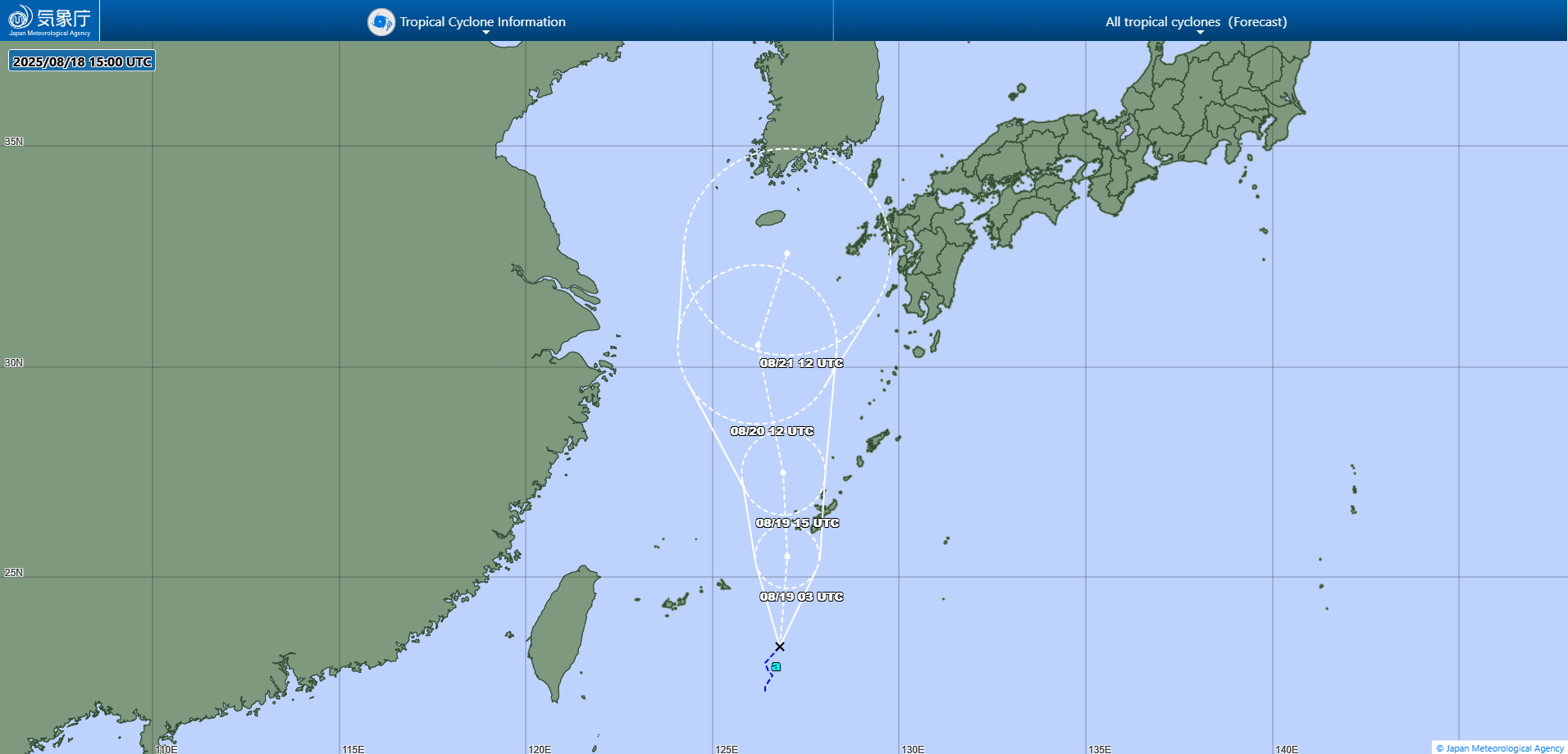
JMA forecast map