- Will Weaver's Weather & Pacific Typhoon Center
- Posts
- Tropical Depression #26W (#Opong) – Tropical Cyclone Advisory #1: 1200 UTC 23 September 2025
Tropical Depression #26W (#Opong) – Tropical Cyclone Advisory #1: 1200 UTC 23 September 2025
Tropical Depression 26W forms north of Palau.
Will Weaver
September 23, 2025
…Tropical Depression 26W forms north of Palau…
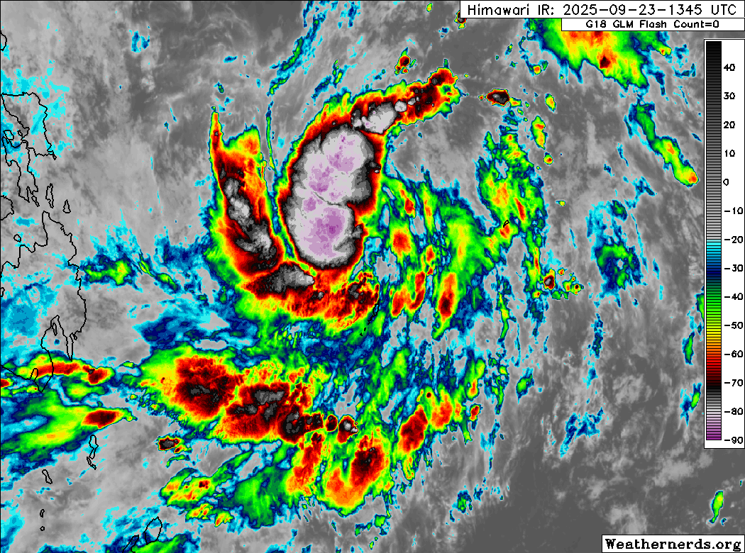
Himawari-9 infrared satellite image (Weathernerds)
Current storm information:
Position: 9.9°N 134.6°E
Movement: W at 7 knots (10 km/h)
Intensity: 30 knots (55 km/h)
Central pressure: 1002 hPa
Trend:
Some strengthening is forecast during the next 24 hours and the depression could become a tropical storm on Wednesday.
Watches and warnings:
| Hazards affecting land:
|
Discussion:
The area of low pressure located just to the north of Palau has developed a fairly well defined closed circulation center, and its associated convection has increased somewhat in organization. The system still has a somewhat lopsided appearance, however, with the only discrete banding located northwest of the center while elsewhere the bands are more fragmented. Still, the system is organized enough to receive Dvorak estimates ranging from T1.5 to T2.0, so the system is now a tropical depression.
TD 26W is located in a rather complicated environment, and its near future is rather uncertain. While SSTs are quite warm, as usual for this part of the Philippine Sea, and Typhoon Ragasa is not far away over in the South China Sea, a TUTT cell situated to the southeast of Okinawa is effectively blocking the shear from Ragasa and allowing for enhanced poleward outflow. Therefore, some short-term strengthening is expected and TD 26W will likely become a tropical storm on Wednesday. By Thursday, however, much of the model guidance suggests that the TUTT cell will gradually fill and dissipate, and this will lead to increased shear over 26W, and this will likely put a stop to any further strengthening before it makes landfall on Samar and/or the Bicol Region on Friday. After landfall, land interaction should cause significant weakening, although 26W should still be a tropical storm by the time it emerges over water just southwest of Metro Manila late Friday night.
By the weekend, Ragasa will be out of the picture, and the environment in the South China Sea should be more favorable. Significant strengthening is possible as 26W moves west-northwestward, and it could become a typhoon by the time it enters the Gulf of Tonkin near the end of the forecast period.
Although the current forecast track shows a track very close to Manila, it needs to be noted that 26W will likely be more of a rain threat than a wind threat, and barring any unexpected rapid strengthening (rapid intensification guidance has not tripped for this system), the exact track probably will not matter very much. Of course, this is subject to change because we all know how unpredictable the Philippine Sea can be.
Forecast positions and maximum winds
000 hrs: 9.9°N 134.6°E – 30 kts
012 hrs: 9.8°N 132.8°E – 35 kts
024 hrs: 10.4°N 131.4°E – 45 kts
048 hrs: 12.3°N 127.3°E – 50 kts
072 hrs: 14.0°N 120.5°E – 35 kts just south of Manila Bay
096 hrs: 15.6°N 113.6°E – 55 kts
120 hrs: 18.1°N 108.1°E – 85 kts
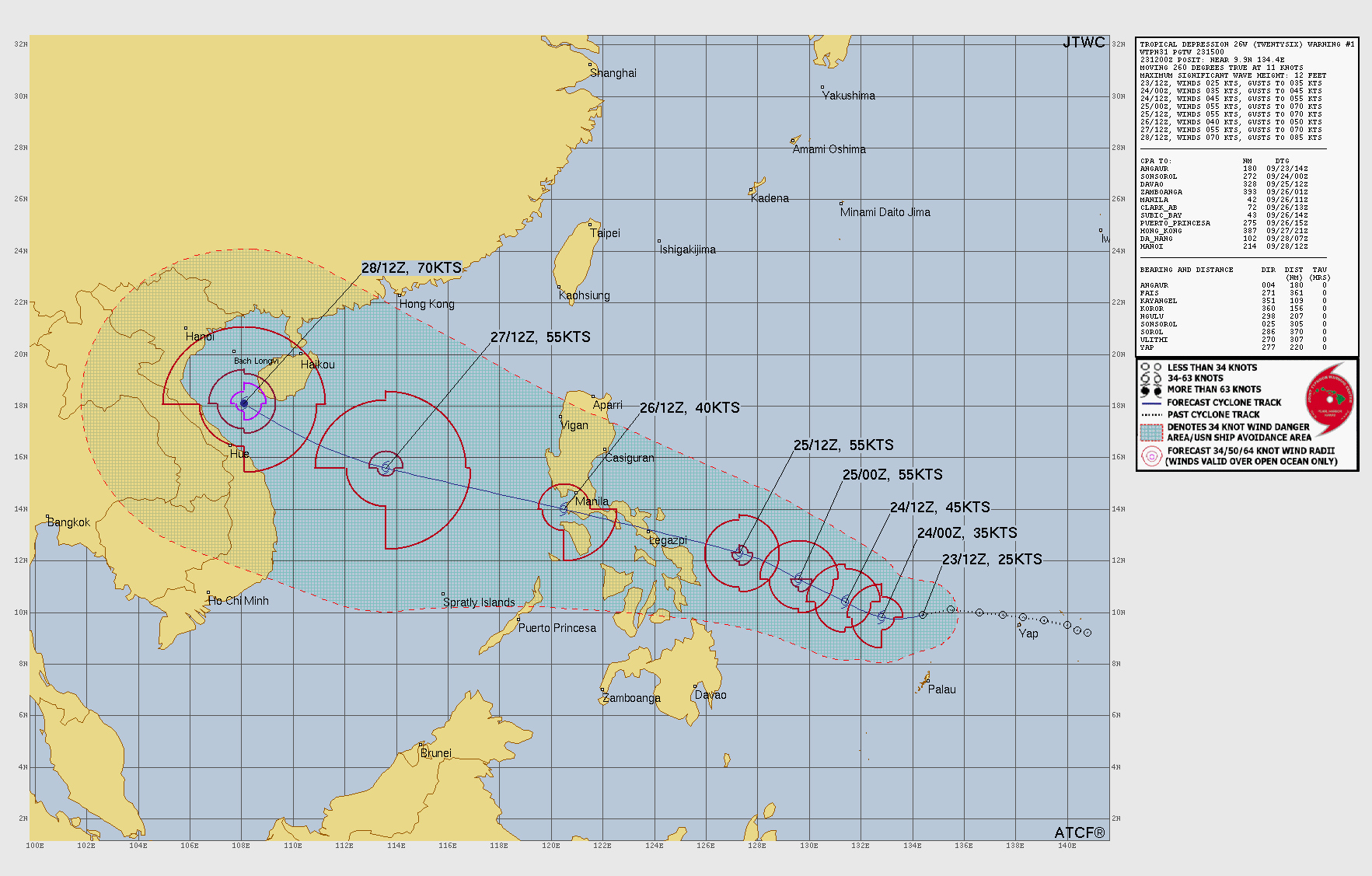
JTWC forecast map