- Will Weaver's Weather & Pacific Typhoon Center
- Posts
- Tropical Depression 23W (Mirasol) – Tropical Cyclone Advisory #2: 0000 UTC 17 September 2025
Tropical Depression 23W (Mirasol) – Tropical Cyclone Advisory #2: 0000 UTC 17 September 2025
Mirasol weakens to a depression as it crosses northern Luzon
…Mirasol weakens to a depression as it crosses northern Luzon…

Himawari-9 visible satellite image (Weathernerds)
Current storm information:
Position: 16.4°N 121.8°E
Movement: WNW at 8 knots (15 km/h)
Intensity: 30 knots (55 km/h)
Central pressure: 1004 hPa
Trend:
Little change in strength is forecast during the next 24 hours.
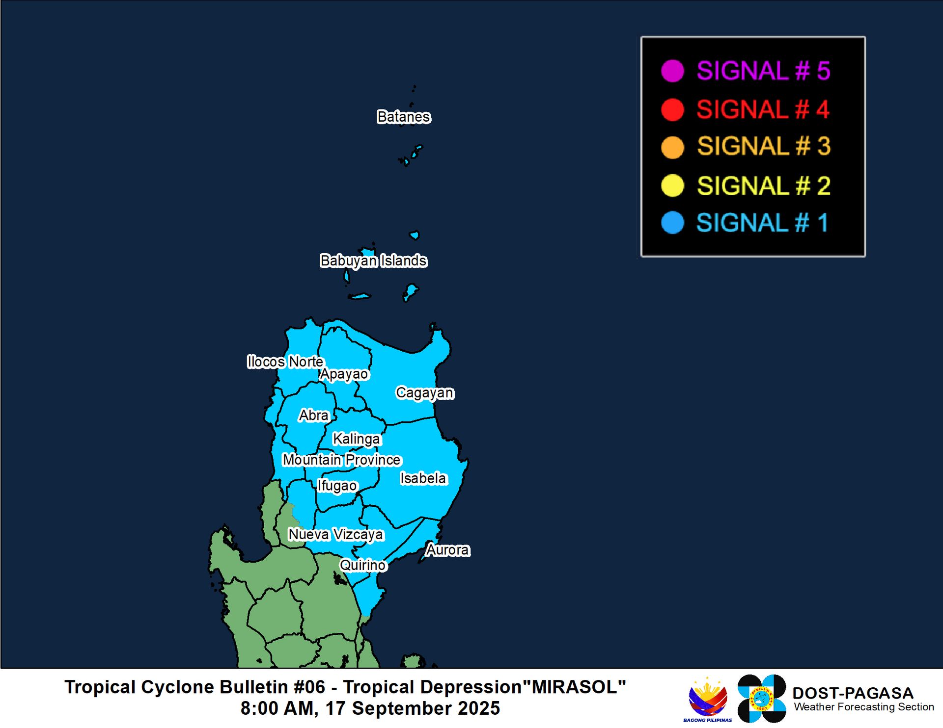
Watches and warnings:
| Hazards affecting land:
|
Discussion:
Prior to 23W/Mirasol’s landfall in Aurora at about 1920 UTC, the tropical cyclone had increased significantly in organization, and scatterometer data and automated estimates supported an increase of its intensity to 45 kts. This is backed up by microwave satellite imagery from shortly after landfall that indicated the formation of a partial eye feature. Although the eye is no longer evident on any available imagery, 23W’s circulation remains quite well defined, although some decoupling has occurred due to interaction with the Cordillera Central - the mid-level circulation is displaced to the northeast of the surface center with some convective bands flaring around it. Given how disrupted and vertically distorted 23W’s structure has become, combined with the general lack of tropical storm force observations, 23W’s intensity is lowered to 30 kts, making it a tropical depression again.
The forecast is a bit complicated because of 23W’s current structure. Most of the model guidance appears to be tracking 23W’s mid-level circulation, and their initial positions do not seem to correspond to 23W’s current position. The guidance generally suggests a straight north-northwestward track, which doesn’t seem particularly likely since the surface circulation is being deflected south of the mountains. However, once the surface circulation moves west of the mountains, it should turn northwestward and realign with the mid-level circulation as 23W moves back out over water. 23W should emerge over the western end of the Luzon Strait tonight. Once there, the environment should be conducive for steady strengthening, and 23W should become a tropical storm again on Thursday. By Friday evening, increasing shear and shallower shelf waters should put an end to any strengthening, and 23W will likely weaken to a tropical depression just inland near Hong Kong by Saturday morning and dissipate by Sunday.
Forecast positions and maximum winds
00 hrs: 16.4°N 121.8°E – 30 kts inland
12 hrs: 19.0°N 120.4°E – 30 kts
24 hrs: 19.7°N 118.5°E – 40 kts
48 hrs: 21.5°N 115.7°E – 50 kts
72 hrs: 22.9°N 113.9°E – 30 kts inland
96 hrs: Dissipated

JMA forecast map
