- Will Weaver's Weather & Pacific Typhoon Center
- Posts
- Tropical Depression 23W (#Mirasol) – Tropical Cyclone Advisory #1: 1200 UTC 16 September 2025
Tropical Depression 23W (#Mirasol) – Tropical Cyclone Advisory #1: 1200 UTC 16 September 2025
Tropical depression forms along the eastern coast of Luzon, likely to bring heavy rainfall to parts of northern Luzon during the next couple of days
…Tropical depression forms along the eastern coast of Luzon… …Likely to bring heavy rainfall to parts of northern Luzon during the next couple of days…

Himawari-9 infrared satellite image (Weathernerds)
Current storm information:
Position: 15.8°N 122.8°E
Movement: NW at 7 knots (10 km/h)
Intensity: 30 knots (55 km/h)
Central pressure: 1006 hPa
Trend:
Little change in strength is forecast during the next 24 hours.
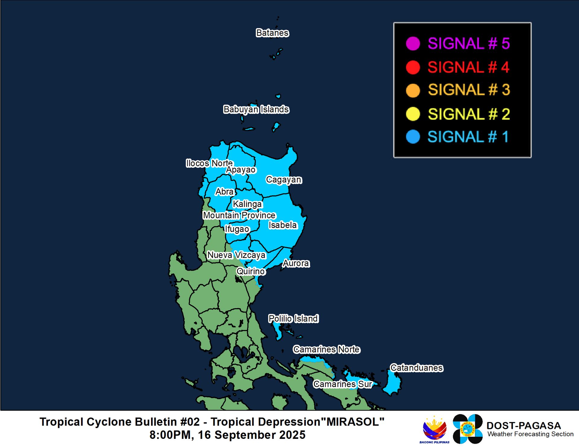
Watches and warnings:
| Hazards affecting land:
|
Discussion:

WSFM MWI 37GHz microwave satellite image. It doesn’t look like much but there is some rudimentary banding wrapping into 23W’s circulation just northeast of Polillo Island.
The area of low pressure off the eastern coast of Luzon has continued to increase in organization since yesterday’s tropical weather outlook. Microwave satellite imagery indicates that some fragmented banding has developed and is wrapping into an increasingly well defined circulation center. A bullseye HYSAT pass from 0959 UTC was able to resolve this circulation center, and a small area of 25 to 30 kt winds is evident primarily to the east of the center. The system is a bit lopsided with most of the convection displaced east of the center by some low to moderate westerly subsidence associated with a mid- to upper-level high pressure area over the South China Sea. Still, the system is organized enough that it can be considered a tropical depression, and the system is now Tropical Depression 23W with winds of 30 kts.
Although TD 23W is in a marginally favorable environment with very warm SSTs offset by the aforementioned westerly shear, it appears unlikely to strengthen significantly before moving inland over northeastern Luzon during the next few hours. Therefore, little change in strength is likely until 23W emerges over the Luzon Strait on Wednesday evening. Once 23W reaches the Luzon Strait, it should run headlong into a very strong subtropical ridge firmly entrenched over the East China Sea and turn sharply westward. The shear is forecast to relax by that point, and this could enable some modest strengthening as 23W approaches southern China. How strong 23W gets will depend on how sharp its westward turn is. The JTWC and JMA forecasts track 23W over southern China by Friday evening and indicate weakening and eventual dissipation, although the operational GFS model and some GFS and ECMWF ensemble members show a track off the coast, and therefore strengthen 23W more. Given that a majority of the ensemble guidance (GFS, ECMWF, and Google DeepMind), as well as the dynamical HWRF and HAFS models, show a track over land, the forecast track below reflects this. However, there is low confidence in that part of the forecast at this time.
Forecast positions and maximum winds
00 hrs: 15.8°N 122.8°E – 30 kts
12 hrs: 17.0°N 122.2°E – 30 kts inland
24 hrs: 18.5°N 121.5°E – 35 kts on the northern Luzon coast
48 hrs: 20.8°N 118.3°E – 45 kts
72 hrs: 22.0°N 115.7°E – 55 kts
96 hrs: 22.1°N 113.8°E – 65 kts
120 hrs: 21.8°N 110.8°E – 40 kts inland

JMA forecast map
