- Will Weaver's Weather & Pacific Typhoon Center
- Posts
- Tropical Depression 12W – Tropical Cyclone Advisory #1: 2100 UTC 23 July 2025
Tropical Depression 12W – Tropical Cyclone Advisory #1: 2100 UTC 23 July 2025
And another tropical depression forms near Guam, forecast to move northward and remain west of the Marianas
Will Weaver
July 23, 2025
…And another tropical depression forms near Guam… …Forecast to move northward and remain west of the Marianas…
 Himawari-9 infrared satellite image (Weathernerds) | Current storm information:
Trend:
|
Watches and warnings:
| Hazards affecting land:
|
Discussion:
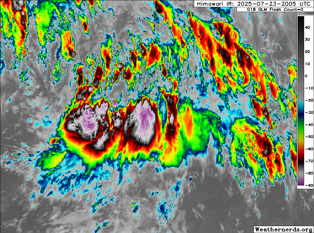
Himawari-9 infrared satellite image (Weathernerds)
Although it does not look particularly pretty, the low pressure area located near Guam has developed a well defined surface circulation which is evident on scatterometer data, and some of the strongly sheared convection is beginning to wrap into it. Since the system is relatively close to Guam and has Dvorak classifications, JTWC has designated it Tropical Depression 12W with an intensity of 25 kts. The system is experiencing strong northwesterly shear partially associated with the large circulation of Tropical Storm Francisco well to the northwest.
TD 12W is currently moving little, but as the monsoon gyre over the western Philippine Sea breaks down, strong ridging to the northeast is expected to build in and cause 12W to accelerate northward during the next couple of days. The forecast more or less calls for 12W to parallel the Marianas to the west through the end of the forecast period. The shear should relax as the monsoon gyre breaks down, and this should allow for some gradual strengthening. The winds listed toward the end of the forecast period are higher than indicated in the JTWC forecast as most of the model guidance suggests a quicker rate of intensification in that part of the forecast as the shear decreases. TD 12W is not expected to directly threaten any major land areas during the next few days.
Forecast positions and maximum winds
00 hrs: 13.2°N 144.1°E – 25 kts
12 hrs: 14.5°N 143.7°E – 30 kts
24 hrs: 15.8°N 143.4°E – 35 kts
48 hrs: 18.0°N 143.6°E – 45 kts
72 hrs: 20.8°N 144.0°E – 55 kts
96 hrs: 24.5°N 144.0°E – 65 kts
120 hrs: 27.5°N 143.2°E – 75 kts

JTWC forecast map