- Will Weaver's Weather & Pacific Typhoon Center
- Posts
- Severe Tropical Storm Sinlaku (04W) – Tropical Cyclone Advisory #5: 1200 UTC 10 April 2026
Severe Tropical Storm Sinlaku (04W) – Tropical Cyclone Advisory #5: 1200 UTC 10 April 2026
Sinlaku continues to strengthen as it batters Chuuk with tropical storm conditions.
Will Weaver
April 10, 2026
…Sinlaku continues to strengthen as it batters Chuuk with tropical storm conditions…
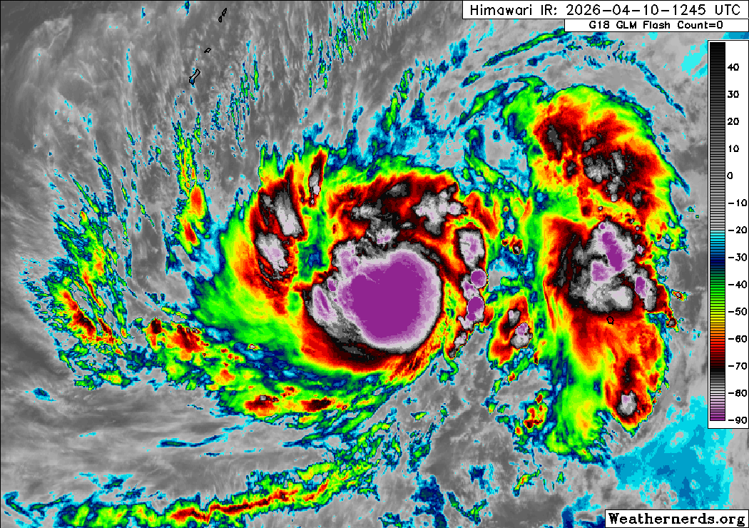
Himawari-9 infrared satellite image (Weathernerds)
Current storm information:
Position: 8.0°N 150.5°E
Movement: Nearly stationary
Intensity: 55 knots (100 km/h)
Central pressure: 980 hPa
Trend:
Steady to rapid strengthening is forecast during the next 24 hours, and Sinlaku could become a typhoon on Saturday.
Watches and warnings:
Areas that should monitor this system:
| Hazards affecting land:
|
Discussion:
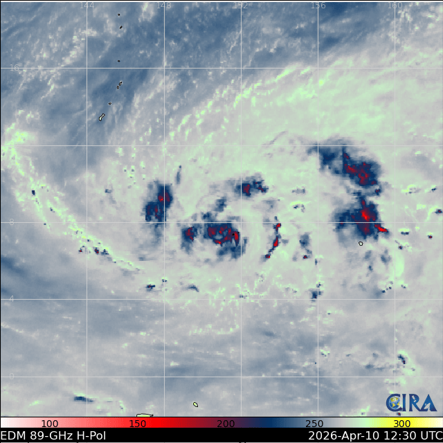
Despite persistent easterly shear, Sinlaku has gotten significantly better organized during the past several hours. The convective banding has coalesced into a central dense overcast feature with very cold cloud tops (colder than -90°C in spots), and although the convection in the eastern semicircle is slightly restricted, Sinlaku sports excellent radial outflow. Surface observations from Chuuk indicate that Sinlaku’s wind field is still rather broad, with sustained tropical storm force winds occurring on the islands while Chuuk International Airport reported a pressure of 990 hPa. Consensus Dvorak estimates of T3.5 combined with similar ADT and D-PRINT estimates support increasing the intensity to 55 kts.
Sinlaku has stalled out due to a weakening of steering currents as it approaches a weaker portion of the subtropical ridge, and the easterly flow is being offset by strong equatorial westerlies associated with a ridge north of Papua New Guinea. The ridge near Papua New Guinea is expected to break down as Tropical Cyclone Maila weakens in the Solomon Sea, while a frontal system moving off the coast of Japan will cause the subtropical ridge to reorient and allow Sinlaku to resume a northwesterly motion. This should also result in the environment becoming significantly more conducive for development, and rapid intensification is expected to begin on Sunday. There is significant spread in the intensity guidance, with the HWRF and ECMWF models indicating a lower peak intensity than the HAFS-A (which makes Sinlaku a Category 5 system by Monday) and GFS models. The forecast below attempts to split the difference, but confidence is low. Confidence in the track forecast is higher as there is more agreement among the deterministic and ensemble models, and interests in Guam need to be monitoring this situation closely.
Forecast positions and maximum winds (1-min)
000 hrs: 08.0°N 150.5°E – 55 kts 100 km/h
012 hrs: 08.4°N 150.5°E – 70 kts 130 km/h
024 hrs: 09.0°N 150.3°E – 85 kts 155 km/h
048 hrs: 10.5°N 148.1°E – 110 kts 205 km/h
072 hrs: 12.3°N 145.0°E – 125 kts 230 km/h
096 hrs: 14.2°N 142.8°E – 125 kts 230 km/h
120 hrs: 15.9°N 141.1°E – 115 kts 215 km/h

Forecast map