- Will Weaver's Weather & Pacific Typhoon Center
- Posts
- Severe Tropical Storm Neoguri (25W) – Tropical Cyclone Advisory #14: 1200 UTC 24 September 2025
Severe Tropical Storm Neoguri (25W) – Tropical Cyclone Advisory #14: 1200 UTC 24 September 2025
There and Back Again: A Tropical Cyclone’s Tale: Neoguri expected to swing back to the west, then to the east on Thursday.
Will Weaver
September 24, 2025
…There and Back Again: A Tropical Cyclone’s Tale… …Neoguri expected to swing back to the west, then to the east on Thursday…
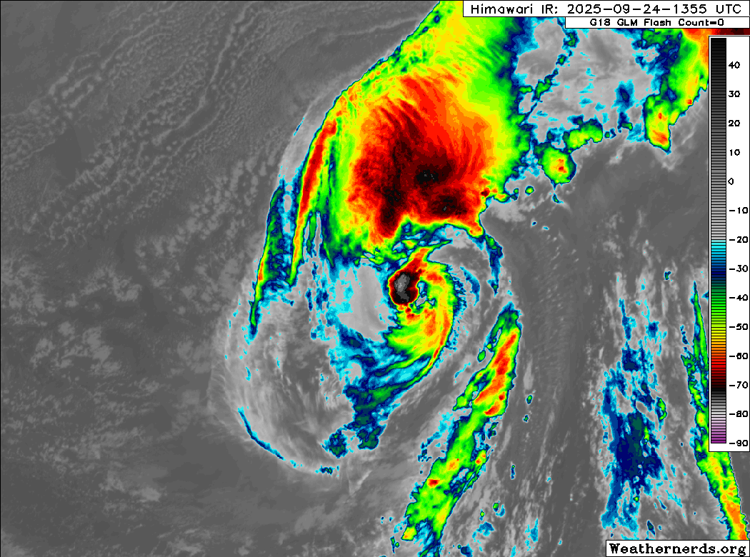
Himawari-9 infrared satellite image (Weathernerds)
Current storm information:
Position: 31.2°N 156.8°E
Movement: NE at 7 knots (10 km/h)
Intensity: 60 knots (110 km/h)
Central pressure: 982 hPa
Trend:
Gradual weakening is forecast during the next 24 hours.
Watches and warnings:
| Hazards affecting land:
|
Discussion:
Neoguri continues to take a beating as it meanders within an extremely hostile environment. It barely looks like a tropical cyclone, and the only obvious sign of it still being one is some persistent convection continuing to occur near its circulation center. However, most of the convection is sheared well to the north and east, and some cooler, drier air is filtering in from the north and west behind the frontal system that is currently leaving Neoguri behind. Another extratropical low is also in the process of forming at the tail end of the front, which is what will end up severing Neoguri from the southwesterly surface flow. Dvorak estimates range from T3.5 to T4.0, and the intensity is lowered to 60 kts.
Once the extratropical low forms and cuts Neoguri off from the frontal boundary to the northeast, Neoguri is expected to swing back westward as ridging builds to the north. The shear currently impacting it should also subside, although extremely dry air and limited oceanic heat content will likely result in continued gradual weakening through the end of the week. By Saturday, another deep-layer trough will approach from the northwest and break down the new ridge, and this one should not leave Neoguri behind. Neoguri is expected to accelerate to the northeast over the weekend and quickly become a powerful hurricane-force post-tropical cyclone on Sunday due to strong baroclinic forcing.
Forecast positions and maximum winds
00 hrs: 31.2°N 156.8°E – 60 kts
12 hrs: 31.8°N 157.0°E – 55 kts
24 hrs: 32.1°N 156.1°E – 45 kts
48 hrs: 32.2°N 154.5°E – 45 kts
72 hrs: 33.7°N 158.9°E – 60 kts
96 hrs: 40.4°N 168.4°E – 70 kts Post-tropical/extratropical
120 hrs: 47.0°N 178.0°E – 70 kts Post-tropical/extratropical
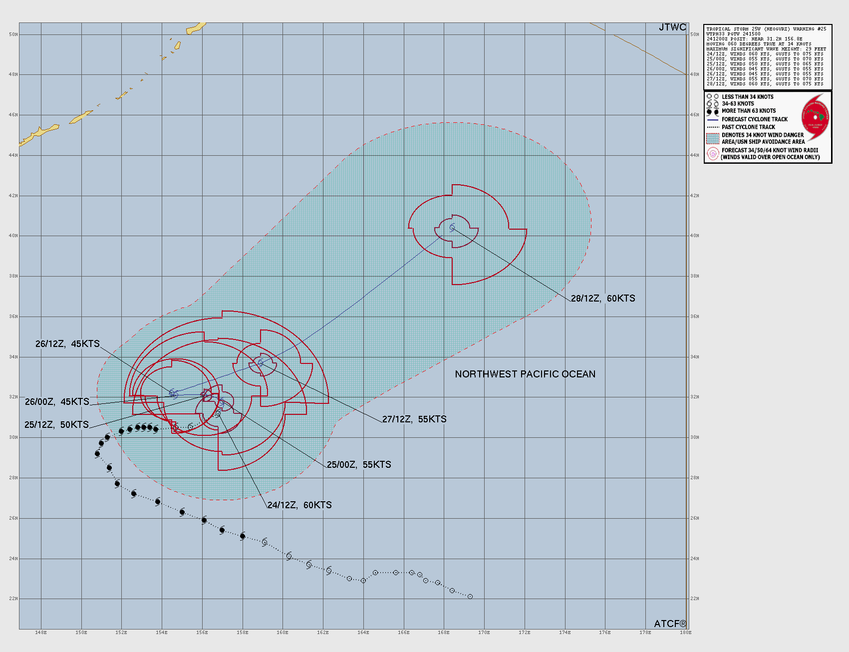
JTWC forecast map