- Will Weaver's Weather & Pacific Typhoon Center
- Posts
- Severe Tropical Storm Nakri (29W) – Tropical Cyclone Advisory #9: 0000 UTC 12 October 2025
Severe Tropical Storm Nakri (29W) – Tropical Cyclone Advisory #9: 0000 UTC 12 October 2025
Nakri strengthening quickly and likely to become a typhoon later today.
Will Weaver
October 11, 2025
…Nakri strengthening quickly and likely to become a typhoon later today…
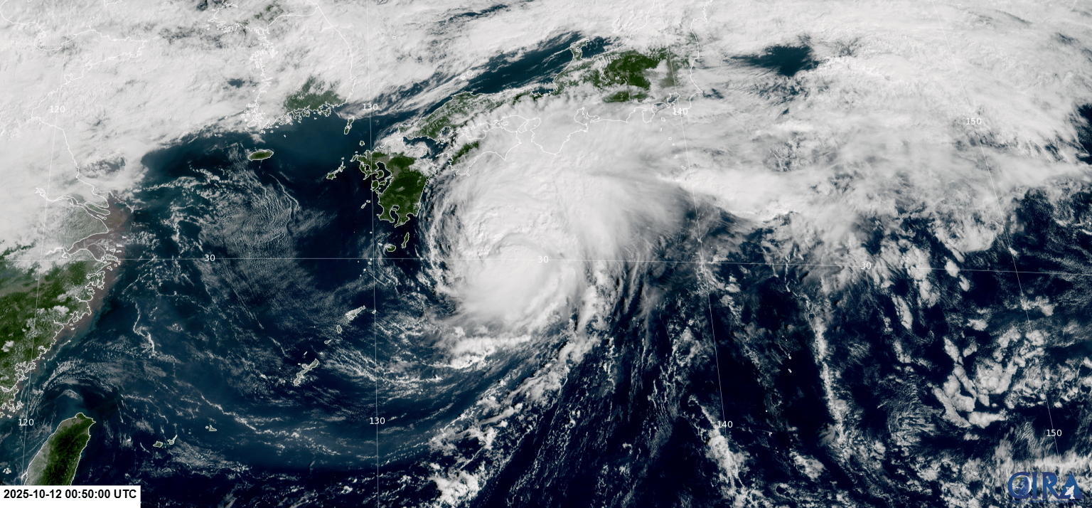
GEO-KOMPSAT-2A visible satellite image (RAMMB/CIRA)
Current storm information:
Position: 30.0°N 133.7°E
Movement: ENE at 14 knots (25 km/h)
Intensity: 60 knots (110 km/h)
Central pressure: 984 hPa
Trend:
Some strengthening is forecast during the next 24 hours and Nakri is likely to become a typhoon later today or tonight.
Watches and warnings:
| Hazards affecting land:
|
Discussion:
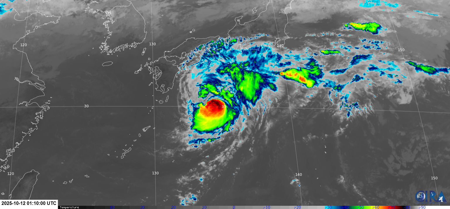
GEO-KOMPSAT-2A infrared satellite image (RAMMB/CIRA)
Himawari-9 has been having transmission issues for the past several hours, so satellite-based products are somewhat limited. Thankfully, we have access to the Korean GEO-KOMPSAT-2A satellite, and all indications are that Nakri is intensifying. Convection has increased significantly in all quadrants and the circulation center is no longer exposed. In addition, an eye feature has been intermittently visible during the past few hours, although this feature has been quite ragged, and convection north of the center is still somewhat fragmented. Dvorak fixes have increased from T3.5 to T4.0 from the various agencies, so the intensity is increased to 60 kts.
Nakri is entering a much more favorable environment with a favorable trough interaction, warm SSTs, and relatively low shear. Therefore, some strengthening is likely as Nakri accelerates east-northeastward, and Nakri should become a typhoon later today. By Tuesday, Nakri should move over cooler waters and become more involved with the trough, and this should result in Nakri becoming a post-tropical cyclone by Wednesday. The post-tropical cyclone should become absorbed by another frontal system soon after.
Forecast positions and maximum winds
000 hrs: 30.0°N 133.7°E – 60 kts
012 hrs: 31.4°N 136.4°E – 70 kts
024 hrs: 32.5°N 140.0°E – 75 kts
048 hrs: 34.3°N 149.5°E – 75 kts
072 hrs: 35.0°N 159.8°E – 60 kts Post-tropical/extratropical
096 hrs: 35.8°N 172.0°E – 40 kts Post-tropical/extratropical
120 hrs: Dissipated
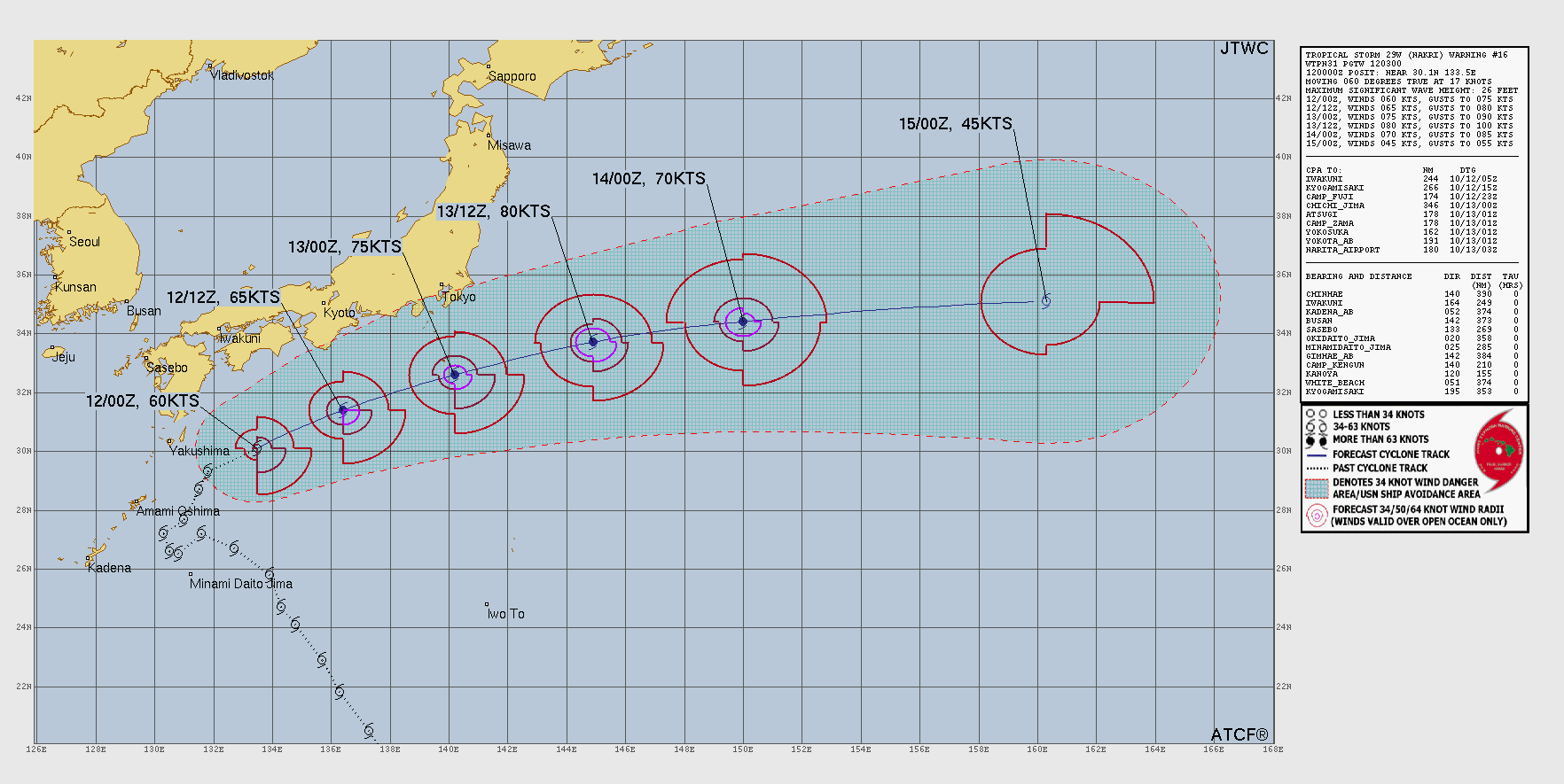
JTWC forecast map