- Will Weaver's Weather & Pacific Typhoon Center
- Posts
- Severe Tropical Storm Bualoi (26W/Opong) – Tropical Cyclone Advisory #6: 0000 UTC 26 September 2025
Severe Tropical Storm Bualoi (26W/Opong) – Tropical Cyclone Advisory #6: 0000 UTC 26 September 2025
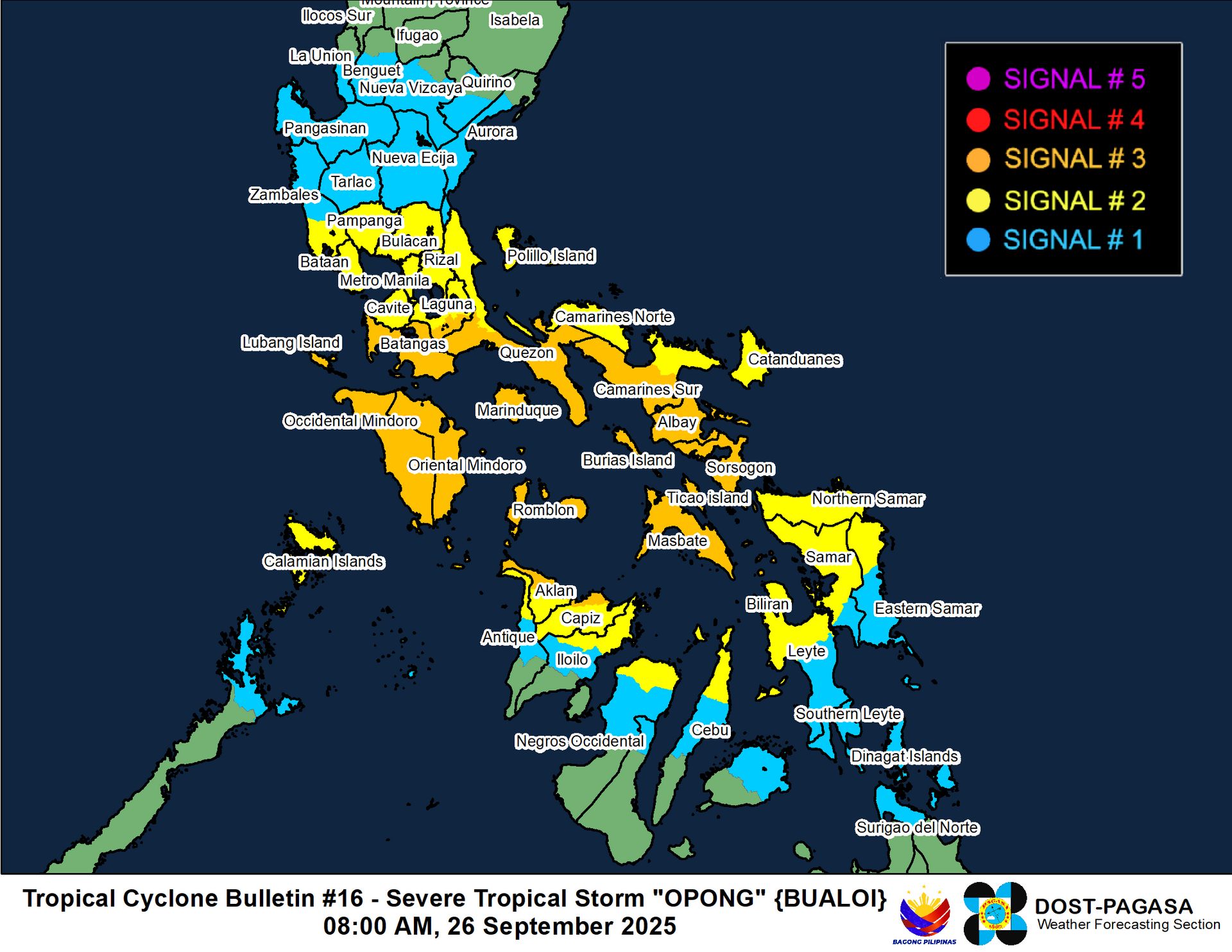
Bualoi over the Sibuyan Sea and accelerating. Very heavy rainfall continues to spread westward across the Visayas and southern Luzon.
…Bualoi over the Sibuyan Sea and accelerating… …Very heavy rainfall continues to spread westward across the Visayas and southern Luzon…

Himawari-9 visible satellite image (Weathernerds)
Current storm information:
Position: 12.2°N 122.9°E
Movement: W at 20 knots (35 km/h)
Intensity: 60 knots (110 km/h)
Central pressure: 990 hPa
Trend:
Some weakening is forecast during the next 24 hours.
Watches and warnings:
| Hazards affecting land:
|
Discussion:
Bualoi has crossed over Samar Island and is now situated in the Sibuyan Sea. The system continues to exhibit the effects of strong northeasterly shear, as the convection continues to exhibit a CCC pattern with the coldest cloud tops located west of the circulation center. Cloud tops near and to the east of the center have warmed and are exhibiting feathering as a result of the shear. Although a warm spot has appeared within the CCC, this warm spot does not appear to be an eye as there is little in the way of banding wrapping into it. CIMSS ADT, AiDT, and D-PRINT estimates range from 55 to 71 kts; the intensity is set to 60 kts.
The shear is forecast to persist for another day or so as Bualoi gradually turns west-northwestward and emerges into the South China Sea. Some weakening is likely before then due to both shear and land interaction. As Bualoi gains some latitude, the shear should relax, and this should enable some strengthening as Bualoi moves quickly across the South China Sea and into the Gulf of Tonkin. Bualoi is likely to become a typhoon by Saturday evening, and it could peak at Category 2 status on Sunday as it turns northwestward. The intensity should level off on Sunday afternoon as Bualoi makes a close approach to Hainan Island, but it should still be a typhoon when it makes landfall in northern Vietnam on Monday. Bualoi should race inland and quickly decay into a trough of low pressure over Laos on Tuesday.
Forecast positions and maximum winds
000 hrs: 12.2°N 122.9°E – 60 kts
012 hrs: 13.5°N 120.1°E – 50 kts
024 hrs: 14.7°N 116.5°E – 65 kts
048 hrs: 16.2°N 110.6°E – 85 kts
072 hrs: 18.9°N 106.3°E – 85 kts
096 hrs: 20.2°N 102.9°E – 30 kts inland
120 hrs: Dissipated

JMA forecast map
