- Will Weaver's Weather & Pacific Typhoon Center
- Posts
- Severe Tropical Storm Bualoi (26W/Opong) – Tropical Cyclone Advisory #5: 1200 UTC 25 September 2025
Severe Tropical Storm Bualoi (26W/Opong) – Tropical Cyclone Advisory #5: 1200 UTC 25 September 2025
Bualoi to make landfall in northern Samar within the next few hours.
…Bualoi to make landfall in northern Samar within the next few hours…

Himawari-9 infrared satellite image (Weathernerds)
Current storm information:
Position: 11.7°N 126.9°E
Movement: WNW at 15 knots (25 km/h)
Intensity: 55 knots (100 km/h)
Central pressure: 992 hPa
Trend:
Some additional weakening is forecast during the next 24 hours.
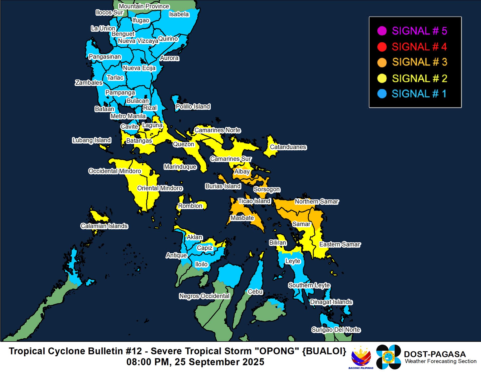
Watches and warnings:
| Hazards affecting land:
|
Discussion:

GPM GMI 37GHz microwave satellite image
Bualoi continues to experience the effects of strong northeasterly shear tonight. The tropical storm is currently exhibiting a central cold cover (CCC) pattern, which is common in strongly sheared tropical cyclones and is not an indication of strengthening. This shear is being produced by a small upper-level anticyclone positioned to the north, off the eastern coast of Luzon. The convection remains quite intense, with cloud tops as cold as -85°C, and the surface circulation center is tucked just under the eastern edge of the convective mass. Microwave satellite imagery indicates that the mid-level structure that had been present before has collapsed, and there are no longer indications of an eye feature present, although convection wrapping into the mid-level circulation center remains quite intense. JMA continues to insist that Bualoi is a typhoon, but none of the available estimates support typhoon strength, and in fact, it appears Bualoi has weakened. The intensity is lowered to 55 kts, based on consensus T3.5 Dvorak fixes and CIMSS ADT and D-PRINT estimates of 57 kts. A recent RCM-3 SAR pass only found winds of 49 kts in the southeastern semicircle, so this could be generous. This pass also indicated that the low-level circulation is quite elongated.
Bualoi is about 6 hours away from making landfall on the island of Samar. The shear is forecast to persist for another day or so, so continued weakening appears likely up to and shortly after landfall. As Bualoi gains some latitude, it should begin to encounter less shear, and passage over water as it traverses the Visayas and Mindoro will likely slow its weakening trend. Bualoi should emerge over the South China Sea on Saturday. Conditions there should be much more conducive for strengthening, although Bualoi will only have a brief window of opportunity to do so as it gets swept up in strong easterly flow associated with a strong subtropical ridge to the north. Nonetheless, Bualoi will likely become a typhoon before it passes near or over Hainan Island late Sunday evening. Bualoi will likely make landfall in northern Vietnam on Monday evening, and the system should quickly decay into a trough of low pressure shortly after.
Forecast positions and maximum winds
000 hrs: 11.7°N 126.9°E – 55 kts
012 hrs: 12.5°N 123.9°E – 50 kts near Ticao Island
024 hrs: 13.4°N 121.1°E – 45 kts inland over Mindoro
048 hrs: 15.5°N 114.6°E – 55 kts
072 hrs: 18.3°N 109.2°E – 65 kts
096 hrs: 20.1°N 104.0°E – 50 kts inland
120 hrs: 20.8°N 101.4°E – 25 kts inland

JMA forecast map
