- Will Weaver's Weather & Pacific Typhoon Center
- Posts
- Severe Tropical Storm Bualoi (26W/Opong) – Tropical Cyclone Advisory #4: 0000 UTC 25 September 2025
Severe Tropical Storm Bualoi (26W/Opong) – Tropical Cyclone Advisory #4: 0000 UTC 25 September 2025
Bualoi starting to become poorly organized as it approaches the Philippines.
…Bualoi starting to become poorly organized as it approaches the Philippines…

Himawari-9 visible satellite image (Weathernerds)
Current storm information:
Position: 10.8°N 129.0°E
Movement: W at 12 knots (25 km/h)
Intensity: 60 knots (110 km/h)
Central pressure: 989 hPa
Trend:
Some weakening is forecast during the next 24 hours.
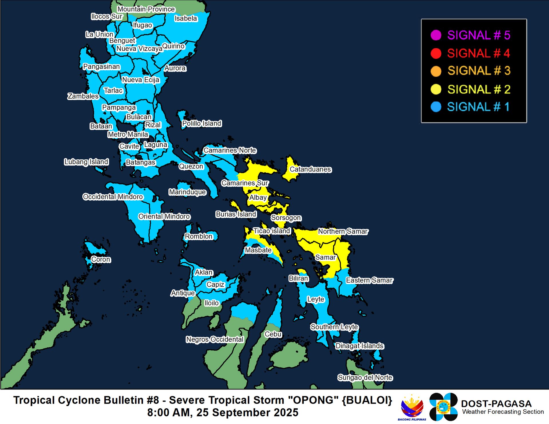
Watches and warnings:
| Hazards affecting land:
|
Discussion:

GPM GMI 89GHz microwave satellite image. There is an eye feature, but it is waaaay to the west of the circulation center
For some reason, and I am not going to speculate as to why, JMA has upgraded Bualoi to a 75 kt (10-min) typhoon. Bualoi has in fact become less organized during the past several hours as a result of increasing easterly shear. Although Bualoi continues to generate some intense convection, it is somewhat formless with little in the way of banding, and the low-level circulation is becoming exposed to the east of the convection. Microwave satellite imagery indicates that the system is very sharply tilted from west to east. Although there is some convective banding wrapping into the mid-level circulation and even a ragged eye feature, this feature is definitely not situated over the low-level center. Discarding the 75 kt estimate from JMA, Dvorak estimates range from T3.5 to T4.0 with CIMSS ADT, AiDT, and D-PRINT estimates ranging from 50 to 66 kts. Taking a blend of these estimates yields an intensity of 60 kts.
At this point, it is becoming unlikely that Bualoi will reach typhoon strength before it makes landfall in the southeastern Bicol Region on Friday. Most of the model guidance suggests that Bualoi will actually weaken before then as moderate to strong easterly shear (25 to 30 kts) persists over the system and continues to decouple it. After landfall, Bualoi should move into an environment with less shear, so despite land interaction, the weakening process will probably become much slower. Bualoi should emerge over the South China Sea on Saturday. Some restrengthening is likely as Bualoi moves west-northwestward across the sea, and Bualoi could become a typhoon by Monday as it enters the Gulf of Tonkin. Bualoi is forecast to make landfall in northern Vietnam on Monday evening.
Although the forecast calls for Bualoi to weaken before moving over the Philippines, it should be noted that confidence in the short-term forecast remains low to medium. However, it is becoming more likely that Bualoi will be more of a rain threat than a wind threat.
Forecast positions and maximum winds
000 hrs: 10.8°N 129.0°E – 60 kts
012 hrs: 12.1°N 126.8°E – 50 kts
024 hrs: 13.0°N 124.1°E – 45 kts inland
048 hrs: 14.4°N 118.2°E – 50 kts
072 hrs: 15.9°N 112.5°E – 60 kts
096 hrs: 17.9°N 108.1°E – 65 kts
120 hrs: 20.1°N 103.9°E – 35 kts inland

JTWC forecast map
