- Will Weaver's Weather & Pacific Typhoon Center
- Posts
- Remnants of Penha (02W / Basyang) – Special Tropical Cyclone Advisory #8 (FINAL): 1800 UTC 6 February 2026
Remnants of Penha (02W / Basyang) – Special Tropical Cyclone Advisory #8 (FINAL): 1800 UTC 6 February 2026
Penha degenerates into a trough of low pressure along the western coast of Negros. This is the last advisory...
Will Weaver
February 06, 2026
…Penha degenerates into a trough of low pressure along the western coast of Negros… …This is the last advisory…
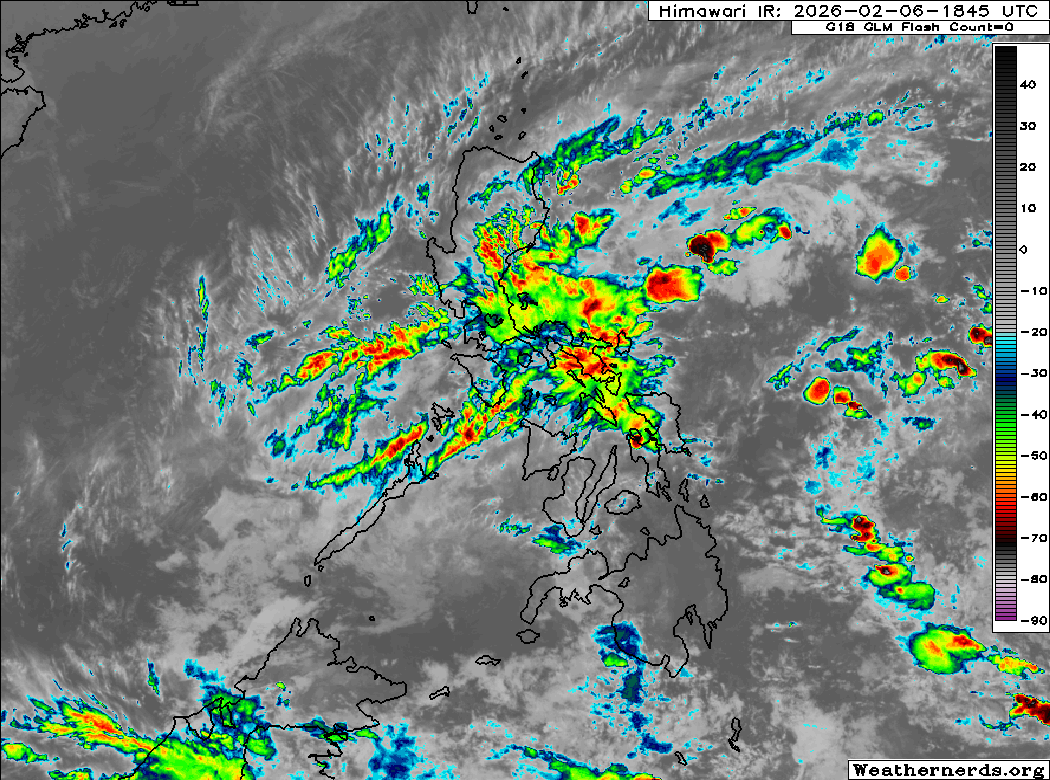
Himawari-9 infrared satellite image (Weathernerds)
Current storm information:
Position: 9.9°N 122.6°E
Movement: Nearly stationary
Intensity: 20 knots (35 km/h)
Central pressure: 1004 hPa
Trend:
N/A
Watches and warnings:  PAGASA wind signal map (click to enlarge)
Areas that should monitor this system:
| Hazards affecting land:
|
Discussion:
Satellite imagery, scatterometer data, and surface observations indicate that Penha no longer has a closed surface circulation. Most of the associated convection has sheared away and is dissipating rapidly within a strong northeasterly cold surge over the South China Sea. Satellite imagery depicts the estimated center of Penha as consisting of a broad area of rotation with multiple swirls present, and available wind data indicates that there are very light or nonexistent westerly winds south of the center. Considering how hostile the environment is rapidly becoming, there doesn’t seem to be any reason to wait a few hours to write a final advisory. The remnant moisture associated with Penha is rapidly evaporating as it encounters the colder, drier air mass to the north, so the rainfall threat associated with it should diminish later today.
This is the last advisory on Penha.
Forecast positions and maximum winds (1-min)
000 hrs: 9.9°N 122.6°E – 20 kts 35 km/h remnants
012 hrs: Dissipated