- Will Weaver's Weather & Pacific Typhoon Center
- Posts
- Remnants of Nuri (03W) – Tropical Cyclone Advisory #5 (FINAL): 1200 UTC 12 March 2026
Remnants of Nuri (03W) – Tropical Cyclone Advisory #5 (FINAL): 1200 UTC 12 March 2026
...Nuri degenerates into a trough of low pressure... ...This is the last advisory...
Will Weaver
March 12, 2026
…Nuri degenerates into a trough of low pressure… …This is the last advisory…
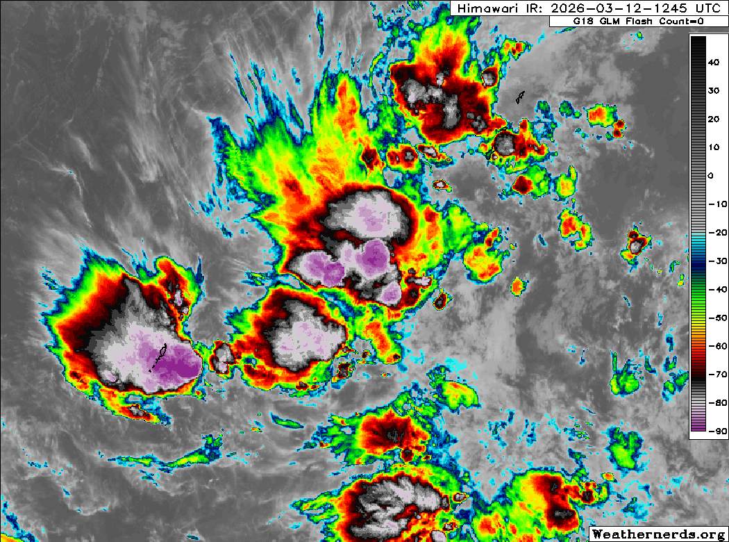
Himawari-9 infrared satellite image (Weathernerds)
Current storm information:
Position: 9.6°N 138.6°E
Movement: E at 5 knots (10 km/h)
Intensity: 25 knots (45 km/h)
Central pressure: 1002 hPa
Trend:
N/A
Watches and warnings:
Areas that should monitor this system:
| Hazards affecting land:
|
Discussion:
Although convection associated with Nuri has increased substantially during the past several hours, scatterometer data and surface observations indicate that Nuri no longer has a closed circulation. In addition, the associated convection remains highly disorganized and sheared and resembles a tropical wave or trough rather than a tropical cyclone. Because of this, Nuri is no longer a tropical cyclone and this is the last advisory.
The remnants of Nuri should continue moving east-northeastward during the next few days. The environment is expected to remain highly unfavorable, so regeneration is not expected.
This is the last advisory on Nuri.
Forecast positions and maximum winds (1-min)
000 hrs: 9.6°N 138.6°E – 25 kts 45 km/h remnants
012 hrs: Dissipated