- Will Weaver's Weather & Pacific Typhoon Center
- Posts
- Remnants of Nongfa (20W) – Tropical Cyclone Advisory #5: 1200 UTC 30 August 2025
Remnants of Nongfa (20W) – Tropical Cyclone Advisory #5: 1200 UTC 30 August 2025
Nongfa dissipates over Vietnam. This is the last advisory.
…Nongfa dissipates over Vietnam… …This is the last advisory…

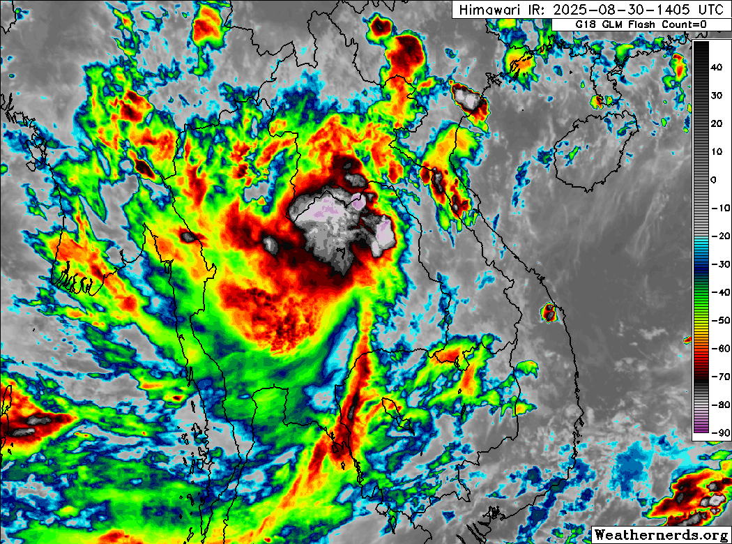
Himawari-9 infrared satellite image (Weathernerds)
Current storm information:
Position: 18.0°N 104.4°E
Movement: WNW at 15 knots (25 km/h)
Intensity: 25 knots (65 km/h)
Central pressure: 1002 hPa
Trend:
N/A
Watches and warnings:
| Hazards affecting land:
|
Discussion:
Radar data from Vietnam indicates that Nongfa made landfall south of Vinh at about 0730 UTC with an intensity of 35 kts. Since then, the low-level circulation has become very poorly defined and is no longer discernible on available satellite imagery. Also, available surface observations from south of the estimated center location indicate very light westerly winds, a sign that the circulation is no longer closed. Therefore, Nongfa has dissipated and this is the last advisory.
Although Nongfa’s low-level circulation has dissipated, its mid-level circulation remains quite robust and is producing a large area of heavy showers and thunderstorms over portions of Vietnam, Laos, and Thailand. This rainfall will likely cause widespread flooding. Refer to products from your local weather office for additional information.
This is the last advisory on Nongfa.
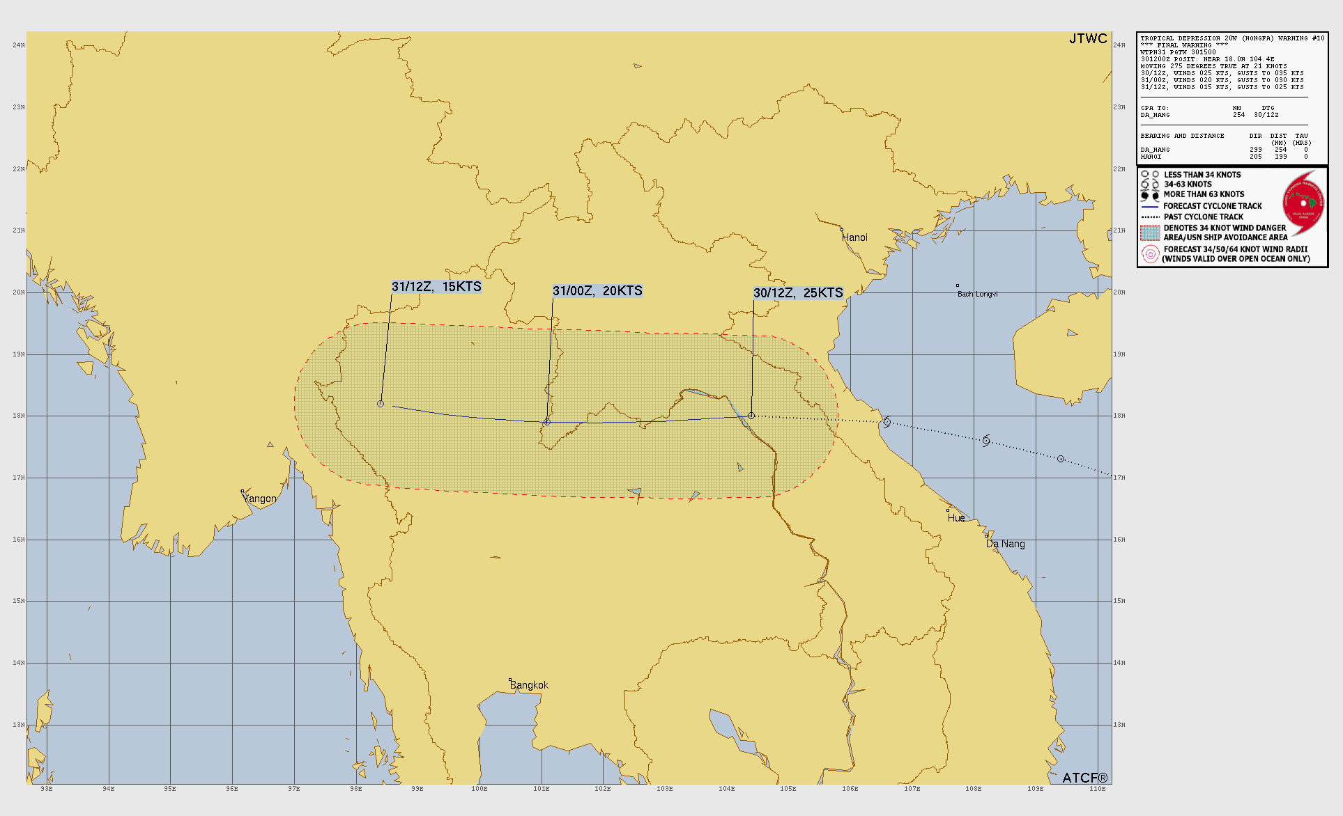
Forecast positions and maximum winds
00 hrs: 18.0°N 104.4°E – 25 kts inland
12 hrs: Dissipated

JTWC forecast map
Please consider sending a tip via Ko-fi! I wear a lot of hats between a day job, being a photographer, and being a worldwide weather enthusiast, and while I will never put any of my content behind a paywall (paywalls kind of defeat the purpose of this blog/newsletter/thingy), your tips definitely help! You can send a tip via the following link: https://ko-fi.com/willweaverrva