- Will Weaver's Weather & Pacific Typhoon Center
- Posts
- Post-Tropical Cyclone Fung-wong (32W/Uwan) – Tropical Cyclone Advisory #20 (FINAL): 0000 UTC 13 November 2025
Post-Tropical Cyclone Fung-wong (32W/Uwan) – Tropical Cyclone Advisory #20 (FINAL): 0000 UTC 13 November 2025
Fung-wong becomes a post-tropical cyclone as it moves away from Taiwan... This is the last advisory...
Will Weaver
November 12, 2025
…Fung-wong becomes a post-tropical cyclone as it moves away from Taiwan… …This is the last advisory…

Himawari-9 visible satellite image (Weathernerds)
Current storm information:
Position: 24.4°N 122.8°E
Movement: NE at 15 knots (25 km/h)
Intensity: 35 knots (65 km/h)
Central pressure: 1002 hPa
Trend:
The post-tropical cyclone will likely dissipate in a day or so.
Watches and warnings:
| Hazards affecting land:
|
Discussion:
The northeast monsoon has done in Fung-wong. The low-level circulation center has become ill-defined and sharply elongated, and its associated moisture is advecting along a frontal boundary. This front appears to have overtaken Fung-wong’s center, and although there is a little bit of convection flaring to the north and east of the center, Fung-wong is no longer a tropical cyclone. The post-tropical cyclone should continue moving northeastward for another day or so before it fully merges with the front.
This is the last advisory on Fung-wong.
Forecast positions and maximum winds (1-min)
000 hrs: 24.4°N 122.8°E – 35 kts 65 km/h Post-tropical/extratropical
012 hrs: 25.4°N 125.8°E – 30 kts 55 km/h Post-tropical/extratropical
024 hrs: Dissipated
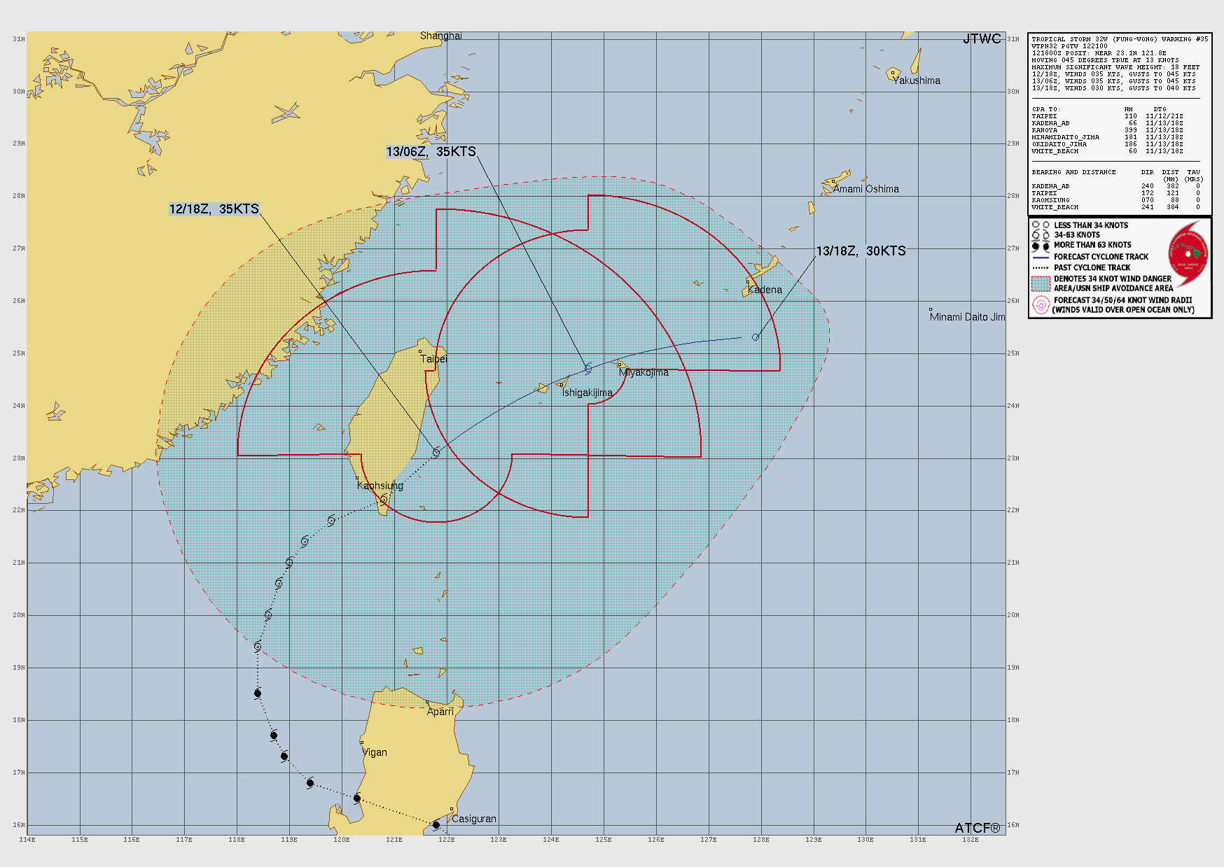
JTWC forecast map