- Will Weaver's Weather & Pacific Typhoon Center
- Posts
- Focus on Central Virginia - Week of 9/8/25
Focus on Central Virginia - Week of 9/8/25
Could it be Actual Fall?! A quiet and mostly pleasant week is on tap for Central Virginia with no major rain chances in sight except for at the beaches. Enjoy it!
Will Weaver
September 08, 2025
Weather Headlines for Central Virginia:
Uh, not much — Second Summer has come and gone and we seem to be well within Actual Fall. High pressure will dominate the northeastern U.S., resulting in absolutely gorgeous weather pretty much every day this week. A weak low pressure area will move up the coast on Wednesday, bringing some slight rain chances to the beach and causing humidity to increase a little, but the humidity will drop again on Thursday.
Getting Kinda Dry — Despite the off and on showers and thunderstorms we had late last week and yesterday, much of Virginia has abnormally dry conditions according to the U.S. Drought Monitor. With little in the way of rain expected this week, some parts of the state could enter drought status by the end of the week.
Quiet Tropics — This week is the peak of the Atlantic hurricane season, but there isn’t much in the way of tropical activity. Invest 91L out in the central Atlantic fizzled out over the weekend and there are no signs of tropical activity during the next 7 days.
Thank You! — This blog got mentioned by Axios Richmond last week. Karri Peifer, who I’ve known for quite a while, was excited about the prospects of Second Summer late last week, and I’m glad it delivered. Thank you so much!
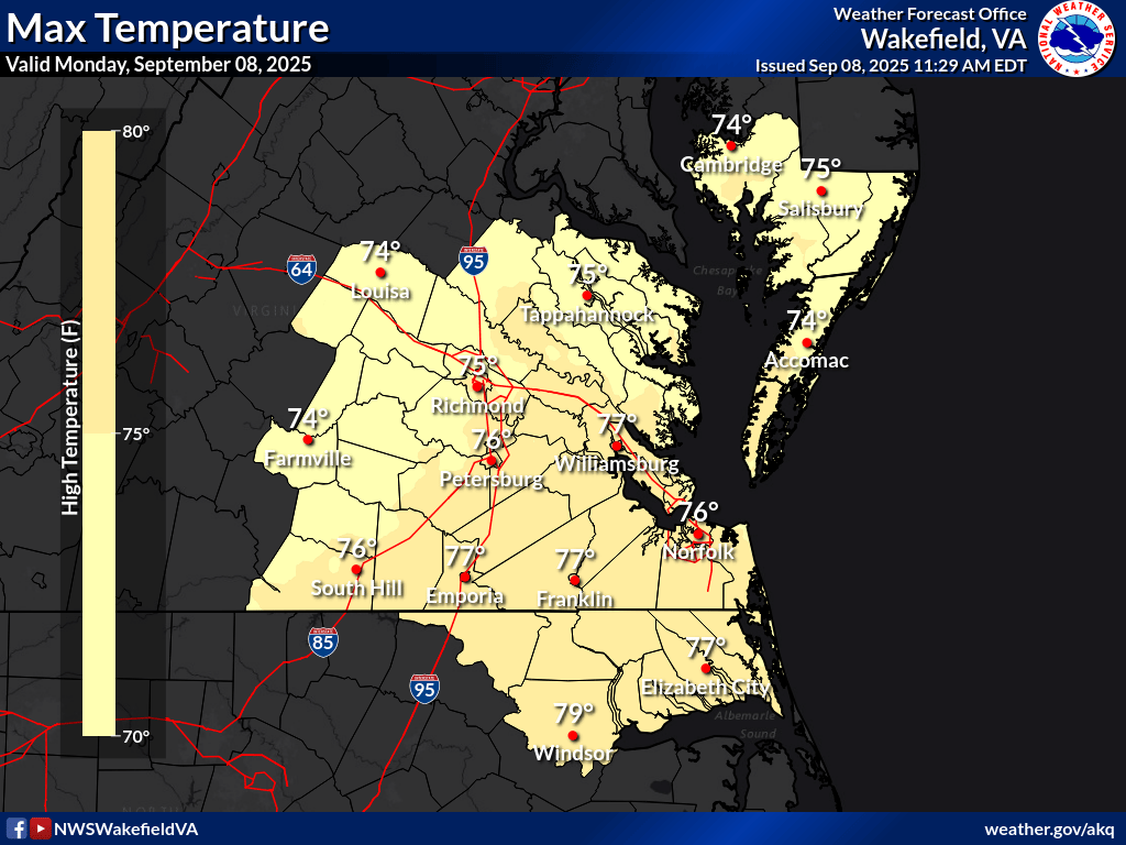
National Weather Service high temperature forecast for Monday 9/8. Highs are in the mid to upper 70s across the entire region.
In Depth:
Second Summer didn’t last long! A series of cold fronts that brought some heavy showers and severe thunderstorms to the region on Thursday and again on Saturday have come and gone, and most of the region is now under clear skies. High pressure has built in and dominates the region, and that is going to result in a return to fall-like weather pretty much every day this week - today through Wednesday will be characterized by sunny skies and high temperatures in the mid to upper 70s, with lows in the low to mid 50s. In fact, I wouldn’t be surprised if parts of the eastern Piedmont (Louisa, Farmville, etc.) dropped into the upper 40s tonight! Keep in mind it’s technically still summer and our average temperature this time of year is still in the mid-80s, so we’re talking seriously below normal here!
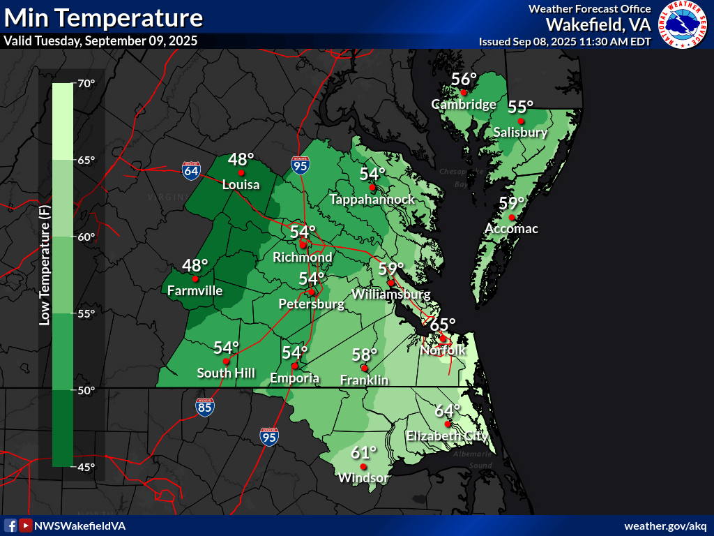
National Weather Service low temperature forecast for Tuesday 9/9. How about low temps in the upper 40s in the eastern Piedmont? Closer to Richmond you’ll find mid- to upper 50s.
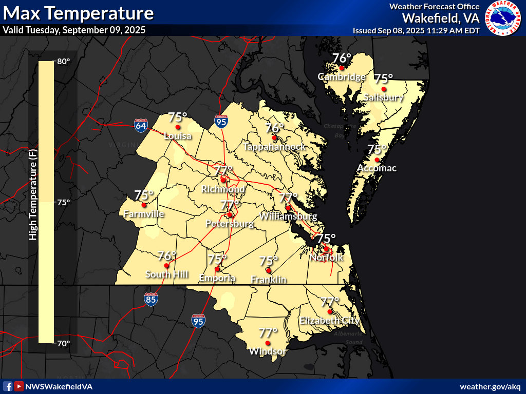
National Weather Service high temperature forecast for Tuesday 9/9. Highs are in the mid to upper 70s across the entire region.
Tuesday and Wednesday will be exactly the same as today - sunny skies, high temps in the upper 70s, lows in the mid to upper 50s. A developing low pressure system off the coast could bring some high clouds to the area on Tuesday evening and Wednesday, but any rain chances should be limited to the beaches. As that low moves up the coast, we could see a slight spike in humidity on Wednesday, but nothing particularly oppressive, and once the low moves out to sea on Thursday, we’ll be back to very low humidity.
Thursday through Sunday should be pleasant…again…with highs around 80, lows in the upper 50s, and low humidity. Enjoy!
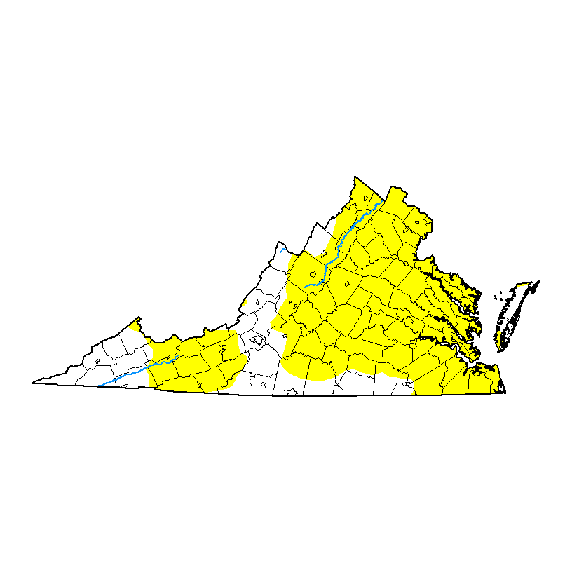
The U.S. Drought Monitor map of the state of Virginia as of 9/2. Every area in yellow, including almost the entire Richmond metro area, is in D0 or “abnormally dry” status.
The pleasant weather is not entirely a good thing. Even though we received some modest rainfall during the past few days, model guidance suggests we may be headed for a fairly decent drought. Prior to this past weekend, much of Virginia was in “abnormally dry” status according to the U.S. Drought Monitor. With little in the way of rain expected during the next 7 days, these dry conditions will likely persist and worsen as the week goes on. Use caution if you need to do any outdoor burning, including grilling.
Here’s a summary of this week’s weather for the Richmond area:
Day | High Temp | Low Temp | Conditions |
|---|---|---|---|
Monday 9/8 | 74° | 53° | Sunny and pleasant |
Tuesday 9/9 | 77° | 56° | Sunny and pleasant |
Wednesday 9/10 | 79° | 61° | Partly cloudy, a bit more humid, showers well E of the area |
Thursday 9/11 | 80° | 57° | Mostly sunny, lower humidity |
Friday 9/12 | 78° | 56° | Partly to mostly sunny |
Saturday 9/13 | 78° | 58° | Mostly sunny |
Sunday 9/14 | 80° | 56° | Mostly sunny |
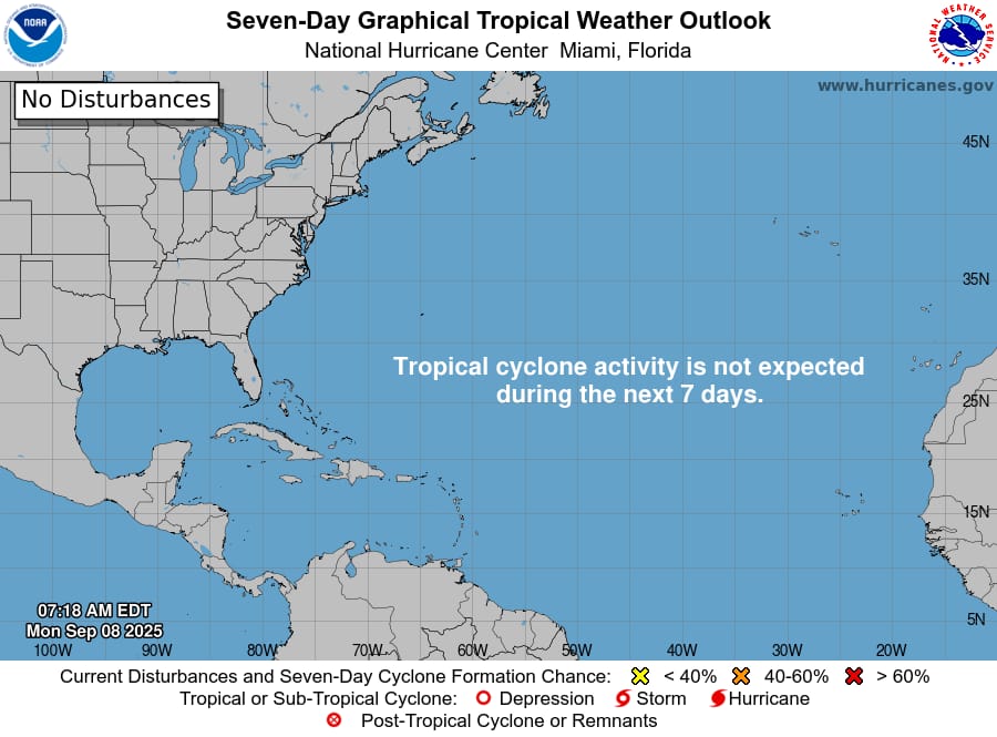
National Hurricane Center Tropical Weather Outlook map. There’s nothing on it.
The tropics are quiet, which is a bit surprising because this week is the usual peak of the Atlantic hurricane season. A disturbance in the central Atlantic that had been designated Invest 91L more or less fizzled out over the weekend, and at the moment there doesn’t appear to be any tropical trouble on the horizon, at least this week.
All in all, this looks like a very quiet and tranquil week with great weather every single day (except near the beaches by the middle of the week), and there are no signs of any major warmups any time soon. Enjoy the weather!
One last thing…
Please consider sending a tip via Ko-fi! I wear a lot of hats between a day job, being a photographer, and being a worldwide weather enthusiast, and while I will never put any of my content behind a paywall (paywalls kind of defeat the purpose of this blog/newsletter/thingy), your tips definitely help! You can send a tip via the following link: https://ko-fi.com/willweaverrva